Category:Photos from Panoramio ID 6692769

Media in category "Photos from Panoramio ID 6692769"
The following 200 files are in this category, out of 331 total.
(previous page) (next page)-
 A bit of good roads. - panoramio.jpg 1,936 × 1,296; 1.13 MB
-
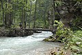
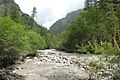
 A good path along the bank of the stream. - panoramio.jpg 1,936 × 1,296; 1.04 MB
-
 A look back at the pass Yala La. - panoramio.jpg 1,936 × 1,296; 1.19 MB
-
 A look back on the last pass 4990 meters. - panoramio.jpg 1,936 × 1,296; 1.34 MB
-
 A look back towards the pass. - panoramio.jpg 1,936 × 1,296; 958 KB
-
 A look for Jumla from Chauriyachaur. - panoramio.jpg 1,936 × 1,296; 1.21 MB
-
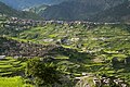
 A small village on the slope. - panoramio.jpg 1,936 × 1,296; 1.06 MB
-
 After that place begins the broad valley. - panoramio.jpg 1,936 × 1,296; 1.1 MB
-
 Always a lot of people in this place. - panoramio.jpg 1,936 × 1,296; 1.09 MB
-
 Always happy to meet with you in this place. - panoramio.jpg 1,936 × 1,296; 1,010 KB
-
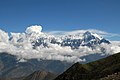 Annapurna all vertices. - panoramio.jpg 1,936 × 1,296; 803 KB
-
 Another bridge on the left Bank. - panoramio.jpg 1,936 × 1,296; 1,002 KB
-
 Apartment house. - panoramio.jpg 1,936 × 1,296; 1.16 MB
-
 At the bottom the valley of Kali Gandaki. - panoramio.jpg 1,800 × 1,200; 910 KB
-
-
 Beginning descent from the pass in Gamgadhi. - panoramio.jpg 1,936 × 1,296; 1.02 MB
-
 Beginning of descent from the pass Chyargo La. - panoramio.jpg 1,936 × 1,296; 992 KB
-
 Beginning of the valley Chyandi Khola to the pass Yala La. - panoramio.jpg 1,936 × 1,296; 1,017 KB
-
 Beside slopes of Yala Kang. - panoramio.jpg 1,936 × 1,296; 1.24 MB
-
 Bhijer is oasis in the valley Yamchho Khola. - panoramio.jpg 1,936 × 1,296; 1.22 MB
-
 Bhijer, Nepal - panoramio (1).jpg 1,800 × 1,200; 1,008 KB
-
 Bhijer, Nepal - panoramio (2).jpg 1,936 × 1,296; 1.13 MB
-
 Bhijer, Nepal - panoramio.jpg 1,936 × 1,296; 1.17 MB
-
 Bhijer, Nepal. - panoramio.jpg 1,936 × 1,296; 924 KB
-
 Bhijer. Each house is a fortress to protect against nature. - panoramio.jpg 1,936 × 1,296; 1.03 MB
-
 Bizarre rocks on the left side. - panoramio.jpg 1,936 × 1,296; 970 KB
-
 Bridge over Chham Khola. - panoramio.jpg 1,936 × 1,296; 1,019 KB
-
 Bridge over Talak Khola. - panoramio.jpg 1,936 × 1,296; 1.26 MB
-
 Bridge over the Tora Khola. - panoramio.jpg 1,936 × 1,296; 929 KB
-
 Bridge, valley of the river Lete Gad. - panoramio.jpg 1,936 × 1,296; 1.12 MB
-
 Brookvalley to the pass Chyargo La. - panoramio.jpg 1,936 × 1,296; 1.04 MB
-
 Bulbule. The road of life. - panoramio.jpg 1,936 × 1,296; 960 KB
-
 Bye bye Pho. The Lost World of the Himalayas. - panoramio.jpg 1,936 × 1,296; 1.04 MB
-
 Camp at an altitude of 5080 m. Upper DOLPA trekking in August. - panoramio.jpg 1,936 × 1,296; 1.08 MB
-
 Camp under a rock. - panoramio.jpg 1,936 × 1,296; 1.22 MB
-
 Chauta. - panoramio.jpg 1,936 × 1,296; 1.05 MB
-
 Check post - verification permissions. - panoramio.jpg 1,800 × 1,200; 1.02 MB
-
 Check post. Rara National Park. - panoramio.jpg 1,936 × 1,296; 1.14 MB
-
 Chhaila. Several houses on the left bank - panoramio.jpg 1,936 × 1,296; 1,014 KB
-
 Chharka Bhot in August. Upper DOLPA trekking - panoramio.jpg 1,936 × 1,296; 1.07 MB
-
 Chhimimaru Khola. - panoramio (1).jpg 1,936 × 1,296; 1,012 KB
-
 Chhimimaru Khola. - panoramio.jpg 1,936 × 1,296; 1.07 MB
-
 Chilenchaura Kharka at the mouth of tributary Chham Khola. - panoramio.jpg 1,936 × 1,296; 1,022 KB
-
 Chilenchaura Kharka. Bridge from the right bank to the left Mugu Nadi. - panoramio.jpg 1,936 × 1,296; 1.22 MB
-
 Chyandi Khola on the border of the forest. - panoramio.jpg 1,936 × 1,296; 1.09 MB
-
 Chyandi Khola place. - panoramio.jpg 1,936 × 1,296; 1,022 KB
-
 Civilization came to this world in the form of solar panels on the roof .. - panoramio.jpg 1,936 × 1,296; 1.07 MB
-
 Clearly visible trail traverses the slope. - panoramio.jpg 1,936 × 1,296; 1.18 MB
-
 Clearly visible Yala La (pass at the centre). - panoramio.jpg 1,936 × 1,296; 1.22 MB
-
 Confluence of two rivers Chharkha Khola and Thasan Khola. - panoramio.jpg 1,936 × 1,296; 1.08 MB
-
 Crossing to the other side. - panoramio.jpg 1,936 × 1,296; 926 KB
-
 Crystal Mountain School, Dho Tarap region, Nepal. - panoramio.jpg 1,936 × 1,296; 1.12 MB
-
 Daphe Langa pass, 3689m. - panoramio.jpg 1,936 × 1,296; 914 KB
-
 Darima, bridge. - panoramio.jpg 1,936 × 1,296; 1.13 MB
-
 Den Khola. - panoramio.jpg 1,936 × 1,296; 996 KB
-
 Descent downwards goes along the ridge. - panoramio.jpg 1,936 × 1,296; 1.12 MB
-
 Dhaulagiri in the clouds. Upper DOLPA trekking. - panoramio.jpg 1,936 × 1,296; 1.06 MB
-
 Dho 21400, Nepal - panoramio.jpg 1,936 × 1,296; 1.06 MB
-
 Dho Tarap and road along Tahari Khola. - panoramio.jpg 1,936 × 1,296; 1.28 MB
-
 Dho Tarap. - panoramio.jpg 1,936 × 1,296; 1.04 MB
-
 Dho Tarap. A good harvest in the fields. - panoramio.jpg 1,936 × 1,296; 1.26 MB
-
 Do not skimp on donations, gentlemen. - panoramio.jpg 1,936 × 1,296; 1.27 MB
-
 Dolphu, Nepal - panoramio (1).jpg 1,936 × 1,296; 1.08 MB
-
 Dolphu, Nepal - panoramio (2).jpg 1,936 × 1,296; 1.01 MB
-
 Dolphu, Nepal - panoramio (3).jpg 1,936 × 1,296; 1.25 MB
-
 Dolphu, Nepal - panoramio (4).jpg 1,936 × 1,296; 1.16 MB
-
 Dolphu, Nepal - panoramio (5).jpg 1,936 × 1,296; 1.05 MB
-
 Dolphu, Nepal - panoramio.jpg 1,936 × 1,296; 988 KB
-
 Expansion of the valley on the border of the forest. - panoramio.jpg 1,936 × 1,296; 965 KB
-
 Fields with a good harvest surround Dho in August. - panoramio.jpg 1,936 × 1,296; 975 KB
-
 First gompa in the river valley. Dho Tarap district. - panoramio.jpg 1,936 × 1,296; 1.2 MB
-
 From here the trail begins to climb. - panoramio.jpg 1,936 × 1,296; 1.09 MB
-
 From the bridge originates steep climb to the pass. - panoramio.jpg 1,936 × 1,296; 997 KB
-
 From the pass goes a very good trail. - panoramio.jpg 1,936 × 1,296; 1.03 MB
-
 From this glacier begins the valley Swaksa Khola. - panoramio.jpg 1,936 × 1,296; 968 KB
-
 Further ascent to the pass. - panoramio.jpg 1,800 × 1,205; 1.07 MB
-
 Further path along the river is impossible. - panoramio.jpg 1,936 × 1,296; 1,000 KB
-
 Further way to the Pho along the ridge. - panoramio.jpg 1,936 × 1,296; 971 KB
-
 Gamgadhi. General view of a large village. - panoramio.jpg 1,800 × 1,200; 1.09 MB
-
 General view of the pass Yala La. - panoramio.jpg 1,936 × 1,296; 952 KB
-
 General view to the pass Chyargo La. - panoramio.jpg 1,800 × 1,200; 1.02 MB
-
 General view to the pass Yala La from the valley Swaksa Khola. - panoramio.jpg 1,936 × 1,296; 994 KB
-
 Glaciers on the border with China. - panoramio.jpg 1,936 × 1,296; 937 KB
-
 Go up to the pass Jungben La (5557) in August - panoramio.jpg 1,800 × 1,200; 1 MB
-
 Gompa 30 minutes on foot to Chharka Bhot. - panoramio.jpg 1,936 × 1,296; 1.11 MB
-
 Gompa before Chharka Bhot. Upper DOLPA trekking from Jumla to Jomsom. - panoramio.jpg 1,936 × 1,296; 1.13 MB
-
 Good forest in the floodplain. - panoramio.jpg 1,936 × 1,296; 1,006 KB
-
 Goodbye Shey Gompa. - panoramio.jpg 1,936 × 1,296; 927 KB
-
 Green fields with artificial irrigation. - panoramio.jpg 1,936 × 1,296; 1.01 MB
-
 He had no luck along the way. - panoramio.jpg 1,800 × 1,200; 1 MB
-
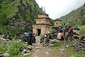
 Hindu temple. Kalika Malika Mandir - panoramio.jpg 1,936 × 1,296; 1.2 MB
-
 Hotel camping in Charka Bhot. - panoramio.jpg 1,936 × 1,296; 1.13 MB
-
 In the distant mountains is located the pass Chyargo La. - panoramio.jpg 1,936 × 1,296; 925 KB
-
 Indian pilgrims on rest. - panoramio.jpg 1,936 × 1,296; 1.19 MB
-
 Influx of Swaksa Khola. - panoramio.jpg 1,936 × 1,296; 1.11 MB
-
 It is a narrow rocky pass. - panoramio.jpg 1,936 × 1,296; 1.15 MB
-
 Jhyarkoi La pass 5440 m. Look down toward Dho Tarap. - panoramio.jpg 1,936 × 1,296; 995 KB
-
 Jhyarkoi La pass 5440 m. The upper reaches of the valley Tahari Khola. - panoramio.jpg 1,936 × 1,296; 1.06 MB
-
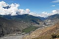 Jomsom is located in the valley Kali Gandaki Nadi. - panoramio.jpg 1,936 × 1,296; 1.07 MB
-
 Jomsom. Main street near the Airport. - panoramio.jpg 1,936 × 1,296; 1.17 MB
-
 Kagbeni 33103, Nepal - panoramio.jpg 1,936 × 1,296; 1.1 MB
-
 Kagbeni, Nepal - panoramio (1).jpg 1,936 × 1,296; 1.23 MB
-
 Kagbeni, Nepal - panoramio (2).jpg 1,800 × 1,200; 879 KB
-
 Kagbeni, Nepal - panoramio (3).jpg 1,800 × 1,200; 1.28 MB
-
 Kagbeni, Nepal - panoramio (4).jpg 1,936 × 1,296; 959 KB
-
 Kagbeni, Nepal - panoramio.jpg 1,936 × 1,296; 973 KB
-
 Kahakar is a compact village in the Thakchiu Kola valley. - panoramio.jpg 1,936 × 1,296; 1.25 MB
-
 Kaitpuchonam Khola. - panoramio.jpg 1,936 × 1,296; 1.23 MB
-
 Khali Chaur. Pastures on the border of the forest. - panoramio.jpg 1,800 × 1,200; 1.03 MB
-
 Labyrinth on the banks of Kali Gandaki near Jomsom.. - panoramio.jpg 1,936 × 1,296; 1.05 MB
-
 Lake near the pass Mola La. - panoramio.jpg 1,936 × 1,296; 1.21 MB
-
 Landscape before descending to the river Swaksa Khola. - panoramio.jpg 1,936 × 1,296; 1 MB
-
 Landscape on a mountain ridge at an altitude of 5300 m. - panoramio.jpg 1,936 × 1,296; 1.06 MB
-
 Last 100 meters to the pass. - panoramio.jpg 1,936 × 1,296; 1.14 MB
-
 Last chorten on the road in front of Santa. - panoramio.jpg 1,936 × 1,296; 1.27 MB
-
 Last overnight stay, from this place a half-day on foot to Jomsom. - panoramio.jpg 1,936 × 1,296; 1.12 MB
-
 Long-awaited Yala La 5414 m. Upper DOLPA trekking - panoramio.jpg 1,936 × 1,296; 942 KB
-
 Look back to the pass Lanmuse La. Upper DOLPA trekking. - panoramio.jpg 1,936 × 1,296; 1.12 MB
-
 Look back to the valley Chyandi Khola. - panoramio.jpg 1,936 × 1,296; 1.09 MB
-
 Looking backwards towards Dho Tarap. - panoramio.jpg 1,936 × 1,296; 1.08 MB
-
 Lusa. - panoramio.jpg 1,936 × 1,296; 1.14 MB
-
 Lusa. The school playground is the best place to camp. - panoramio.jpg 1,936 × 1,296; 1.16 MB
-
 Main road to Tibet. - panoramio.jpg 1,936 × 1,296; 1.08 MB
-
 Mangri 21100, Nepal - panoramio (1).jpg 1,936 × 1,296; 1.13 MB
-
 Mangri 21100, Nepal - panoramio.jpg 1,936 × 1,296; 1,013 KB
-
 Morning in the Valley Kyalunpa Khola. - panoramio.jpg 1,800 × 1,200; 883 KB
-
 Morning. River Valley upstream. - panoramio.jpg 1,936 × 1,296; 1.04 MB
-
 Mountain stream on the valley slope. - panoramio.jpg 1,936 × 1,296; 1,019 KB
-
 Mugu Karnali river downstream. - panoramio.jpg 1,936 × 1,296; 1.03 MB
-
 Mugu Nadi river. Humla region. - panoramio.jpg 1,936 × 1,296; 1.21 MB
-
 Mugu Nadi. Shey Phoksundo National Park. - panoramio.jpg 1,936 × 1,296; 947 KB
-
 Mugu Nadi. This is not the place for rafting. - panoramio.jpg 1,936 × 1,296; 1.1 MB
-
 Narrowing valley Swaksa Khola. - panoramio.jpg 1,936 × 1,296; 1.01 MB
-
 Natural rockeries at an altitude of 5200 m. - panoramio.jpg 1,936 × 1,296; 1.22 MB
-
 New hotels in the Mangri. - panoramio.jpg 1,936 × 1,296; 892 KB
-
 Not a lot of snow peaks in this district. - panoramio.jpg 1,800 × 1,200; 715 KB
-
 Nulungsumda Kharka place. - panoramio.jpg 1,936 × 1,296; 1.01 MB
-
 Numala La (North) 5148 m in August. - panoramio.jpg 1,936 × 1,296; 903 KB
-
 Nyingma Gyanzen La 5564 m. - panoramio.jpg 1,800 × 1,200; 1.23 MB
-
 Nyingma Gyanzen La 5564 m.View to the north. - panoramio.jpg 1,936 × 1,296; 1.07 MB
-
 Of stone tours show the direction towards the pass. - panoramio.jpg 1,936 × 1,296; 1.25 MB
-
 On the roof of the temple. - panoramio.jpg 1,936 × 1,296; 1.04 MB
-
 One gompa in the middle of the valley. - panoramio.jpg 1,936 × 1,296; 1,023 KB
-
 Only one main street in this town. - panoramio.jpg 1,936 × 1,296; 979 KB
-
 Pass 4808 m on the road from Bhijer to Shey Gompa. - panoramio.jpg 1,800 × 1,200; 900 KB
-
 Pass 5100 m is located just left of the center photo. - panoramio.jpg 1,936 × 1,296; 1.23 MB
-
 Pass 5100 meters is the last pass above 5000 meters on the road to Jomsom. - panoramio.jpg 1,936 × 1,296; 1.16 MB
-
 Pass at the level 4990 meters. - panoramio.jpg 1,936 × 1,296; 975 KB
-
 Pass Chyargo La 5140 m. - panoramio.jpg 1,936 × 1,296; 856 KB
-
 Pass Ghurchi Lagna. 3458m. - panoramio.jpg 1,800 × 1,200; 1.13 MB
-
 Pass into the valley of Kali Gandaki. - panoramio.jpg 1,936 × 1,296; 1,008 KB
-
 Pass Mola La 5026 meters. - panoramio.jpg 1,936 × 1,296; 1.11 MB
-
 Path at a height of 5000 meters. - panoramio (1).jpg 1,800 × 1,200; 1.03 MB
-
 Path at a height of 5000 meters. - panoramio.jpg 1,936 × 1,296; 1.09 MB
-
 Path from Pho to the bridge over the Tora Khola. - panoramio.jpg 1,936 × 1,296; 941 KB
-
 Path to Mugu and farther to Tibet. - panoramio.jpg 1,936 × 1,296; 1.03 MB
-
 Path to Pho at an altitude of 5400 m. - panoramio.jpg 1,936 × 1,296; 1.31 MB
-
 Peasant house on the edge of the village. - panoramio.jpg 1,800 × 1,200; 907 KB
-
 Pho - it's just a few houses at an altitude of 4090 meters. - panoramio.jpg 1,936 × 1,296; 1.07 MB
-
 Pho and pass 4990 m. - panoramio.jpg 1,800 × 1,200; 1.22 MB
-
 Pho as the palm. - panoramio.jpg 1,936 × 1,296; 1.01 MB
-
 Place to camp under a rock. - panoramio.jpg 1,936 × 1,296; 1.04 MB
-
 Poor horse with rider climbs to the pass 5100 m. - panoramio.jpg 1,936 × 1,296; 1.02 MB
-
 Prayer and thanks to the gods. Camp. - panoramio.jpg 1,936 × 1,296; 1.14 MB
-
 Pulu, Nepal - panoramio.jpg 1,936 × 1,296; 928 KB
-
 Pulu. Only four houses - for the night caravan. - panoramio.jpg 1,936 × 1,296; 1.1 MB
-
 Pung Kharka, Bhijer, Nepal. - panoramio.jpg 1,936 × 1,296; 952 KB
-
 River and valley Chyandi Khola in downstream. - panoramio.jpg 1,936 × 1,296; 1.04 MB
-

-
 River valley below Pung Kharka. - panoramio.jpg 1,936 × 1,296; 979 KB
-
 River Valley Chhimimaru Khola. - panoramio.jpg 1,936 × 1,296; 1.04 MB
-
 River Valley downstream. - panoramio.jpg 1,936 × 1,296; 1,023 KB
-
 River valley Swaksa Khola. - panoramio.jpg 1,936 × 1,296; 1.04 MB
-
 River Valley to the top of the stream. - panoramio.jpg 1,936 × 1,296; 1.24 MB
-
 River valley towards Chharka Bhot with a height of 5000 m. - panoramio.jpg 1,936 × 1,296; 998 KB
-
 River valley towards GAMGADHI. - panoramio.jpg 1,936 × 1,296; 1.04 MB
-
 Road in the rocks after the bridge. - panoramio.jpg 1,936 × 1,296; 1.2 MB
-
 Road to Jomsom. Traverse slope in the valley Kyalunpa Khola. - panoramio.jpg 1,936 × 1,296; 1.19 MB
-
 Road to Shey Gompa at an altitude of 4800 m. - panoramio.jpg 1,936 × 1,296; 1.03 MB
-
 Road to Tibet above Mangri. - panoramio.jpg 1,936 × 1,296; 1.23 MB
-
 Rocky pass 5408 meters. A look back. - panoramio.jpg 1,936 × 1,296; 942 KB
-
 Rocky pass 5408 meters. Clearly visible the further way to the top. - panoramio.jpg 1,936 × 1,296; 1.04 MB
-
 Rocky pass 5408 meters. View through the pass. - panoramio.jpg 1,936 × 1,296; 932 KB
-
 Saldang, Nepal - panoramio (1).jpg 1,936 × 1,296; 1.1 MB
-
 Saldang, Nepal - panoramio (10).jpg 1,936 × 1,296; 1.19 MB
-
 Saldang, Nepal - panoramio (11).jpg 1,936 × 1,296; 1,007 KB
-
 Saldang, Nepal - panoramio (12).jpg 1,936 × 1,296; 949 KB
-
 Saldang, Nepal - panoramio (13).jpg 1,936 × 1,296; 895 KB
-
 Saldang, Nepal - panoramio (14).jpg 1,936 × 1,296; 1.12 MB
-
 Saldang, Nepal - panoramio (2).jpg 1,936 × 1,296; 1.07 MB
-
 Saldang, Nepal - panoramio (3).jpg 1,936 × 1,296; 1.22 MB
-
 Saldang, Nepal - panoramio (4).jpg 1,936 × 1,296; 1.08 MB
-
 Saldang, Nepal - panoramio (5).jpg 1,936 × 1,296; 1.22 MB
-
 Saldang, Nepal - panoramio (6).jpg 1,936 × 1,296; 1.05 MB
-
 Saldang, Nepal - panoramio (7).jpg 1,800 × 1,200; 1.28 MB
-
 Saldang, Nepal - panoramio (8).jpg 1,936 × 1,296; 948 KB
-
 Saldang, Nepal - panoramio (9).jpg 1,936 × 1,296; 1.04 MB
-
 Saldang, Nepal - panoramio.jpg 1,936 × 1,296; 1.3 MB
-
 Santa is a very compact village in the valley Kyalunpa Khola. - panoramio.jpg 1,936 × 1,296; 1.25 MB
-
 Shelter for caravans with contraband. - panoramio.jpg 1,936 × 1,296; 1.01 MB


.jpg)
.jpg)


.jpg)


.jpg)
.jpg)
.jpg)
.jpg)
.jpg)


_in_August_-_panoramio.jpg)


.jpg)
.jpg)
.jpg)
.jpg)


.jpg)


_5148_m_in_August._-_panoramio.jpg)


.jpg)


.jpg)
.jpg)
.jpg)
.jpg)
.jpg)
.jpg)
.jpg)
.jpg)
.jpg)
.jpg)
.jpg)
.jpg)
.jpg)
.jpg)


._-_panoramio.jpg)