Category:Pilbara
administrative region of Western Australia   | |||||
| Upload media | |||||
| Instance of | |||||
|---|---|---|---|---|---|
| Location | Western Australia, AUS | ||||
| Different from | |||||
| official website | |||||
 | |||||
Subcategories
This category has the following 40 subcategories, out of 40 total.
A
- Andover Station (8 F)
C
D
F
- Flora of the Pilbara (36 F)
G
- Gary Highway (2 F)
H
- Harding River (1 F)
K
- Karlamilyi National Park (3 F)
L
- Little Sandy Desert (5 F)
M
- Maps of the Pilbara (16 F)
- Marble Bar, Western Australia (11 F)
- Minerals of Bali Hi (2 F)
- Minerals of Millstream Station (11 F)
- Murujuga National Park (8 F)
N
- Nanutarra, Western Australia (5 F)
O
P
- Pannawonica, Western Australia (18 F)
R
- Robe River (2 F)
S
- Sandfire, Western Australia (3 F)
- Soklich Open Cut (5 F)
T
W
- Wickham, Western Australia (1 F)
- Wittenoom, Western Australia (20 F)
Media in category "Pilbara"
The following 16 files are in this category, out of 16 total.
-
 Damien 2020-02-09 0239Z.jpg 3,689 × 4,914; 3.36 MB
-
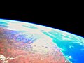
 Dry Lakes Hazlett and Willis WA ISS.jpg 720 × 480; 366 KB
-
 Earth from Space- Pilbara, Western Australia ESA24830604.jpg 6,070 × 4,504; 8.18 MB
-
 Earth from Space- Pilbara, Western Australia ESA24830604.tiff 12,140 × 9,008; 312.9 MB
-
 Fish rock north of port hedland.jpg 1,600 × 1,200; 272 KB
-
 Hamersley Range, Western Australia, April 1990 (27946233281).jpg 5,088 × 4,000; 13.43 MB
-
 Mowering with two goannas, cropped & tweaked.png 1,831 × 2,860; 8.13 MB
-
 North coast of Western Australia.jpg 1,024 × 768; 112 KB
-
 North West Shelf (43332992714).jpg 4,096 × 832; 3.22 MB
-
 On the Road (29528877907).jpg 2,048 × 1,367; 3.72 MB
-
 PIA23551-MarsRover-OldEarthFossilsStudied-20190819.jpg 4,032 × 3,024; 2.31 MB
-
 Pilbara 1.jpg 1,024 × 768; 184 KB
-
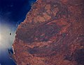
 Pilbara craton from satellite.jpg 2,400 × 1,600; 564 KB
-
 Pilbara, NW Australia (ASTER).jpg 3,365 × 3,681; 2.78 MB
-
 Splash! (29364238517).jpg 2,088 × 1,503; 3.48 MB
-
 Strelley Pool formation.jpg 5,412 × 5,412; 4.88 MB


.jpg)


.jpg)


.jpg)
.jpg)

.jpg)