Category:Pitt Lake
lake in British Columbia, Canada | |||||
| Upload media | |||||
| Instance of | |||||
|---|---|---|---|---|---|
| Location | British Columbia, Canada | ||||
| Elevation above sea level |
| ||||
| Inflows | |||||
| Outflows | |||||
| Basin country | |||||
 | |||||
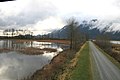
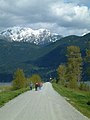
English: Pitt Lake is the second-largest lake in the Lower Mainland of British Columbia, being about 53.5 square kilometres in area. It is about 25 km long and about 4.5 km wide at its widest, and is also one of the world's largest tidal lakes, its confluence with the Fraser being only a few miles upstream from that river's estuary into the Strait of Georgia. Its southern tip, where the Pitt River resumes, is 40 km east of Downtown Vancouver.
Polski: Pitt ( ang. Pitt Lake) – jezioro w Kolumbii Brytyjskiej, w Kanadzie. Jest drugim co do wielkości (po Williston Lake) jeziorem w prowincji, o powierzchni 53.5 km². Liczy ok. 25 km długości oraz 2,5 km szerokości w najszerszym miejscu, stanowi także największe na świecie jezioro pływowe.
Media in category "Pitt Lake"
The following 12 files are in this category, out of 12 total.
-
 Cacus Point, Pitt Lake.jpg 640 × 480; 88 KB
-
 Flight from Kelowna to Whitehorse - Edge Peak, with Pitt Lake behind (14283608357).jpg 2,121 × 1,414; 2.32 MB
-
 Mountain sunset and lovers (153444091).jpg 1,296 × 972; 891 KB
-
 Mountains above Pitt Lake.jpg 3,456 × 2,304; 3.67 MB
-
 Maple Ridge BC Wikivoyage banner.jpg 799 × 114; 115 KB
-
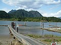
 Pitt Lake bog and dike.jpg 800 × 533; 326 KB
-
 Pitt Lake 007.jpg 2,128 × 2,832; 2.21 MB
-
 Pitt Lake 023.jpg 2,832 × 2,128; 2.15 MB
-
 Pitt Lake 04.jpg 2,832 × 2,128; 2.25 MB
-
 Pitt Lake from Grant Narrows Regional Park.jpg 2,240 × 1,680; 646 KB
-
 Pitt Lake with Canoes.jpg 2,832 × 2,128; 2.28 MB
-
 Sunset Over Pitt Lake.jpg 4,640 × 3,480; 1.66 MB

.jpg)
.jpg)


