Category:Piz Lunghin
mountain   | |||||
| Upload media | |||||
| Pronunciation audio | |||||
|---|---|---|---|---|---|
| Instance of | |||||
| Part of |
| ||||
| Location | Grisons, Switzerland | ||||
| Mountain range | |||||
| Topographic prominence |
| ||||
| Topographic isolation |
| ||||
| Elevation above sea level |
| ||||
| Parent peak | |||||
 | |||||
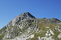
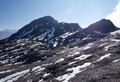
Deutsch: Der Piz Lunghin ist ein 2'780 m hoher Berg auf dem Gebiet der politischen Gemeinde Bregaglia im Kanton Graubünden in der Schweiz.
Media in category "Piz Lunghin"
The following 51 files are in this category, out of 51 total.
-
 2011-08-01 12-13-10 Switzerland Maloja.jpg 4,197 × 2,787; 3.98 MB
-
 Albula range 4.jpg 25,349 × 5,095; 30.83 MB
-
 Bergeller Berge und Piz Lunghin von der Station Murtel.jpg 3,648 × 2,736; 792 KB
-
 Blick auf Val-Maroz-Gipfel von oberhalb Salecina.JPG 1,600 × 1,200; 524 KB
-
 Chaviolas on Lake Sils with Piz Duan, Piz Lunghin.jpg 5,760 × 3,840; 7.07 MB
-
 ETH-BIB-Maloja - Piz Lunghin, von Süd-Ost-Dia 247-03394-1.tif 3,451 × 2,806; 27.82 MB
-
 ETH-BIB-Maloja und Piz Lunghin von Südosten-Dia 247-03394.tif 3,498 × 2,806; 28.2 MB
-
 ETH-BIB-Maloja, Piz Lunghin-LBS H1-017989.tif 6,855 × 4,804; 94.37 MB
-
 ETH-BIB-Piz dal Sasc, Piz Lunghin, Silsersee, Malojapass-Inlandflüge-LBS MH05-50-13.tif 3,508 × 2,361; 23.75 MB
-
 Giovanni Giacometti Piz Longhino.jpg 2,000 × 1,567; 580 KB
-
 Graubünden Malojapass 1.JPG 3,444 × 2,586; 5.73 MB
-
 InnFountainRiver.JPG 1,536 × 1,024; 1,005 KB
-
 Lunghinsee panorama.jpg 12,059 × 2,730; 7.62 MB
-
 Lunginsee panorama.jpg 25,840 × 5,248; 27.3 MB
-
 Lägh dal Lunghin as seen from Piz Lunghin.jpg 3,046 × 1,899; 823 KB
-
 Maloja - Piz Lunghin.jpg 4,310 × 2,402; 2.6 MB
-
 Maloja-Schlange.JPG 3,008 × 2,000; 602 KB
-
 Mountain panorama 5.jpg 24,709 × 3,509; 16.43 MB
-
 Mountain panorama 7.jpg 23,232 × 3,009; 14.75 MB
-
 Palm-Express-Malojapass.jpg 1,024 × 681; 163 KB
-
 Pass Lunghin - panoramio.jpg 6,284 × 3,441; 14.78 MB
-
 Pass Lunghin - Piz Grevasalvas - Piz Lunghin.jpg 21,555 × 2,805; 18.1 MB
-
 Piz Grevasalvas - Piz Lunghin.jpg 23,666 × 3,050; 15.33 MB
-
 Piz Grevasalvas and Piz Lunghin.jpg 25,043 × 4,522; 27.74 MB
-
 Piz Grevasalvas as seen from Sils Maria.jpg 4,608 × 3,456; 5.39 MB
-
 Piz Lunghin - Lunghinsee.jpg 11,290 × 3,006; 8.08 MB
-
 Piz Lunghin 2.jpg 5,472 × 3,648; 4.89 MB
-
 Piz Lunghin 2021.jpg 5,472 × 3,105; 4.93 MB
-
 Piz Lunghin 3.jpg 5,433 × 2,482; 4.45 MB
-
 Piz Lunghin 4.jpg 5,425 × 2,490; 3.39 MB
-
 Piz Lunghin 5.jpg 4,916 × 3,114; 3.7 MB
-
 Piz Lunghin 6.jpg 7,196 × 3,188; 5.85 MB
-
 Piz Lunghin and trail 2.jpg 4,712 × 3,603; 5.41 MB
-
 Piz Lunghin and trail.jpg 5,472 × 3,648; 4.93 MB
-
 Piz Lunghin as seen from Maloja 1.jpg 4,608 × 3,456; 7.25 MB
-
 Piz Lunghin as seen from Maloja 2.jpg 4,608 × 2,272; 1.71 MB
-
 Piz Lunghin as seen from Pass Lunghin.jpg 5,312 × 2,988; 3.15 MB
-
 Piz Lunghin in August 2021.jpg 5,146 × 3,264; 3.83 MB
-
 Piz Lunghin Panorama.jpg 62,464 × 4,004; 25.83 MB
-
 Piz Lunghin panorama.jpg 23,722 × 3,166; 10.66 MB
-
 Piz Lunghin Spherical Panorama.jpg 19,456 × 9,728; 63 MB
-
 Piz Lunghin top 2.jpg 5,187 × 2,444; 2.6 MB
-
 Piz Lunghin top.jpg 5,472 × 3,648; 4.31 MB
-
 Piz Lunghin.jpg 5,472 × 3,648; 5.33 MB
-
 Piz Lunghin.tiff 4,260 × 2,913; 35.51 MB
-
Roh-surmiran-Piz Lunghin.ogg 1.3 s; 17 KB
-
 Snow and Piz Lunghin.jpg 7,070 × 2,935; 6.7 MB
-
 Trail and Piz Lunghin.jpg 5,472 × 3,648; 6.34 MB
-
 Trail to Piz Lunghin 2.jpg 5,472 × 3,648; 6.88 MB
-
 Trail to Piz Lunghin.jpg 5,472 × 3,648; 6.34 MB
-
 Upper Engadin as seen from Piz Lunghin.jpg 4,000 × 2,252; 2.96 MB


