Category:Planegg
municipality of Germany | |||||
| Upload media | |||||
| Instance of |
| ||||
|---|---|---|---|---|---|
| Part of |
| ||||
| Location | Munich, Upper Bavaria, Bavaria, Germany | ||||
| Located in or next to body of water | |||||
| Head of government |
| ||||
| Population |
| ||||
| Area |
| ||||
| Elevation above sea level |
| ||||
| official website | |||||
 | |||||
Subcategories
This category has the following 16 subcategories, out of 16 total.
A
- Arthur buses (5 F)
B
C
- Culture of Planegg (4 F)
D
- Deutsches Skimuseum (6 F)
E
G
- Geography of Planegg (8 F)
H
K
M
N
P
S
- Sculptures in Planegg (2 F)
T
Media in category "Planegg"
The following 68 files are in this category, out of 68 total.
-
20210626-forstkasten-001.jpg 4,128 × 2,322; 6.65 MB
-
20210626-forstkasten-002.jpg 4,128 × 2,322; 5.69 MB
-
20210626-forstkasten-003.jpg 4,128 × 2,322; 7.42 MB
-
20210626-forstkasten-004.jpg 4,128 × 2,322; 6.71 MB
-
20210626-forstkasten-005.jpg 4,128 × 2,322; 7.92 MB
-
20210626-forstkasten-007.jpg 4,128 × 2,322; 5.66 MB
-
20210626-forstkasten-008.jpg 4,128 × 2,322; 7.17 MB
-
20210626-forstkasten-009.jpg 4,128 × 2,322; 7.94 MB
-
20210626-forstkasten-010.jpg 4,128 × 2,322; 8.35 MB
-
Baumbesetzung gegen Abholzung und Kiesabbau im Forst Kasten 2021 03.jpg 2,736 × 3,648; 4.9 MB
-
Bombenkrater (vermutet) im Wald bei Planegg am Planegger Sträßel.jpg 5,120 × 3,840; 8.93 MB
-
De-Planegg.ogg 1.7 s; 17 KB
-
Der Grünzug am Lichtweg Infotafel Planegg Gräfelfing 01.jpg 3,648 × 2,736; 2.87 MB
-
DEU Planegg COA.svg 512 × 497; 42 KB
-
Forst Kasten Hochsitz in rekultiviertem Gebiet ehemals Kiesgrube und Deponie 01.jpg 2,736 × 3,648; 4.06 MB
-
Forst Kasten Hochsitz in rekultiviertem Gebiet ehemals Kiesgrube und Deponie 02.jpg 2,736 × 3,648; 4.48 MB
-
Fürstenrieder Wald Futterkrippe Kirrung.jpg 2,736 × 3,648; 5.49 MB
-
Gedenkstein Geschichte Einödhof Kreuzling Kreuzlinger Forst bei Planegg 01.jpg 3,648 × 2,736; 5.95 MB
-
Gedenkstein Geschichte Einödhof Kreuzling Kreuzlinger Forst bei Planegg Detail.jpg 3,648 × 2,736; 6.1 MB
-
Glück Kieswerk Planegg Kiesabbau und Wiederverfüllung mit Bauschutt 04.jpg 3,648 × 2,736; 3.59 MB
-
Heidevolm.jpeg 1,280 × 960; 232 KB
-
Heiliggeist Geräumt Waldweg Schild und Figur Forst Kasten.jpg 2,736 × 3,648; 6.03 MB
-
Hinweisschild Kompostierung mit Riesen-Bärenklau davor.jpg 3,648 × 2,736; 5.61 MB
-
Insel mit Riesen-Bärenklau zwischen Planegg und Forst Kasten im Lusthain.jpg 5,120 × 3,840; 8.65 MB
-
Karte mit Bauhäusern im Forst Kasten 190621.jpg 423 × 251; 15 KB
-
Kiesgrube bei Planegg.jpg 2,048 × 1,536; 1.28 MB
-
Kiesgrube mit Bauschuttauffüllung.jpg 3,648 × 2,736; 3.58 MB
-
Kiesgrube und Deponie für Bauschutt Forst Kasten zwischen Planegg und Neuried 01.jpg 5,120 × 3,840; 9.53 MB
-
Kiesgrube und Deponie für Bauschutt Forst Kasten zwischen Planegg und Neuried 02.jpg 5,120 × 3,840; 7.17 MB
-
Kiesgrube und Deponie für Bauschutt Forst Kasten zwischen Planegg und Neuried 03.jpg 5,120 × 3,840; 6.99 MB
-
Kiesgrube und Deponie für Bauschutt Forst Kasten zwischen Planegg und Neuried 04.jpg 5,120 × 3,840; 7.49 MB
-
Kiesgrube und Deponie für Bauschutt Forst Kasten zwischen Planegg und Neuried 05.jpg 5,120 × 3,840; 7.41 MB
-
Kiesgrube und Deponie für Bauschutt Forst Kasten zwischen Planegg und Neuried 06.jpg 3,648 × 2,736; 3.66 MB
-
Kiesgrube und Deponie für Bauschutt Forst Kasten zwischen Planegg und Neuried 07.jpg 3,648 × 2,736; 3.65 MB
-
Kiesgrube und Deponie Rekultivierung zwischen Planegg und Neuried.jpg 5,120 × 3,840; 7.58 MB
-
Kirrung mit Wildkamera vor einer Tonne mit Mais im Fürstenrieder Wald.jpg 3,648 × 2,736; 6.59 MB
-
Kneippanlage Planegg Margaretenstraße.jpg 3,264 × 2,448; 3.82 MB
-
Massive Polizeipräsenz im Forst Kasten wegen Klimaprotest gegen Kahlschlag 190621.jpg 2,736 × 3,648; 3.17 MB
-
Neuried bei München Protestplakat gegen Kahlschlag im Forst Kasten Details.jpg 2,736 × 3,648; 2.82 MB
-
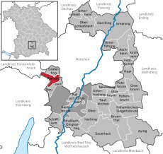
Planegg - Lage im Landkreis.png 157 × 185; 25 KB
-
Planegg Blick auf einen Wall mit Riesen-Bärenklau und der Kiesgrube Richtung Neuried.jpg 5,120 × 3,840; 5.52 MB
-
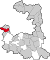
Planegglkrm.svg 593 × 711; 120 KB
-
Polizeihelikopter im Tiefflug über dem Klimacamp (Baumhaus) im Forst Kasten.jpg 3,648 × 2,736; 1.42 MB
-
Polizeihubschrauber direkt über Baumhaus von Waldschützern im Forst Kasten Samstag 19.06.21.ogg 11 s, 1,024 × 576; 11.35 MB
-
Proteste gegen Abholzung und Kiesabbau im Forst Kasten 2021 01.jpg 5,120 × 3,840; 8.44 MB
-
Riesen-Bärenklau auf Rekultivierungsfläche zwischen Planegg und Neuried.jpg 5,120 × 3,840; 8.29 MB
-
Riesen-Bärenklau bei alter Kiesgrube Glueck zwischen Planegg und Neuried 01.jpg 3,648 × 2,736; 7.44 MB
-
Riesen-Bärenklau bei alter Kiesgrube Glueck zwischen Planegg und Neuried 02.jpg 3,648 × 2,736; 6.8 MB
-
Räumung einer Plattform im Forst Kasten durch einen SEK-Beamten Montag 21.06.2021.ogg 6.9 s, 1,280 × 720; 17.22 MB
-
SchlossaltarPlanegg.jpg 2,592 × 4,608; 2.72 MB
-
Straßenschild Planegg.jpg 4,608 × 2,592; 3.42 MB
-
Trockene Stauden Riesen-Bärenklau Ruderalvegetation Forst Kasten Jägerstern.jpg 3,648 × 2,736; 4.74 MB
-
Versteckter Hochsitz Forst Kasten Jägerstern München Fürstenried.jpg 2,736 × 3,648; 4.71 MB
-
Wall mit Riesen-Bärenklau an der Kiesgrube.jpg 3,840 × 5,120; 8.83 MB
-
Wappen Planegg.jpg 640 × 633; 65 KB
-
Wappen Planegg.png 192 × 206; 11 KB
-
Wegschild Planegg.jpg 4,608 × 2,592; 3.59 MB
-
Ziegen beim Abweiden von Riesen-Bärenklau zwischen Neuried und Planegg bei München 02.jpg 3,648 × 2,736; 5.09 MB


