Category:Plaques in County Tyrone
Subcategories
This category has the following 2 subcategories, out of 2 total.
O
- Plaques in Omagh (54 F)
P
- Plaques in Strabane (8 F)
Media in category "Plaques in County Tyrone"
The following 56 files are in this category, out of 56 total.
-
Ancestral home of James Buchanan - geograph.org.uk - 55612.jpg 512 × 383; 64 KB
-
Ardstraw Orange Hall wall plaque - geograph.org.uk - 136184.jpg 640 × 479; 122 KB
-
ARDSTRAW plaque - geograph.org.uk - 135378.jpg 640 × 479; 168 KB
-
Ballygawley National School plaque - geograph.org.uk - 1024771.jpg 640 × 448; 91 KB
-
DC 1780, Ballygawley - geograph.org.uk - 1024754.jpg 640 × 479; 41 KB
-
Departure sculpture, Strabane (03), January 2010.JPG 4,272 × 2,848; 5.92 MB
-
Drumquin National School plaque - geograph.org.uk - 1035641.jpg 449 × 640; 109 KB
-
Inscription on cross - geograph.org.uk - 1267658.jpg 640 × 479; 81 KB
-
Inscription, St Pat's Hall - geograph.org.uk - 1413257.jpg 640 × 264; 42 KB
-
Marshall Country Trail Plaque - geograph.org.uk - 1620516.jpg 640 × 480; 86 KB
-
Plaque at Caledon - geograph.org.uk - 618235.jpg 640 × 503; 72 KB
-
Plaque, Ardstraw Orange Hall - geograph.org.uk - 1450476.jpg 640 × 479; 54 KB
-
Plaque, Ardstraw Presbyterian Church - geograph.org.uk - 1450472.jpg 640 × 479; 62 KB
-
Plaque, Cathedral Hall, Clogher - geograph.org.uk - 1033458.jpg 640 × 482; 37 KB
-
Plaque, Cavanacaw National School - geograph.org.uk - 1050255.jpg 640 × 451; 58 KB
-
Plaque, Cookstown Methodist Church - geograph.org.uk - 1623104.jpg 480 × 640; 96 KB
-
Plaque, Donaghanie Orange Hall - geograph.org.uk - 1013904.jpg 640 × 382; 44 KB
-
Plaque, Drumlegagh Orange Hall - geograph.org.uk - 1460453.jpg 640 × 479; 84 KB
-
Plaque, Dungannon Methodist Church - geograph.org.uk - 942320.jpg 640 × 552; 71 KB
-
Plaque, G.W. Gibson, Beragh - geograph.org.uk - 1013895.jpg 640 × 513; 61 KB
-
Plaque, Gortin Presbyterian Church - geograph.org.uk - 1402703.jpg 640 × 595; 71 KB
-
Plaque, Lisnacreaght National School - geograph.org.uk - 1451251.jpg 640 × 367; 68 KB
-
Plaque, Mass Rock site - geograph.org.uk - 1267642.jpg 640 × 479; 82 KB
-
Plaque, Methodist Church - geograph.org.uk - 1412820.jpg 640 × 479; 57 KB
-
Plaque, Mountjoy Orange Hall - geograph.org.uk - 1074669.jpg 640 × 479; 65 KB
-
Plaque, Newtownstewart - geograph.org.uk - 988967.jpg 640 × 554; 113 KB
-
Plaque, Newtownstewart Town Hall - geograph.org.uk - 989734.jpg 640 × 496; 51 KB
-
Plaque, St Mary's Church - geograph.org.uk - 1458992.jpg 640 × 435; 56 KB
-
Plaque, St Matthew's School - geograph.org.uk - 1052757.jpg 640 × 250; 25 KB
-
Plaque, St Patrick's Hall - geograph.org.uk - 1413250.jpg 640 × 437; 71 KB
-
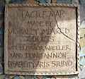
Plaque, Tactile Map - geograph.org.uk - 2495098.jpg 640 × 597; 93 KB
-
Plaque, Viscount Restaurant - geograph.org.uk - 942331.jpg 640 × 479; 66 KB
-
Plaque, Weighbridge, Caledon - geograph.org.uk - 623826.jpg 640 × 462; 41 KB
-
Plaque, Wesleyan Church, Augher - geograph.org.uk - 3514636.jpg 4,320 × 3,240; 4.93 MB
-
St Marys Church, Cloughcor, May 2010 (04).JPG 4,272 × 2,848; 6.11 MB
-
St Marys Church, Cloughcor, May 2010 (11).JPG 2,848 × 4,272; 5.24 MB
-
St Patricks Church, Ballymagorry, May 2010 (14).JPG 2,848 × 4,272; 4.57 MB
-
St Patricks Church, Ballymagorry, May 2010 (15).JPG 2,848 × 4,272; 3.77 MB
-
St Patricks Church, Ballymagorry, May 2010 (20).JPG 2,848 × 4,272; 3.8 MB
-
St Patricks Church, Ballymagorry, May 2010 (21).JPG 4,272 × 2,848; 6.05 MB
-
Wall Plaque - geograph.org.uk - 765113.jpg 640 × 480; 54 KB
-
War Memorial Plaque - geograph.org.uk - 87979.jpg 640 × 479; 138 KB
-
WF Marshall, Sixmilecross - geograph.org.uk - 133641.jpg 640 × 479; 116 KB
-
Plaque on wall - geograph.org.uk - 466890.jpg 517 × 640; 112 KB
-
Plaque, Religious Society of Friends - geograph.org.uk - 601398.jpg 640 × 479; 67 KB
-
Plaque, Seskinore National School - geograph.org.uk - 547777.jpg 479 × 640; 123 KB


