Category:Platt, Kent
village and civil parish in Kent, England, UK  | |||||
| Upload media | |||||
| Instance of | |||||
|---|---|---|---|---|---|
| Location | Tonbridge and Malling, Kent, South East England, England | ||||
| Population |
| ||||
 | |||||
Subcategories
This category has the following 6 subcategories, out of 6 total.
Media in category "Platt, Kent"
The following 200 files are in this category, out of 265 total.
(previous page) (next page)-
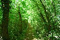
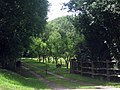
 A footpath in Valley Woods - geograph.org.uk - 6769495.jpg 1,024 × 768; 259 KB
-
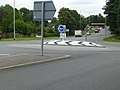 A new roundabout at Wrotham Heath - geograph.org.uk - 4650331.jpg 640 × 480; 67 KB
-
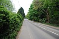
 A20 - geograph.org.uk - 3627990.jpg 640 × 430; 60 KB
-
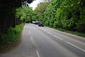
 A25 - A20 junction - geograph.org.uk - 3611619.jpg 640 × 430; 52 KB
-
 A25 - A20 junction - geograph.org.uk - 3611622.jpg 640 × 430; 65 KB
-
 A25, Wrotham Heath - geograph.org.uk - 3612045.jpg 640 × 430; 88 KB
-
 A25, Wrotham Heath - geograph.org.uk - 3612046.jpg 640 × 430; 77 KB
-
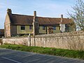
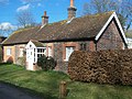
 Almshouses at Platt - geograph.org.uk - 4903595.jpg 4,608 × 3,456; 3.37 MB
-
 Almshouses at Platt - geograph.org.uk - 4903601.jpg 4,608 × 3,456; 3.38 MB
-
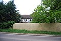
 Attractive house in Platt - geograph.org.uk - 2945256.jpg 4,000 × 3,000; 3.9 MB
-
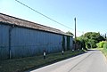 Barn, Crouch Lane - geograph.org.uk - 2515162.jpg 640 × 430; 55 KB
-
 Basted Lane - geograph.org.uk - 2570493.jpg 640 × 430; 90 KB
-
 Basted Lane Sign - geograph.org.uk - 4310631.jpg 640 × 480; 151 KB
-
 Basted Lane, Mill Lane junction - geograph.org.uk - 2578539.jpg 640 × 430; 89 KB
-
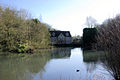
 Basted Mill Pond - geograph.org.uk - 2570477.jpg 640 × 430; 105 KB
-
 Basted Mill Pond - geograph.org.uk - 2570481.jpg 640 × 430; 105 KB
-
 Basted Mill Pond - geograph.org.uk - 2570490.jpg 640 × 430; 81 KB
-
 Basted Mill Pond.jpg 640 × 428; 97 KB
-
 Beechin Wood Farm - geograph.org.uk - 2512875.jpg 640 × 430; 74 KB
-
 Beechin Wood Farm - geograph.org.uk - 2512883.jpg 640 × 430; 64 KB
-
 Beechin Wood Lane - geograph.org.uk - 2512879.jpg 640 × 430; 92 KB
-
 Beechin Wood Lane - geograph.org.uk - 2512881.jpg 640 × 430; 88 KB
-
 Beechin Wood Lane - geograph.org.uk - 2515127.jpg 640 × 430; 99 KB
-
 Beechin Wood Lane - geograph.org.uk - 2515134.jpg 640 × 430; 98 KB
-
 Beechin Wood Lane, St. Mary's Platt - geograph.org.uk - 5127576.jpg 3,264 × 2,448; 1.99 MB
-
 Beechin Wood Lane, St. Mary's Platt - geograph.org.uk - 5127728.jpg 3,264 × 2,448; 2.48 MB
-
 Blue Anchor, St. Mary's Platt - geograph.org.uk - 4679242.jpg 2,272 × 1,704; 772 KB
-
 Bluebells by the A25 - geograph.org.uk - 3613049.jpg 640 × 430; 139 KB
-
 Bluebells in Hatcham's Wood - geograph.org.uk - 2939371.jpg 4,000 × 3,000; 4.31 MB
-
 Bluebells in Hatcham's Wood - geograph.org.uk - 2942492.jpg 4,000 × 3,000; 4.36 MB
-
 Bluebells, Gate House Wood - geograph.org.uk - 3611604.jpg 640 × 430; 145 KB
-
 Bluebells, Nepicar - geograph.org.uk - 3613088.jpg 640 × 430; 141 KB
-
 Bluebells, Nepicar - geograph.org.uk - 3613091.jpg 640 × 430; 141 KB
-
 Boneashe Lane - geograph.org.uk - 2512882.jpg 640 × 430; 103 KB
-
 Boneashe Lane, Platt, Kent - geograph.org.uk - 239796.jpg 640 × 480; 396 KB
-
 Boneashe Lane, St. Mary's Platt - geograph.org.uk - 5127537.jpg 3,264 × 2,448; 2.18 MB
-
 Boneashe Lane, St. Mary's Platt - geograph.org.uk - 5127724.jpg 3,264 × 2,448; 2.54 MB
-
 Bridge House, Basted - geograph.org.uk - 2578541.jpg 640 × 430; 152 KB
-
 Bridleway off Crouch Lane - geograph.org.uk - 2515169.jpg 640 × 430; 147 KB
-
 Bridleway off Long Mill Lane - geograph.org.uk - 2515157.jpg 640 × 430; 139 KB
-
 Bridleway to Basted - geograph.org.uk - 2570435.jpg 640 × 430; 153 KB
-
 Bridleway to Basted - geograph.org.uk - 2570460.jpg 640 × 430; 139 KB
-
 Bridleway to Basted - geograph.org.uk - 2570463.jpg 640 × 430; 153 KB
-
 By the A25 - geograph.org.uk - 3613042.jpg 640 × 430; 87 KB
-
 Cast a long shadow - geograph.org.uk - 6761114.jpg 1,024 × 768; 175 KB
-
 Cleared orchard - geograph.org.uk - 2793832.jpg 640 × 425; 73 KB
-
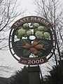 Close-up of Platt Parish Village Sign - geograph.org.uk - 2278503.jpg 2,304 × 3,072; 2.14 MB
-

-
 Comp Lane, St. Mary's Platt - geograph.org.uk - 5127558.jpg 2,989 × 2,241; 1.48 MB
-
 Coppiced trees, Hurst Wood - geograph.org.uk - 2503165.jpg 640 × 430; 158 KB
-
 Coppiced trees, Mereworth Woods - geograph.org.uk - 2504961.jpg 640 × 430; 149 KB
-
 Cottage and converted oast houses, Platt - geograph.org.uk - 2939387.jpg 4,000 × 3,000; 4.47 MB
-
 Cottage by the path - geograph.org.uk - 2512877.jpg 640 × 430; 60 KB
-
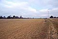
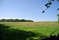
 Cropland near Platt - geograph.org.uk - 2512859.jpg 640 × 430; 64 KB
-
 Crouch Lane - geograph.org.uk - 2515163.jpg 640 × 430; 124 KB
-
 Crouch Lane in the rain - geograph.org.uk - 4898747.jpg 4,608 × 3,456; 3.45 MB
-
 Crouch Lane, Crouch - geograph.org.uk - 5127746.jpg 3,264 × 2,448; 2.96 MB
-
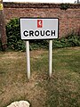 Crouch Village Sign - geograph.org.uk - 5127781.jpg 2,448 × 3,264; 3.27 MB
-
 Entrance to Little Harp's Vineyard - geograph.org.uk - 1397090.jpg 640 × 480; 120 KB
-
 ESSO Filling Station - geograph.org.uk - 3611611.jpg 640 × 430; 73 KB
-

-
 Extreme fly tipping. - geograph.org.uk - 4957684.jpg 640 × 480; 109 KB
-
 Farmland by Long Mill Lane - geograph.org.uk - 2515148.jpg 640 × 430; 67 KB
-
 Farmland near Black Horse Farm - geograph.org.uk - 2570430.jpg 640 × 430; 58 KB
-
 Farmland near Long Bottom Wood - geograph.org.uk - 2570446.jpg 640 × 430; 83 KB
-
 Farmland, Black Horse Farm - geograph.org.uk - 2515172.jpg 640 × 430; 92 KB
-
 Farmland, Nepicar Farm - geograph.org.uk - 3613096.jpg 640 × 430; 61 KB
-
 Farmland, Nepicar Farm - geograph.org.uk - 3613098.jpg 640 × 430; 50 KB
-
 Flowerbed at Great Comp Garden - geograph.org.uk - 6236930.jpg 3,356 × 2,701; 3.56 MB
-
 Foot path through Valley Woods - geograph.org.uk - 6761121.jpg 1,024 × 768; 276 KB
-
 Footpath going west to Platt - geograph.org.uk - 5039014.jpg 800 × 600; 209 KB
-
 Footpath leaves Grange Road - geograph.org.uk - 5039028.jpg 800 × 600; 177 KB
-
 Footpath near Black Horse Farm - geograph.org.uk - 2570426.jpg 640 × 430; 121 KB
-
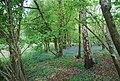
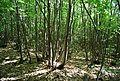
 Footpath through the woods - geograph.org.uk - 2503166.jpg 640 × 430; 157 KB
-
 Footpath to Basted - geograph.org.uk - 2570418.jpg 640 × 430; 120 KB
-
 Footpath to Basted - geograph.org.uk - 2570424.jpg 640 × 430; 117 KB
-
 Footpath, Hurst Wood - geograph.org.uk - 2503164.jpg 640 × 430; 150 KB
-
 Ford Lane - geograph.org.uk - 3611590.jpg 640 × 430; 115 KB
-
 Ford Lane, Wrotham Heath - geograph.org.uk - 4939195.jpg 3,264 × 2,448; 3.08 MB
-
 Ford Place from the south - geograph.org.uk - 4903680.jpg 4,608 × 3,456; 3.54 MB
-
 Gate House Wood - geograph.org.uk - 3611597.jpg 640 × 430; 147 KB
-
 Gate, Hurst Wood - geograph.org.uk - 5169268.jpg 640 × 428; 259 KB
-
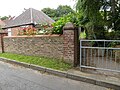
 Grange Road, Platt - geograph.org.uk - 2867831.jpg 1,600 × 1,200; 546 KB
-
 Grange Road, Platt - geograph.org.uk - 2867841.jpg 1,600 × 1,200; 598 KB
-
 Grange Road, St. Mary's Platt - geograph.org.uk - 5127430.jpg 3,264 × 2,448; 1.86 MB
-
 Great Comp - geograph.org.uk - 5062171.jpg 4,525 × 3,393; 2.99 MB
-
 Great Comp - geograph.org.uk - 5062522.jpg 4,608 × 3,456; 3.38 MB
-
 Great Comp - geograph.org.uk - 5799205.jpg 4,000 × 3,000; 4.58 MB
-
 Great Comp from its garden - geograph.org.uk - 6236943.jpg 4,000 × 3,000; 5 MB
-
 Great Comp from the garden - geograph.org.uk - 5031628.jpg 4,608 × 3,456; 3.33 MB
-
 Great Comp from the garden - geograph.org.uk - 5031630.jpg 4,608 × 3,456; 3.39 MB
-
 Great Comp from the garden - geograph.org.uk - 5062178.jpg 4,321 × 3,241; 2.88 MB
-
 Great Comp from the garden - geograph.org.uk - 5062181.jpg 4,608 × 3,456; 3.61 MB
-
 Great Comp from the garden - geograph.org.uk - 5801116.jpg 4,000 × 3,000; 4.95 MB
-
 Great Comp Garden - geograph.org.uk - 2939400.jpg 4,000 × 3,000; 4.06 MB
-
 Great Comp Garden - geograph.org.uk - 5031634.jpg 4,608 × 3,456; 3.39 MB
-
 Great Comp Garden - geograph.org.uk - 5031658.jpg 4,608 × 3,456; 3.4 MB
-
 Great Comp Garden - geograph.org.uk - 5031661.jpg 4,608 × 3,456; 3.41 MB
-
 Great Comp Garden - geograph.org.uk - 5062175.jpg 4,608 × 3,456; 3.33 MB
-
 Great Comp Garden - geograph.org.uk - 5062186.jpg 4,608 × 3,456; 3.44 MB
-
 Great Comp Garden - geograph.org.uk - 5062517.jpg 4,377 × 3,283; 3.84 MB
-
 Great Comp Garden - geograph.org.uk - 6236927.jpg 4,000 × 3,000; 4.56 MB
-
 Great Comp Garden - geograph.org.uk - 6236940.jpg 4,000 × 3,000; 4.73 MB
-
 Great Comp Garden - geograph.org.uk - 6236941.jpg 4,000 × 3,000; 4.79 MB
-
 Great Comp Garden - geograph.org.uk - 6236945.jpg 3,837 × 2,879; 3.14 MB
-
 Great Comp Gardens - geograph.org.uk - 4516981.jpg 1,024 × 683; 361 KB
-
 Great Comp Gardens - geograph.org.uk - 4518503.jpg 1,067 × 1,600; 748 KB
-
 Great Comp Gardens - geograph.org.uk - 4518504.jpg 683 × 1,024; 301 KB
-
 Great Comp Gardens - geograph.org.uk - 4518506.jpg 683 × 1,024; 310 KB
-
 Great Comp Gardens - geograph.org.uk - 4519028.jpg 1,600 × 1,200; 895 KB
-
 Great Comp Gardens - geograph.org.uk - 4519038.jpg 1,024 × 768; 388 KB
-
 Great Comp Gardens - geograph.org.uk - 4519039.jpg 1,024 × 768; 397 KB
-
 Great Comp Gardens - geograph.org.uk - 4519040.jpg 1,024 × 768; 269 KB
-
 Great Comp Gardens - geograph.org.uk - 4519041.jpg 1,024 × 819; 433 KB
-
 Great Comp Gardens - geograph.org.uk - 4519043.jpg 1,024 × 768; 248 KB
-
 Great Comp Gardens - geograph.org.uk - 4519044.jpg 1,024 × 683; 207 KB
-
 Great Comp Gardens - geograph.org.uk - 4519045.jpg 768 × 1,024; 453 KB
-
 Great Comp Gardens Nursery - geograph.org.uk - 4519047.jpg 1,024 × 768; 390 KB
-
 Green Acres - geograph.org.uk - 2515124.jpg 640 × 430; 69 KB
-
 Green Acres - geograph.org.uk - 2515125.jpg 640 × 430; 63 KB
-
 Green Acres, Beechin Wood Lane - geograph.org.uk - 2512873.jpg 640 × 430; 71 KB
-
 Grooms Cottage, Basted - geograph.org.uk - 2570501.jpg 640 × 430; 97 KB
-
 Hazel Cottage - geograph.org.uk - 1196337.jpg 640 × 481; 92 KB
-
 Historic houses - geograph.org.uk - 4516424.jpg 1,024 × 683; 293 KB
-
 Historic houses - geograph.org.uk - 4516980.jpg 1,024 × 768; 228 KB
-
 Holiday Inn, Wrotham - geograph.org.uk - 3627993.jpg 640 × 430; 95 KB
-
 Horse riders on Crouch Lane - geograph.org.uk - 4898749.jpg 4,608 × 3,456; 3.41 MB
-
 Horses in Hurst Wood - geograph.org.uk - 4310620.jpg 640 × 480; 102 KB
-
 House by Basted Mill Pond - geograph.org.uk - 2570486.jpg 640 × 430; 109 KB
-
 House by the A25 - geograph.org.uk - 3612047.jpg 640 × 430; 94 KB
-
 House in Long Mill Lane, Platt - geograph.org.uk - 2945254.jpg 4,000 × 3,000; 4.02 MB
-
 House, Long Mill Lane - geograph.org.uk - 2515151.jpg 640 × 396; 60 KB
-
 House, Wrotham Heath - geograph.org.uk - 3612039.jpg 640 × 430; 86 KB
-
 Houses by the stream, Basted - geograph.org.uk - 2570468.jpg 640 × 430; 135 KB
-
 Huntsman Lane - geograph.org.uk - 3612043.jpg 640 × 430; 97 KB
-
 Huntsman Lane - geograph.org.uk - 6758772.jpg 480 × 640; 66 KB
-
 Huntsman Lane at the junction of the A25 - geograph.org.uk - 4994740.jpg 2,048 × 1,536; 1.04 MB
-
 Huntsman Lane, Wrotham Heath - geograph.org.uk - 4963673.jpg 2,304 × 1,728; 841 KB
-
 Hurst Wood - geograph.org.uk - 1737492.jpg 640 × 480; 109 KB
-
 Hurst Wood - geograph.org.uk - 4310624.jpg 640 × 480; 100 KB
-
 Hurst Wood - geograph.org.uk - 5030452.jpg 4,608 × 3,456; 3.44 MB
-
 In Wrotham Heath - geograph.org.uk - 3612038.jpg 640 × 430; 87 KB
-

-

-
 Junction of Grange Road and Maidstone Road, Platt - geograph.org.uk - 2867642.jpg 1,600 × 1,200; 547 KB
-
 Junction of Grange Road and Maidstone Road, Platt - geograph.org.uk - 2867655.jpg 1,600 × 1,200; 551 KB
-
 Junction of the A20 and A25, Wrotham Heath - geograph.org.uk - 3457459.jpg 2,048 × 1,536; 1.5 MB
-
 Lambards Oast - geograph.org.uk - 2512832.jpg 640 × 347; 54 KB
-
 Lambards Oast - geograph.org.uk - 2512834.jpg 640 × 399; 69 KB
-
 Logging machinery, Hurst Wood - geograph.org.uk - 2503168.jpg 640 × 430; 129 KB
-
 London Countryway in Kent (105) - geograph.org.uk - 5046006.jpg 800 × 600; 170 KB
-
 London Countryway in Kent (106) - geograph.org.uk - 5046020.jpg 800 × 600; 178 KB
-
 London Countryway in Kent (107) - geograph.org.uk - 5046028.jpg 800 × 600; 242 KB
-
 London Countryway in Kent (108) - geograph.org.uk - 5046036.jpg 800 × 600; 242 KB
-
 London Countryway in Kent (109) - geograph.org.uk - 5046041.jpg 800 × 600; 171 KB
-
 London Countryway in Kent (110) - geograph.org.uk - 5046053.jpg 800 × 600; 148 KB
-
 London Countryway in Kent (111) - geograph.org.uk - 5046057.jpg 800 × 600; 160 KB
-
 London Countryway in Kent (112) - geograph.org.uk - 5046065.jpg 800 × 600; 171 KB
-
 London Countryway in Kent (113) - geograph.org.uk - 5046940.jpg 800 × 600; 192 KB
-
 London Countryway in Kent (114) - geograph.org.uk - 5046950.jpg 800 × 600; 217 KB
-
 London Countryway in Kent (115) - geograph.org.uk - 5046962.jpg 800 × 600; 189 KB
-
 London Countryway in Kent (116) - geograph.org.uk - 5046975.jpg 800 × 600; 233 KB
-
 London Countryway in Kent (117) - geograph.org.uk - 5046987.jpg 800 × 600; 208 KB
-
 London Countryway in Kent (118) - geograph.org.uk - 5047003.jpg 800 × 600; 198 KB
-
 London Countryway in Kent (119) - geograph.org.uk - 5047008.jpg 800 × 600; 204 KB
-
 London Countryway in Kent (120) - geograph.org.uk - 5047014.jpg 800 × 600; 192 KB
-
 London Countryway in Kent (121) - geograph.org.uk - 5047048.jpg 800 × 600; 150 KB
-
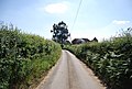
 Long Mill Lane - geograph.org.uk - 2515139.jpg 640 × 430; 119 KB
-
 Long Mill Lane - geograph.org.uk - 2515142.jpg 640 × 430; 115 KB
-
 Long Mill Lane - geograph.org.uk - 2515147.jpg 640 × 430; 111 KB
-
 Long Mill Lane - geograph.org.uk - 2515154.jpg 640 × 430; 105 KB
-
 Long Mill Lane - geograph.org.uk - 2515158.jpg 640 × 430; 75 KB
-
 Long Mill Lane Crouch - geograph.org.uk - 4650338.jpg 640 × 480; 99 KB
-
 Long Mill Lane, Crouch - geograph.org.uk - 3726946.jpg 1,024 × 768; 223 KB
-
 Long Mill Lane, Crouch - geograph.org.uk - 5127741.jpg 3,264 × 2,448; 2.05 MB
-
 Long Mill Lane, Crouch - geograph.org.uk - 5127743.jpg 3,083 × 2,313; 1.76 MB
-
 Long Mill Lane, Crouch - geograph.org.uk - 5127748.jpg 3,264 × 2,448; 1.98 MB
-
 Long Mill Lane, Crouch - geograph.org.uk - 5127753.jpg 3,264 × 2,448; 2.48 MB
-
 Long Mill Lane, Crouch - geograph.org.uk - 5127787.jpg 3,264 × 2,448; 2.14 MB
-
 Long Mill Lane, St. Mary's Platt - geograph.org.uk - 4679234.jpg 2,272 × 1,704; 786 KB
-
 Long Mill Lane, St. Mary's Platt - geograph.org.uk - 4679249.jpg 2,272 × 1,704; 795 KB
-
 Long Mill Lane, St. Mary's Platt - geograph.org.uk - 5127456.jpg 3,264 × 2,448; 1.51 MB
-
 Long Mill Lane, St. Mary's Platt - geograph.org.uk - 5127733.jpg 3,264 × 2,448; 2.04 MB
-
 Long Mill Lane, St. Mary's Platt - geograph.org.uk - 5127736.jpg 3,264 × 2,448; 2.59 MB
-
 Looking along Comp Lane - geograph.org.uk - 2942500.jpg 4,000 × 3,000; 4.41 MB
-
 Lorries in a lay-by - geograph.org.uk - 6758763.jpg 1,024 × 1,024; 214 KB
-
 Maidstone Road, Borough Green - geograph.org.uk - 2868075.jpg 1,600 × 1,200; 602 KB
-
 Maidstone Road, St. Mary's Platt - geograph.org.uk - 4679226.jpg 2,272 × 1,704; 754 KB
-
 Maidstone Road, St. Mary's Platt - geograph.org.uk - 5127425.jpg 3,264 × 2,448; 1.72 MB
-
 Maidstone Road, Wrotham Heath - geograph.org.uk - 4939186.jpg 3,264 × 2,448; 1.68 MB
-
 Maidstone Road, Wrotham Heath - geograph.org.uk - 4963686.jpg 2,304 × 1,728; 862 KB
-
 Maidstone Road, Wrotham Heath - geograph.org.uk - 4993518.jpg 2,048 × 1,536; 1.52 MB
-
 Maidstone Road, Wrotham Heath - geograph.org.uk - 4993521.jpg 2,048 × 1,536; 1.51 MB
-
 Ming, Wrotham Heath - geograph.org.uk - 3611613.jpg 640 × 430; 63 KB
-
 Miniature Silver Appleyard and Mallard - geograph.org.uk - 1964978.jpg 640 × 480; 100 KB
-
 Napps Farm - geograph.org.uk - 1200035.jpg 640 × 481; 112 KB
-
 Near Nepicar Farm - geograph.org.uk - 3613100.jpg 640 × 430; 83 KB
-
 Nepicar Farm - geograph.org.uk - 1196287.jpg 640 × 481; 71 KB
-
 Nepicar Farm - geograph.org.uk - 3613094.jpg 640 × 430; 35 KB
-
 Nepicar Farm - geograph.org.uk - 3613103.jpg 640 × 430; 92 KB


_-_geograph.org.uk_-_5046006.jpg)
_-_geograph.org.uk_-_5046020.jpg)
_-_geograph.org.uk_-_5046028.jpg)
_-_geograph.org.uk_-_5046036.jpg)
_-_geograph.org.uk_-_5046041.jpg)
_-_geograph.org.uk_-_5046053.jpg)
_-_geograph.org.uk_-_5046057.jpg)
_-_geograph.org.uk_-_5046065.jpg)
_-_geograph.org.uk_-_5046940.jpg)
_-_geograph.org.uk_-_5046950.jpg)
_-_geograph.org.uk_-_5046962.jpg)
_-_geograph.org.uk_-_5046975.jpg)
_-_geograph.org.uk_-_5046987.jpg)
_-_geograph.org.uk_-_5047003.jpg)
_-_geograph.org.uk_-_5047008.jpg)
_-_geograph.org.uk_-_5047014.jpg)
_-_geograph.org.uk_-_5047048.jpg)


