Category:Police Operational Facility Dyer Avenue
| Object location | | View all coordinates using: OpenStreetMap |
|---|
中文:戴亞街警務處行動設施
Media in category "Police Operational Facility Dyer Avenue"
The following 3 files are in this category, out of 3 total.
-
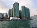 Laguna Verde South Side viewed from Victoria Harbour.jpg 4,736 × 3,552; 8.15 MB
-
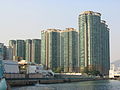 Laguna Verde.jpg 1,999 × 1,499; 728 KB
-
 P1010077.JPG 1,600 × 1,200; 390 KB


