Category:Political maps of Belmont County, Ohio as of the 2000 United States Census
Media in category "Political maps of Belmont County, Ohio as of the 2000 United States Census"
The following 35 files are in this category, out of 35 total.
-
 Map of Belmont County Ohio Highlighting Barnesville Village.png 596 × 502; 25 KB
-
 Map of Belmont County Ohio Highlighting Bellaire Village.png 596 × 502; 25 KB
-
 Map of Belmont County Ohio Highlighting Belmont Village.png 596 × 502; 25 KB
-
 Map of Belmont County Ohio Highlighting Bethesda Village.png 596 × 502; 25 KB
-
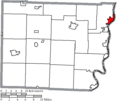
 Map of Belmont County Ohio Highlighting Bridgeport Village.png 596 × 502; 25 KB
-
 Map of Belmont County Ohio Highlighting Brookside Village.png 596 × 502; 25 KB
-
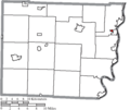
 Map of Belmont County Ohio Highlighting Colerain Township.png 596 × 502; 25 KB
-
 Map of Belmont County Ohio Highlighting Fairview Village.png 596 × 502; 25 KB
-
 Map of Belmont County Ohio Highlighting Flushing Township.png 596 × 502; 25 KB
-
 Map of Belmont County Ohio Highlighting Flushing Village.png 596 × 502; 25 KB
-
 Map of Belmont County Ohio Highlighting Goshen Township.png 596 × 502; 25 KB
-
 Map of Belmont County Ohio Highlighting Holloway Village.png 596 × 502; 25 KB
-
 Map of Belmont County Ohio Highlighting Kirkwood Township.png 596 × 502; 25 KB
-
 Map of Belmont County Ohio Highlighting Martins Ferry City.png 596 × 502; 25 KB
-
 Map of Belmont County Ohio Highlighting Mead Township.png 596 × 502; 25 KB
-
 Map of Belmont County Ohio Highlighting Morristown Village.png 596 × 502; 25 KB
-
 Map of Belmont County Ohio Highlighting Pease Township.png 596 × 502; 25 KB
-
 Map of Belmont County Ohio Highlighting Powhatan Point Village.png 596 × 502; 25 KB
-
 Map of Belmont County Ohio Highlighting Pultney Township.png 596 × 502; 25 KB
-
 Map of Belmont County Ohio Highlighting Richland Township.png 596 × 502; 25 KB
-
 Map of Belmont County Ohio Highlighting Saint Clairsville City.png 596 × 502; 25 KB
-
 Map of Belmont County Ohio Highlighting Shadyside Village.png 596 × 502; 25 KB
-
 Map of Belmont County Ohio Highlighting Smith Township.png 596 × 502; 25 KB
-
 Map of Belmont County Ohio Highlighting Somerset Township.png 596 × 502; 25 KB
-
 Map of Belmont County Ohio Highlighting Union Township.png 596 × 502; 25 KB
-
 Map of Belmont County Ohio Highlighting Warren Township.png 596 × 502; 25 KB
-
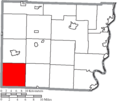
 Map of Belmont County Ohio Highlighting Washington Township.png 596 × 502; 25 KB
-
 Map of Belmont County Ohio Highlighting Wayne Township.png 596 × 502; 25 KB
-
 Map of Belmont County Ohio Highlighting Wheeling Township.png 596 × 502; 25 KB
-
 Map of Belmont County Ohio Highlighting Wilson Village.png 596 × 502; 25 KB
-
 Map of Belmont County Ohio Highlighting York Township.png 596 × 502; 25 KB
-
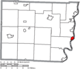
 Map of Belmont County Ohio Highlighting Yorkville Village.png 596 × 502; 25 KB
-
 Map of Belmont County Ohio With Municipal and Township Labels.PNG 691 × 502; 53 KB
-
 Map of Belmont County, Ohio No Text, Municipalities Distinct.png 596 × 502; 25 KB
-
 Map of Belmont County, Ohio No Text.png 596 × 502; 25 KB


