Category:Political maps of Delaware County, Ohio as of the 2000 United States Census
Media in category "Political maps of Delaware County, Ohio as of the 2000 United States Census"
The following 31 files are in this category, out of 31 total.
-
 Map of Delaware County Ohio Highlighting Ashley Village.png 556 × 479; 24 KB
-
 Map of Delaware County Ohio Highlighting Berkshire Township.png 556 × 479; 24 KB
-
 Map of Delaware County Ohio Highlighting Berlin Township.png 556 × 479; 24 KB
-
 Map of Delaware County Ohio Highlighting Brown Township.png 556 × 479; 24 KB
-
 Map of Delaware County Ohio Highlighting Columbus City.png 556 × 479; 24 KB
-
 Map of Delaware County Ohio Highlighting Concord Township.png 556 × 479; 24 KB
-
 Map of Delaware County Ohio Highlighting Delaware City.png 556 × 479; 24 KB
-
 Map of Delaware County Ohio Highlighting Delaware Township.png 556 × 479; 24 KB
-
 Map of Delaware County Ohio Highlighting Dublin City.png 556 × 479; 24 KB
-
 Map of Delaware County Ohio Highlighting Galena Village.png 556 × 479; 24 KB
-
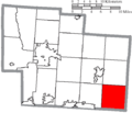
 Map of Delaware County Ohio Highlighting Genoa Township.png 556 × 479; 24 KB
-
 Map of Delaware County Ohio Highlighting Harlem Township.png 556 × 479; 24 KB
-
 Map of Delaware County Ohio Highlighting Kingston Township.png 556 × 479; 24 KB
-
 Map of Delaware County Ohio Highlighting Liberty Township.png 556 × 479; 24 KB
-
 Map of Delaware County Ohio Highlighting Marlboro Township.png 556 × 479; 24 KB
-
 Map of Delaware County Ohio Highlighting Orange Township.png 556 × 479; 24 KB
-
 Map of Delaware County Ohio Highlighting Ostrander Village.png 556 × 479; 24 KB
-
 Map of Delaware County Ohio Highlighting Oxford Township.png 556 × 479; 24 KB
-
 Map of Delaware County Ohio Highlighting Porter Township.png 556 × 479; 24 KB
-
 Map of Delaware County Ohio Highlighting Powell City.png 556 × 479; 24 KB
-
 Map of Delaware County Ohio Highlighting Radnor Township.png 556 × 479; 24 KB
-
 Map of Delaware County Ohio Highlighting Scioto Township.png 556 × 479; 24 KB
-
 Map of Delaware County Ohio Highlighting Shawnee Hills Village.png 556 × 479; 24 KB
-
 Map of Delaware County Ohio Highlighting Sunbury Village.png 556 × 479; 24 KB
-
 Map of Delaware County Ohio Highlighting Thompson Township.png 556 × 479; 24 KB
-
 Map of Delaware County Ohio Highlighting Trenton Township.png 556 × 479; 24 KB
-
 Map of Delaware County Ohio Highlighting Troy Township.png 556 × 479; 24 KB
-
 Map of Delaware County Ohio Highlighting Westerville City.png 556 × 479; 24 KB
-
 Map of Delaware County Ohio With Municipal and Township Labels.PNG 556 × 479; 45 KB
-
 Map of Delaware County, Ohio No Text, Municipalities Distinct.png 556 × 479; 24 KB
-
 Map of Delaware County, Ohio No Text.png 556 × 479; 24 KB


