Category:Political maps of Greene County, Ohio as of the 2000 United States Census
Media in category "Political maps of Greene County, Ohio as of the 2000 United States Census"
The following 25 files are in this category, out of 25 total.
-
 Map of Greene County Ohio Highlighting Bath Township.png 521 × 464; 28 KB
-
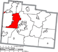
 Map of Greene County Ohio Highlighting Beavercreek City.png 521 × 464; 28 KB
-
 Map of Greene County Ohio Highlighting Beavercreek Township.png 521 × 464; 28 KB
-
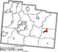
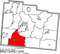
 Map of Greene County Ohio Highlighting Bellbrook City.png 521 × 464; 28 KB
-
 Map of Greene County Ohio Highlighting Bowersville Village.png 521 × 464; 28 KB
-
 Map of Greene County Ohio Highlighting Caesarscreek Township.png 521 × 464; 28 KB
-
 Map of Greene County Ohio Highlighting Cedarville Township.png 521 × 464; 28 KB
-
 Map of Greene County Ohio Highlighting Cedarville Village.png 521 × 464; 28 KB
-
 Map of Greene County Ohio Highlighting Clifton Village.png 521 × 464; 28 KB
-
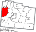
 Map of Greene County Ohio Highlighting Fairborn City.png 521 × 464; 28 KB
-
 Map of Greene County Ohio Highlighting Jamestown Village.png 521 × 464; 28 KB
-
 Map of Greene County Ohio Highlighting Jefferson Township.png 521 × 464; 28 KB
-
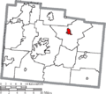
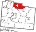 Map of Greene County Ohio Highlighting Miami Township.png 521 × 464; 28 KB
-
 Map of Greene County Ohio Highlighting New Jasper Township.png 521 × 464; 28 KB
-
 Map of Greene County Ohio Highlighting Ross Township.png 521 × 464; 28 KB
-
 Map of Greene County Ohio Highlighting Silvercreek Township.png 521 × 464; 28 KB
-
 Map of Greene County Ohio Highlighting Spring Valley Township.png 521 × 464; 28 KB
-
 Map of Greene County Ohio Highlighting Spring Valley Village.png 521 × 464; 28 KB
-
 Map of Greene County Ohio Highlighting Sugarcreek Township.png 521 × 464; 28 KB
-
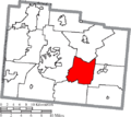
 Map of Greene County Ohio Highlighting Xenia City.png 521 × 464; 28 KB
-
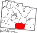
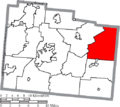
 Map of Greene County Ohio Highlighting Xenia Township.png 521 × 464; 28 KB
-
 Map of Greene County Ohio Highlighting Yellow Springs Village.png 521 × 464; 28 KB
-
 Map of Greene County Ohio With Municipal and Township Labels.PNG 521 × 464; 47 KB
-
 Map of Greene County, Ohio No Text, Municipalities Distinct.png 521 × 464; 28 KB
-
 Map of Greene County, Ohio No Text.png 521 × 464; 27 KB


