Category:Political maps of Iowa
States of the United States: Alabama · Alaska · Arizona · Arkansas · California · Colorado · Connecticut · Delaware · Florida · Georgia · Hawaii · Idaho · Illinois · Indiana · Iowa · Kansas · Kentucky · Louisiana · Maine · Maryland · Massachusetts · Michigan · Minnesota · Mississippi · Missouri · Montana · Nebraska · Nevada · New Hampshire · New Jersey · New Mexico · New York · North Carolina · North Dakota · Ohio · Oklahoma · Oregon · Pennsylvania · Rhode Island · South Carolina · Tennessee · Texas · Utah · Vermont · Virginia · Washington · West Virginia · Wisconsin · Wyoming – Washington, D.C.
American Samoa · Northern Mariana Islands · United States Virgin Islands
American Samoa · Northern Mariana Islands · United States Virgin Islands
Subcategories
This category has the following 3 subcategories, out of 3 total.
C
E
Media in category "Political maps of Iowa"
The following 7 files are in this category, out of 7 total.
-
 Iowa 1905 Census Map Indian Terr Accessions.jpg 1,351 × 908; 1.01 MB
-
 Iowa Presidential Election Results 1968.svg 744 × 498; 179 KB
-
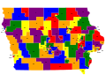 Iowa State House Districts, 2002-2012.svg 792 × 612; 2.15 MB
-
 Iowa State House Districts, 2012-2022.svg 600 × 388; 1.54 MB
-
 Iowa State Senate Districts, 2002-2012.svg 792 × 612; 1.54 MB
-
 Iowa State Senate Districts, 2012-2022.svg 700 × 428; 1.31 MB
-


.jpg)