Category:Political maps of Portage County, Ohio as of the 2000 United States Census
Media in category "Political maps of Portage County, Ohio as of the 2000 United States Census"
The following 33 files are in this category, out of 33 total.
-
 Map of Portage County Ohio Highlighting Atwater Township.png 467 × 579; 23 KB
-
 Map of Portage County Ohio Highlighting Aurora City.png 467 × 579; 23 KB
-
 Map of Portage County Ohio Highlighting Brady Lake Village.png 467 × 579; 23 KB
-
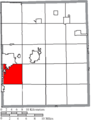 Map of Portage County Ohio Highlighting Brimfield Township.png 467 × 579; 23 KB
-
 Map of Portage County Ohio Highlighting Charlestown Township.png 467 × 579; 23 KB
-
 Map of Portage County Ohio Highlighting Deerfield Township.png 467 × 579; 23 KB
-
 Map of Portage County Ohio Highlighting Edinburg Township.png 467 × 579; 23 KB
-
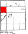
 Map of Portage County Ohio Highlighting Franklin Township.png 467 × 579; 23 KB
-
 Map of Portage County Ohio Highlighting Freedom Township.png 467 × 579; 23 KB
-
 Map of Portage County Ohio Highlighting Garrettsville Village.png 467 × 579; 23 KB
-
 Map of Portage County Ohio Highlighting Hiram Township.png 467 × 579; 23 KB
-
 Map of Portage County Ohio Highlighting Hiram Village.png 467 × 579; 23 KB
-
 Map of Portage County Ohio Highlighting Kent City.png 467 × 579; 23 KB
-
 Map of Portage County Ohio Highlighting Mantua Township.png 467 × 579; 23 KB
-
 Map of Portage County Ohio Highlighting Mantua Village.png 467 × 579; 23 KB
-
 Map of Portage County Ohio Highlighting Mogadore Village.png 467 × 579; 23 KB
-
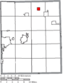
 Map of Portage County Ohio Highlighting Nelson Township.png 467 × 579; 23 KB
-
 Map of Portage County Ohio Highlighting Palmyra Township.png 467 × 579; 23 KB
-
 Map of Portage County Ohio Highlighting Paris Township.png 467 × 579; 23 KB
-
 Map of Portage County Ohio Highlighting Randolph Township.png 467 × 579; 23 KB
-
 Map of Portage County Ohio Highlighting Ravenna City.png 467 × 579; 23 KB
-
 Map of Portage County Ohio Highlighting Ravenna Township.png 467 × 579; 23 KB
-
 Map of Portage County Ohio Highlighting Rootstown Township.png 467 × 579; 23 KB
-
 Map of Portage County Ohio Highlighting Shalersville Township.png 467 × 579; 23 KB
-
 Map of Portage County Ohio Highlighting Streetsboro City.png 467 × 579; 23 KB
-
 Map of Portage County Ohio Highlighting Suffield Township.png 467 × 579; 23 KB
-

-
 Map of Portage County Ohio Highlighting Tallmadge City.png 467 × 579; 23 KB
-
 Map of Portage County Ohio Highlighting Windham Township.png 467 × 579; 23 KB
-
 Map of Portage County Ohio Highlighting Windham Village.png 467 × 579; 23 KB
-
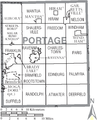 Map of Portage County Ohio With Municipal and Township Labels.PNG 467 × 579; 45 KB
-
 Map of Portage County, Ohio No Text, Municipalities Distinct.png 467 × 579; 23 KB
-
 Map of Portage County, Ohio No Text.png 467 × 579; 23 KB


