Category:Political maps of Slovenia
Subcategories
This category has the following 3 subcategories, out of 3 total.
Media in category "Political maps of Slovenia"
The following 16 files are in this category, out of 16 total.
-
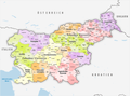 Gemeinden Slowenien 2020.png 4,000 × 2,961; 2.05 MB
-
 Map of Slovenia.gif 255 × 274; 22 KB
-
 Si-map-ja.png 636 × 325; 11 KB
-
 Slovenia Base Map.png 1,104 × 695; 292 KB
-
 Slovenia blank.png 636 × 325; 6 KB
-
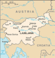
 Slovenia CIA map PL.jpg 737 × 377; 70 KB
-
 Slovenia map CIA fr.png 636 × 325; 13 KB
-
 Slovenia map.png 2,466 × 1,890; 1.59 MB
-
 Slovenia regions map ru.svg 1,550 × 1,220; 3.07 MB
-
 Slovenia-CIA WFB Map mk.png 328 × 353; 13 KB
-
 Slovenia-CIA WFB Map.png 328 × 353; 13 KB
-
 Slovenia-map no.png 737 × 377; 93 KB
-
 Slovenia-map sl.png 737 × 377; 89 KB
-
 Slovenia-map-CIA.png 636 × 325; 9 KB
-
 Sloveniait.png 630 × 319; 10 KB
-
 Slovenien karta svensk text.png 636 × 325; 18 KB


