Category:Polnessan
village in East Ayrshire, Scotland, UK  | |||||
| Upload media | |||||
| Instance of | |||||
|---|---|---|---|---|---|
| Location |
| ||||
 | |||||

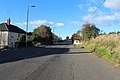
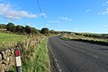
Polnessan is a small rural village in East Ayrshire, Scotland. Polnessan has a population of 87, and is located one kilometre north of Patna on the A713 road.
Media in category "Polnessan"
The following 20 files are in this category, out of 20 total.
-
 A break In The Forest - geograph.org.uk - 404820.jpg 512 × 384; 86 KB
-
 A Path Through The Forest - geograph.org.uk - 404865.jpg 512 × 384; 75 KB
-
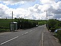 A713 at Polnessan - geograph.org.uk - 182616.jpg 640 × 480; 74 KB
-
 A713 north of Polnessan - geograph.org.uk - 182614.jpg 640 × 480; 73 KB
-
 Bridge south of Holehouse Junction - geograph.org.uk - 182613.jpg 640 × 485; 78 KB
-
 Broom Hill plantation - geograph.org.uk - 182618.jpg 640 × 480; 50 KB
-
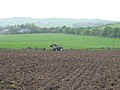 Farmland near Old Smithston - geograph.org.uk - 182621.jpg 640 × 480; 73 KB
-
 Farmland near Old Smithston - geograph.org.uk - 3693345.jpg 1,920 × 1,280; 1.5 MB
-
 Farmland near Polnessan - geograph.org.uk - 3693349.jpg 1,920 × 1,280; 1.64 MB
-

-
-
-
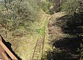
 Holehouse Junction geograph-3683263-by-Ben-Brooksbank.jpg 2,391 × 1,396; 2.21 MB
-
 Pipes by the B730 - geograph.org.uk - 182623.jpg 640 × 480; 58 KB
-
 Road to Ayr at Polnessan - geograph.org.uk - 3693335.jpg 1,920 × 1,280; 1.61 MB
-
 Road to Ayr near Polnessan - geograph.org.uk - 3693341.jpg 1,920 × 1,280; 1.5 MB
-
 Road to Dalmellington at Polnessan - geograph.org.uk - 3693336.jpg 1,920 × 1,280; 1.89 MB
-
 Road to Dalmellington near Polnessan - geograph.org.uk - 3693342.jpg 1,920 × 1,280; 1.64 MB
-
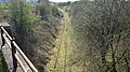
 The Holehouse Junction area, view south, Dalmellington Branch, East Ayrshire.jpg 4,896 × 2,752; 8.01 MB
-
 The Interconnector - geograph.org.uk - 821985.jpg 640 × 480; 70 KB


