Category:Pomp Hoogstraat (Eenrum)
| Object location | | View all coordinates using: OpenStreetMap |
|---|
 | |||||
| Upload media | |||||
| Instance of | |||||
|---|---|---|---|---|---|
| Location | Eenrum, Het Hogeland, Groningen, Netherlands | ||||
| Heritage designation |
| ||||
 | |||||
|
This is a category about rijksmonument number 14544
|
| Address |
|
Media in category "Pomp Hoogstraat (Eenrum)"
The following 4 files are in this category, out of 4 total.
-
 Eenrum - rode pomp.jpg 3,013 × 2,260; 2.77 MB
-
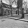
 Hoogstraat west - Eenrum - 20067458 - RCE.jpg 1,200 × 1,181; 304 KB
-
 Kerkpad - Eenrum - 20067467 - RCE.jpg 1,200 × 1,188; 433 KB
-
 Pomp - Eenrum - 20067554 - RCE.jpg 1,200 × 1,198; 418 KB


