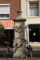
Category:Pomp op de Markt, Culemborg
| Object location | | View all coordinates using: OpenStreetMap |
|---|
 | |||||
| Upload media | |||||
| Instance of | |||||
|---|---|---|---|---|---|
| Location | Culemborg, Gelderland, Netherlands | ||||
| Street address |
| ||||
| Heritage designation |
| ||||
 | |||||
|
This is a category about rijksmonument number 11615
|
| Address |
|
Media in category "Pomp op de Markt, Culemborg"
The following 17 files are in this category, out of 17 total.
-
 Culemborg - Markt bij 10 - Waterpomp.JPG 2,592 × 3,888; 5.12 MB
-
 Culemborg - Markt bij 10 Waterpomp - stadswapen.JPG 3,888 × 2,592; 5.72 MB
-
 Culemborg - Markt bij 34 Waterpomp.JPG 2,592 × 3,888; 4.68 MB
-
 Culemborg, Netherlands - panoramio (10).jpg 1,148 × 2,048; 476 KB
-
 Culemborg, Netherlands - panoramio (103).jpg 1,148 × 2,048; 426 KB
-
 Culemborg, Netherlands - panoramio (9).jpg 1,148 × 2,048; 452 KB
-
 Overzicht van de voorgevel met daarvoor een stadspomp - Culemborg - 20382234 - RCE.jpg 1,200 × 1,193; 287 KB
-
 Pomp - Culemborg - 20051498 - RCE.jpg 884 × 1,200; 264 KB
-
 Pomp - Culemborg - 20051505 - RCE.jpg 967 × 1,200; 215 KB
-
 Pomp - Culemborg - 20322268 - RCE.jpg 605 × 1,200; 163 KB
-
 Pomp Markt 34 Culemborg.jpg 2,491 × 4,251; 2.33 MB
-
 Pomp Markt Culemborg.JPG 3,056 × 4,592; 4.93 MB
-
 Voorgevel - Culemborg - 20051947 - RCE.jpg 1,133 × 1,200; 298 KB
-
 Voorgevel - Culemborg - 20051948 - RCE.jpg 797 × 1,200; 219 KB
-
 Voorgevels - Culemborg - 20051949 - RCE.jpg 1,200 × 799; 234 KB
-
 Wapen op pomp Markt Culemborg.JPG 4,592 × 3,056; 5.69 MB
-
 Waterpomp, detail reliëf - Culemborg - 20371159 - RCE.jpg 1,200 × 783; 235 KB


.jpg)
.jpg)
.jpg)


