Category:Ponca Creek bridge T33N R19W S18-19
| Object location | | View all coordinates using: OpenStreetMap |
|---|
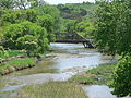
This is not the Ponca Creek Bridge listed in the National Register of Historic Places in Boyd County, although it is close to the site of that bridge. Note that this bridge has a hip vertical member (running vertically downward from the top of the sloping end post). A photo of the NRHP bridge at the Nebraska State Historical Society website shows no hip vertical member on that bridge.
Media in category "Ponca Creek bridge T33N R19W S18-19"
The following 3 files are in this category, out of 3 total.
-
 Boyd County Ponca Creek bridge T33N R9W S18-19 (1).JPG 2,409 × 1,470; 1.5 MB
-
 Boyd County Ponca Creek bridge T33N R9W S18-19 (2).JPG 2,560 × 1,920; 2.19 MB
-
 Boyd County Ponca Creek bridge T33N R9W S18-19 (3).JPG 1,892 × 879; 700 KB
.JPG)
.JPG)
.JPG)