Category:Ponds in Northumberland
Media in category "Ponds in Northumberland"
The following 74 files are in this category, out of 74 total.
-
 A pond near Thirston New Houses - geograph.org.uk - 438521.jpg 632 × 468; 118 KB
-
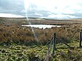 A pond on the moor - geograph.org.uk - 396794.jpg 640 × 480; 102 KB
-
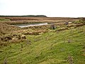
 A pool by the Pennine Way - geograph.org.uk - 265124.jpg 640 × 480; 71 KB
-
 Arcot Pond - geograph.org.uk - 105540.jpg 640 × 480; 129 KB
-
 Boat House Pond - geograph.org.uk - 675449.jpg 640 × 480; 89 KB
-
 Cresswell Pond panorama.jpg 3,450 × 900; 2.04 MB
-
 Decoy ponds in Wark Forest. - geograph.org.uk - 131624.jpg 640 × 272; 54 KB
-
 Duck pond on Whaup Moss - geograph.org.uk - 594752.jpg 640 × 480; 120 KB
-
 Eland Hall Farm duckpond - geograph.org.uk - 296166.jpg 640 × 427; 106 KB
-
 Garden pond, Harwood - geograph.org.uk - 1411536.jpg 640 × 480; 119 KB
-
 Heron by pond, Humbleton Hill - geograph.org.uk - 718204.jpg 640 × 222; 40 KB
-
 Howick Pond - geograph.org.uk - 107392.jpg 640 × 480; 132 KB
-
 Kilham Valley - geograph.org.uk - 165346.jpg 640 × 415; 117 KB
-
 Netherton Pond - geograph.org.uk - 306238.jpg 640 × 426; 137 KB
-
 Pond - geograph.org.uk - 35180.jpg 640 × 480; 165 KB
-

-
 Pond east of Broomley - geograph.org.uk - 727045.jpg 640 × 480; 57 KB
-
 Pond in Blubbery Wood - geograph.org.uk - 770030.jpg 640 × 480; 102 KB
-
 Pond in the Rowley valley - geograph.org.uk - 1458497.jpg 640 × 480; 420 KB
-
 Pond in Threestoneburn Wood - geograph.org.uk - 1102651.jpg 640 × 480; 111 KB
-
 Pond NE edge of Blubbery Wood - geograph.org.uk - 772223.jpg 640 × 480; 70 KB
-
 Pond near Old Ridley - geograph.org.uk - 727064.jpg 640 × 480; 119 KB
-
 Pond near Watergate Sike, Wark Forest - geograph.org.uk - 290549.jpg 640 × 480; 97 KB
-
 Sled lane pond - geograph.org.uk - 53682.jpg 640 × 480; 32 KB
-
 Soney Gap - geograph.org.uk - 719688.jpg 640 × 427; 86 KB
-
 The Beehive Flash - geograph.org.uk - 714340.jpg 640 × 480; 81 KB
-
 Wishing Pool - geograph.org.uk - 369678.jpg 640 × 480; 194 KB
-
 Woodhorn Pond - geograph.org.uk - 280656.jpg 640 × 480; 103 KB
-
 A pond near Wooperton Hall - geograph.org.uk - 427541.jpg 640 × 480; 110 KB
-
 Archie's Pond, Longhorsley - geograph.org.uk - 626931.jpg 640 × 480; 121 KB
-
 Bog Pool - geograph.org.uk - 683099.jpg 640 × 480; 112 KB
-
 Cocklawburn Pond - geograph.org.uk - 106411.jpg 640 × 480; 75 KB
-

-
 Coney Garth - geograph.org.uk - 132607.jpg 640 × 480; 83 KB
-
 Cresswell Pond - geograph.org.uk - 298822.jpg 640 × 480; 56 KB
-
 Cresswell Pond - geograph.org.uk - 72999.jpg 640 × 480; 84 KB
-
 Creswell Pond - geograph.org.uk - 97969.jpg 640 × 480; 96 KB
-
 Cygnet in a pond near Brenkley - geograph.org.uk - 79709.jpg 640 × 500; 69 KB
-
 Decoy pond near Low Park - geograph.org.uk - 334325.jpg 640 × 480; 107 KB
-
 Duck Pond, Mitford Steads Farm - geograph.org.uk - 120060.jpg 640 × 498; 106 KB
-
 East Chevington Nature Reserve - geograph.org.uk - 149368.jpg 640 × 480; 56 KB
-
 Evening Water - geograph.org.uk - 152909.jpg 200 × 150; 13 KB
-
 Fishing Lake - geograph.org.uk - 277355.jpg 640 × 480; 55 KB
-
 Fishing lake near Shiel Dykes - geograph.org.uk - 616438.jpg 640 × 480; 73 KB
-
 Fishing Pond - geograph.org.uk - 244391.jpg 640 × 480; 94 KB
-
 Gibbs Hill Pond - geograph.org.uk - 381780.jpg 640 × 480; 102 KB
-
 Gravel Pit now Pond - geograph.org.uk - 454463.jpg 640 × 480; 72 KB
-
 Harehope - geograph.org.uk - 252097.jpg 640 × 447; 80 KB
-
 Holywell Pond - geograph.org.uk - 32737.jpg 640 × 480; 87 KB
-
 Howick Hall Pond in Winter - geograph.org.uk - 726322.jpg 640 × 480; 87 KB
-
 Lilburn Pond - geograph.org.uk - 389942.jpg 640 × 480; 111 KB
-
 Mediaeval fish ponds - geograph.org.uk - 592733.jpg 640 × 480; 70 KB
-
 Moorland pool, Whitfield - geograph.org.uk - 574283.jpg 640 × 480; 124 KB
-
 Oxford Ponds with Swans - geograph.org.uk - 106387.jpg 640 × 480; 108 KB
-
 Pond and wildlife near Limestones - geograph.org.uk - 452211.jpg 640 × 480; 77 KB
-
 Pond at Heiferlaw Bridge - geograph.org.uk - 466619.jpg 640 × 480; 132 KB
-

-
 Pond at Well Hill - geograph.org.uk - 322655.jpg 630 × 425; 67 KB
-
 Pond at Woodhead - geograph.org.uk - 306141.jpg 640 × 479; 83 KB
-
 Pond in Kielder Forest - geograph.org.uk - 203783.jpg 480 × 640; 209 KB
-
 Pond in Yearhaugh plantation - geograph.org.uk - 595814.jpg 640 × 480; 142 KB
-
 Pond near Far Skerr - geograph.org.uk - 303119.jpg 640 × 368; 51 KB
-
 Pond near Hetherington - geograph.org.uk - 488146.jpg 640 × 480; 101 KB
-
 Pond near High Buston - geograph.org.uk - 304069.jpg 640 × 480; 82 KB
-
 Pond near quarry on approach to Ingoe - geograph.org.uk - 251529.jpg 640 × 480; 122 KB
-
 Pond near Shawfield Farm - geograph.org.uk - 302275.jpg 640 × 426; 113 KB
-
 Pond near St Peter's Church, Newbrough - geograph.org.uk - 693416.jpg 640 × 480; 132 KB
-
 Pool northeast of Wolf Hole - geograph.org.uk - 305549.jpg 480 × 640; 110 KB
-
 Reigh Pond - geograph.org.uk - 440388.jpg 640 × 480; 160 KB
-
 Reigh Pond West - geograph.org.uk - 447953.jpg 640 × 480; 130 KB
-
 Roosting Gulls - geograph.org.uk - 454437.jpg 640 × 480; 68 KB
-
 Two ponds on a moor - geograph.org.uk - 634531.jpg 640 × 480; 76 KB
-
 Winter Pond with Swans. - geograph.org.uk - 109011.jpg 576 × 374; 112 KB
-
 Woolsington Country Park - geograph.org.uk - 55137.jpg 640 × 475; 119 KB


_Allenheads_Smelt_Mill_and_the_line_of_the_lead_smelting_flue_-_geograph.org.uk_-_721436.jpg)


_Allenheads_Smelt_Mill_-_geograph.org.uk_-_603874.jpg)


