Category:Pont Charles-de-Gaulle (La Ferté-sous-Jouarre)
| Object location | | View all coordinates using: OpenStreetMap |
|---|
Media in category "Pont Charles-de-Gaulle (La Ferté-sous-Jouarre)"
The following 10 files are in this category, out of 10 total.
-
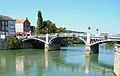 La Ferté-sous-Jouarre-Pont sur Marne.jpg 1,158 × 736; 106 KB
-
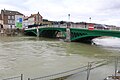 Pont De Gaulle Ferté Jouarre 1.jpg 5,184 × 3,456; 6.68 MB
-
 Pont De Gaulle Ferté Jouarre 2.jpg 5,184 × 3,456; 6.93 MB
-
 Pont De Gaulle Ferté Jouarre 3.jpg 5,184 × 3,456; 6.57 MB
-
 Pont De Gaulle Ferté Jouarre 4.jpg 5,184 × 3,456; 6.99 MB
-
 Pont De Gaulle Ferté Jouarre 5.jpg 5,184 × 3,456; 6.81 MB
-
 Pont De Gaulle Ferté Jouarre 6.jpg 5,184 × 3,456; 7.58 MB
-
 Pont De Gaulle Ferté Jouarre 7.jpg 5,184 × 3,456; 7.15 MB
-
 Pont De Gaulle Ferté Jouarre 8.jpg 5,184 × 3,456; 6.2 MB
-
 The Western Front, 1914 Q53252.jpg 800 × 569; 81 KB


