Category:Population density maps of Belgium
Media in category "Population density maps of Belgium"
The following 24 files are in this category, out of 24 total.
-
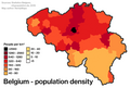 Population density in Belgium.png 790 × 530; 104 KB
-
 30 of '(Longmans' Junior School Geography, etc.)' (11213569933).jpg 2,704 × 2,001; 1.18 MB
-
 Afbeelding bevolkingsdichtheid 2016.png 832 × 591; 195 KB
-
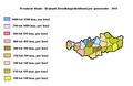
 Antwerpenbevolkingsdichtheid.PNG 634 × 390; 21 KB
-
 Belgium Population Density, 2000 (5457010423).jpg 2,502 × 3,265; 608 KB
-
 Belgium Population Density, 2000 (6172432808).jpg 2,394 × 2,882; 551 KB
-
 Belgiumpopulationdensity.PNG 897 × 750; 72 KB
-
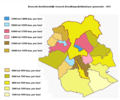
 Bevolkingsdichtheid 2017 - Gemeenten van Provincie.png 497 × 298; 44 KB
-
 BHGbevolkingsdichtheid.PNG 600 × 500; 50 KB
-
 Cities in Europe Central.png 1,344 × 743; 65 KB
-
 Decline in Belgians 2000 - 2021.gif 478 × 402; 550 KB
-
 Henegouwenbevolkingsdichtheid.PNG 578 × 445; 24 KB
-

-
 Limburgbevolkingsdichtheid.PNG 474 × 376; 17 KB
-
 Luikbevolkingsdichtheid.PNG 578 × 445; 25 KB
-
 Luxemburgbevolkingsdichtheid.PNG 506 × 381; 16 KB
-
 Namenbevolkingsdichtheid.PNG 533 × 462; 17 KB
-
 Namurbevolkingsdichtheid.PNG 533 × 462; 21 KB
-
 OostVlaanderenbevolkingsdichtheid.PNG 832 × 624; 175 KB
-
 Population density of Belgium provinces.png 6,225 × 5,223; 831 KB
-
 Provinces of Belgium by population (2017).png 4,290 × 3,605; 918 KB
-
 VlaamsBrabantbevolkingsdichtheid.PNG 597 × 402; 20 KB
-
 WaalsBrabantbevolkingsdichtheid.PNG 506 × 331; 13 KB
-
 WestVlaanderenbevolkingsdichtheid.PNG 635 × 401; 22 KB

%27_(11213569933).jpg)


.jpg)
.jpg)


%27_(16403163210).jpg)


.png)


