Category:Population maps
English: Population maps.
See also:
Subcategories
This category has the following 11 subcategories, out of 11 total.
*
A
D
E
F
G
L
M
P
Media in category "Population maps"
The following 60 files are in this category, out of 60 total.
-
 American countries by population, 2018.png 4,752 × 6,510; 1.28 MB
-
 Amerind population.png 589 × 625; 72 KB
-
 Approximate World Population.png 1,000 × 1,000; 88 KB
-
 Australian population density 2016.png 7,015 × 4,965; 677 KB
-
 Basic Population Distribution of Scotland.png 1,048 × 1,664; 158 KB
-
 Bauchet European clusters.png 1,954 × 1,222; 847 KB
-
 Bevölkerungsdichte Deutschland.png 645 × 721; 334 KB
-
 Brazilian States by Population (2018).svg 774 × 872; 247 KB
-
 Can Provinces by Population Growth Rate.svg 1,304 × 1,263; 117 KB
-
 Canada Population Map.png 2,000 × 1,937; 88 KB
-
 Canada provinces and territories by population.png 1,337 × 1,358; 189 KB
-
 Cl-cities.png 749 × 1,736; 311 KB
-
 DensidaddePoblacionenCentroamerica.jpg 554 × 317; 70 KB
-
 Ethnic map East Prussia 1907.jpeg 1,682 × 2,139; 4.75 MB
-
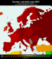 Europe net birth rate 2007.png 751 × 840; 387 KB
-
 Genetic Structure of Europeans - Nelis et alli 2009.png 1,182 × 966; 491 KB
-
 HistPol-narodowosci1931.png 1,771 × 2,118; 393 KB
-
 Isodemographische Karte Weltbevoelkerung.png 1,242 × 842; 43 KB
-
 Largest cities of Pakistan.png 3,840 × 2,160; 848 KB
-
 Lithuania Minor.png 1,471 × 955; 3.56 MB
-
 Map Demographic synthesis 1992 - Touring Club Italiano CART-TEM-046.jpg 5,000 × 3,378; 9.5 MB
-

-

-

-

-
 Map Family structure 1990 - Touring Club Italiano CART-TEM-043.jpg 5,000 × 3,406; 10.24 MB
-
 Map Health I 1992 - Touring Club Italiano CART-TEM-037.jpg 5,000 × 3,265; 9.15 MB
-
 Map Health II 1992 - Touring Club Italiano CART-TEM-038.jpg 5,000 × 3,362; 9.49 MB
-
 Map Population distribution I 1989 - Touring Club Italiano CART-TEM-047.jpg 5,000 × 3,355; 11.76 MB
-
 Map Workforce and employment II 1989 - Touring Club Italiano CART-TEM-045.jpg 5,000 × 3,274; 10.52 MB
-
 Mapa dos estados brasileiros por população (2022).svg 775 × 758; 204 KB
-
 Marehan Clans in Gedo.jpg 759 × 495; 80 KB
-
 NacionalidadesEnPolonia1931.svg 1,608 × 2,000; 407 KB
-
 Narody2RP zh.png 497 × 535; 35 KB
-
 Narody2RP-de.png 497 × 535; 45 KB
-
 Narody2RP.png 497 × 535; 24 KB
-
 Nationalities in Second Polish Republic ca. 1931.png 668 × 900; 193 KB
-
 Oregon county pop 2007.png 1,600 × 1,300; 117 KB
-
 PercentOfUSPopInEachState.gif 1,513 × 983; 710 KB
-
 Polacy na Kresach 1931.PNG 1,337 × 1,473; 113 KB
-
 Poland1937linguistic hu.svg 800 × 603; 423 KB
-
 Poland1937linguistic.jpg 600 × 452; 324 KB
-
 Polska-ww1-nation.png 791 × 1,000; 560 KB
-
 Polska1912.jpg 2,180 × 1,941; 811 KB
-
 Pomeranian density 2007.png 1,952 × 1,587; 68 KB
-

-
 Provinces of Belgium by population (2017).png 4,290 × 3,605; 918 KB
-
 Ri towns by population.png 800 × 1,216; 134 KB
-
 Shires of Scotland by population (2011).png 940 × 1,226; 353 KB
-
 Tamil Community - Worldwide.PNG 1,480 × 625; 57 KB
-
 TamilPopulation-World.png 1,480 × 625; 69 KB
-
 Turkey annual population growth by province 2014.png 1,200 × 515; 175 KB
-
 Turkey net migration by province 2013.png 1,579 × 677; 264 KB
-
 Turkey net migration by province 2015.png 1,579 × 677; 255 KB
-
 Turkey population density by province 2014.png 1,200 × 515; 149 KB
-
 Turkey unemployment rate by province(2013).png 1,579 × 677; 252 KB
-
 West Azerbaijan Counties Map by Population.svg 510 × 694; 39 KB
-
 West Azerbaijan Province Districts Map by Population.svg 510 × 694; 51 KB
-

-
 WorldCenterOfPopulation.png 1,073 × 661; 141 KB


.svg)


.jpg)
.jpg)
.jpg)
.jpg)


.svg)


.png)
.png)

.png)


.png)


_(IA_worldbookorganiz01unse)_(page_468_crop).jpg)
