Category:Poria Farm
| Object location | | View all coordinates using: OpenStreetMap |
|---|
| Upload media | |||||
| Location | Poria Illit, Emek HaYarden Regional Council, Kinneret sub-district, Northern District, Israel | ||||
|---|---|---|---|---|---|
| Heritage designation | |||||
 | |||||
Media in category "Poria Farm"
The following 70 files are in this category, out of 70 total.
-
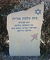
"השלט בכניסה לבית הקברות של "פוריה.JPG 1,936 × 2,330; 1.85 MB
-
PikiWiki Israel 65325 upper poriha.jpg 1,152 × 2,048; 1.34 MB
-
PikiWiki Israel 65326 upper poriha.jpg 2,048 × 1,152; 1.05 MB
-
PikiWiki Israel 65327 upper poriha.jpg 2,048 × 1,152; 997 KB
-
PikiWiki Israel 65328 upper poriha.jpg 2,304 × 4,096; 3.25 MB
-
PikiWiki Israel 65329 upper poriha.jpg 4,096 × 2,528; 2.72 MB
-
PikiWiki Israel 65330 upper poriha.jpg 2,304 × 4,096; 2.37 MB
-
PikiWiki Israel 65331 upper poriha.jpg 2,048 × 1,152; 1.03 MB
-
Poria Farm (1).jpg 2,560 × 1,920; 1.21 MB
-
Poria Farm (10).jpg 2,560 × 1,920; 1.4 MB
-
Poria Farm (11).jpg 2,560 × 1,920; 1.4 MB
-
Poria Farm (12).jpg 2,560 × 1,920; 1.35 MB
-
Poria Farm (13).jpg 2,560 × 1,920; 1.44 MB
-
Poria Farm (14).jpg 2,560 × 1,920; 1.54 MB
-
Poria Farm (15).jpg 2,560 × 1,920; 1.55 MB
-
Poria Farm (16).jpg 2,560 × 1,920; 1.25 MB
-
Poria Farm (17).jpg 2,560 × 1,920; 1.41 MB
-
Poria Farm (18).jpg 2,560 × 1,920; 1.53 MB
-
Poria Farm (19).jpg 2,560 × 1,920; 1.24 MB
-
Poria Farm (2).jpg 2,560 × 1,920; 1.42 MB
-
Poria Farm (20).jpg 2,560 × 1,920; 1.53 MB
-
Poria Farm (21).jpg 2,560 × 1,920; 1.55 MB
-
Poria Farm (22).jpg 2,560 × 1,920; 1.57 MB
-
Poria Farm (23).jpg 2,560 × 1,920; 1.43 MB
-
Poria Farm (24).jpg 2,560 × 1,920; 1.59 MB
-
Poria Farm (3).jpg 2,560 × 1,920; 1.38 MB
-
Poria Farm (4).jpg 2,560 × 1,920; 1.45 MB
-
Poria Farm (5).jpg 2,560 × 1,920; 1.43 MB
-
Poria Farm (6).jpg 2,560 × 1,920; 1.49 MB
-
Poria Farm (7).jpg 2,560 × 1,920; 1.61 MB
-
Poria Farm (8).jpg 2,560 × 1,920; 1.37 MB
-
Poria Farm (9).jpg 2,560 × 1,920; 1.36 MB
-
Poria Farm 1912.png 735 × 539; 448 KB
-
אליהו איזראעליט.jpg 1,639 × 3,614; 1,016 KB
-
אליהו מפוריה.jpg 1,615 × 2,557; 1.48 MB
-
בית הועד בפוריה.jpg 300 × 153; 15 KB
-
גז בתנאי שדה.jpg 1,188 × 747; 367 KB
-
גז הכבשים בתנאי שדה.jpg 1,612 × 826; 421 KB
-
הבית ההרוס של משפחת גולדמן.JPG 1,936 × 1,936; 712 KB
-
הכשרה מגויסת של התנועה המאוחדת במשמר השרון, 1945חלקם התיישב בפוריה.jpg 3,544 × 2,347; 752 KB
-
התחלת העבודות.jpg 300 × 181; 13 KB
-
חדר האוכל של אחוזת פוריה.jpg 977 × 645; 254 KB
-
חוות פוריה 01.jpg 3,456 × 2,304; 2.31 MB
-
חוות פוריה 02.jpg 2,304 × 3,456; 2.32 MB
-
חוות פוריה 03.jpg 3,456 × 2,304; 2.3 MB
-
חוות פוריה 04.jpg 3,456 × 2,304; 2.12 MB
-
חוות פוריה 05.jpg 3,456 × 2,304; 2.46 MB
-
חוות פוריה 06.jpg 3,456 × 2,304; 1.99 MB
-
חוות פוריה א.jpg 1,544 × 1,024; 933 KB
-
חוות פוריה ב.jpg 1,544 × 1,024; 954 KB
-
חוות פוריה ג.jpg 1,544 × 1,024; 943 KB
-
חוות פוריה צילום- ליאו קאהן 1912 - i וגנרi btm747.jpeg 585 × 453; 118 KB
-
חוות פוריה.jpg 4,000 × 3,000; 5.48 MB
-
חוץ משלושה - היתר בולגרים.jpg 1,384 × 956; 504 KB
-
חלוצים בפוריה - סוף 1946.jpg 3,537 × 2,225; 831 KB
-
חליבה וסינון החלב בתנאי שדה.jpg 1,207 × 841; 371 KB
-
חצר פוריה לפני פירוק צריפי אלומות 1946.jpg 1,433 × 979; 312 KB
-
טכס בפוריה - מוקטן.jpg 300 × 209; 22 KB
-
מה שנותר מחוות פוריה.jpg 1,544 × 1,024; 1 MB
-
מראה כללי של חוות פוריה.jpg 300 × 176; 24 KB
-
פועלים בחווה.jpg 2,484 × 2,073; 1.07 MB
-
פועלים בפוריה.jpg 2,484 × 1,793; 1.06 MB
-
פוריה 1946 בית הקברות.jpg 716 × 472; 207 KB
-
פוריה 1946.jpg 3,546 × 2,067; 711 KB
-
פוריה. רחיצת העדר במוצא הירדן מהכנרת-אבו מסמס.tif 2,960 × 1,973; 5.65 MB
-
ציון לקבר של דני קזן.JPG 1,936 × 2,592; 1.32 MB
-
צריף הבנות.jpg 1,396 × 957; 557 KB
-
קבוצת בנות 1948-1947.jpg 1,401 × 862; 368 KB
-
שמעון גולדמן מחוות פוריה.jpg 892 × 1,878; 270 KB


