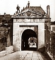
Category:Porte-Neuve
| Object location | | View all coordinates using: OpenStreetMap |
|---|
part of the Luxembourg Fortress | |||||
| Upload media | |||||
| Instance of | |||||
|---|---|---|---|---|---|
| Part of | |||||
| Location | Luxembourg, Canton of Luxembourg, Luxembourg | ||||
| Inception |
| ||||
| Dissolved, abolished or demolished date |
| ||||
 | |||||
Media in category "Porte-Neuve"
The following 10 files are in this category, out of 10 total.
-
Consolatrix avenue de la Porte-Neuve Luxembourg 2014.jpg 2,256 × 1,887; 2.85 MB
-
Consolatrix Porte-Neuve Luxembourg 2014.jpg 2,407 × 4,226; 10.85 MB
-
Consolatrix PorteNeuve Luxbg.jpg 1,920 × 2,560; 962 KB
-
Louis Kuschmann - D'Neipourt 1868.jpg 1,007 × 1,600; 387 KB
-
Luxembourg, Porte-Neuve côté Glacis (1871).jpg 701 × 760; 515 KB
-
Luxembourg, Porte-Neuve côté Ville (1871).jpg 1,105 × 1,035; 1.09 MB
-
Michel Engels - 18 La porte Neuve (côté intérieur).jpg 2,369 × 3,027; 5.73 MB
-
Michel Engels - 19 La porte Neuve (côté extérieur).jpg 2,193 × 3,017; 5.27 MB
-
Muttergottes Porte Neuve.jpg 2,337 × 3,518; 4.32 MB
-
Nei-Paart----w.jpg 203 × 274; 19 KB


