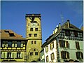
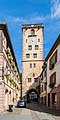
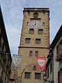
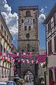
Category:Porte des bouchers (Ribeauvillé)
| Object location | | View all coordinates using: OpenStreetMap |
|---|
|
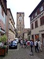
This building is inscrit au titre des monuments historiques de la France. It is indexed in the base Mérimée, a database of architectural heritage maintained by the French Ministry of Culture, under the references PA00085590
|
 | |||||
| Upload media | |||||
| Instance of | |||||
|---|---|---|---|---|---|
| Part of | |||||
| Location | Ribeauvillé, canton of Ribeauvillé | ||||
| Heritage designation |
| ||||
| Inception |
| ||||
 | |||||
Media in category "Porte des bouchers (Ribeauvillé)"
The following 32 files are in this category, out of 32 total.
-
 00 0237 Porte des bouchers.jpg 2,533 × 3,800; 10.19 MB
-
-

-

-
 Porte des bouchers in Ribeauville 01.jpg 2,887 × 5,778; 7.11 MB
-
 Porte des bouchers in Ribeauville 02.jpg 5,090 × 3,856; 8.38 MB
-
 Porte des bouchers in Ribeauville 03.jpg 4,207 × 3,240; 6.64 MB
-
 Porte des bouchers in Ribeauville 04.jpg 5,216 × 3,721; 8.72 MB
-
 Porte des bouchers in Ribeauville 05.jpg 2,809 × 5,008; 5.76 MB
-

-

-

-

-

-
-
 Ribeauvillé 02.JPG 2,448 × 3,264; 3.41 MB
-
 Ribeauvillé 2016 (29372861864).jpg 5,910 × 3,929; 12.8 MB
-
 Ribeauvillé 2016 (29706594720).jpg 4,000 × 6,016; 13.68 MB
-
 Ribeauvillé 2016 (29917375531).jpg 4,000 × 6,016; 13.64 MB
-
 Ribeauvillé 2016 (30000326515).jpg 3,721 × 5,900; 11.49 MB
-
 Ribeauvillé GrandRue 61.JPG 3,648 × 2,736; 2.74 MB
-
 Ribeauvillé TourEnceinte 01a.jpg 3,000 × 4,000; 769 KB
-
 Ribeauvillé TourEnceinte 01b.jpg 3,000 × 4,000; 1.05 MB
-
 Ribeauvillé TourEnceinte 02.JPG 3,648 × 2,736; 2.75 MB
-
 Ribeauvillé TourEnceinte 03.JPG 2,736 × 3,648; 3.18 MB
-
 Ribeauvillé TourEnceinte 04.JPG 3,648 × 2,736; 3.02 MB
-
 Ribeauvillé TourEnceinte 05.JPG 2,736 × 3,648; 3.17 MB
-
 Ribeauvillé TourEnceinte 06.JPG 1,858 × 2,484; 975 KB
-
 Ribeauvillé, Porte des bouchers ( détail ).jpg 2,000 × 3,008; 2.49 MB
-
 Ribeauvillé, Porte des bouchers.jpg 3,008 × 2,000; 2.67 MB
-
 Torre civica Ribeauvillé.jpg 2,448 × 3,264; 2.22 MB
-
 Tour (Ribeauvillé).jpg 1,944 × 2,592; 434 KB

.jpg)
.jpg)
.jpg)


_(enceinte_fortifi%C3%A9e_urbaine)_-_Grand-Rue_(3-2016)_P1050713.jpg)
_(enceinte_fortifi%C3%A9e_urbaine)_-_Grand-Rue_(2-2016)_P1050726.jpg)
_(enceinte_fortifi%C3%A9e_urbaine)_-_Grand-Rue_(4-2016)_P1050715.jpg)
_(enceinte_fortifi%C3%A9e_urbaine)_-_Grand-Rue_(5-2016)_P1050723.jpg)
_(enceinte_fortifi%C3%A9e_urbaine)_(4-2016)_IMG_3299.jpg)
_(enceinte_fortifi%C3%A9e_urbaine)_-_Grand-Rue_(6-2016)_(IMG_3298.jpg)

.jpg)
.jpg)
.jpg)
.jpg)


.jpg)

.jpg)