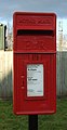
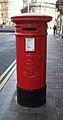
Category:Post boxes in HU postcode area
Media in category "Post boxes in HU postcode area"
The following 200 files are in this category, out of 381 total.
(previous page) (next page)-
 'Crown and Anchor' Pub at Kilnsea - geograph.org.uk - 874745.jpg 640 × 426; 105 KB
-
 All Saints Parish Church, Tunstall - geograph.org.uk - 45860.jpg 640 × 480; 102 KB
-
 Anonymous Postbox, Queen Street - geograph.org.uk - 3390995.jpg 682 × 1,024; 163 KB
-
 Anonymous Victorian postbox on Spring Bank, Hull - geograph.org.uk - 5684693.jpg 1,434 × 2,734; 661 KB
-
 Ark Royal, near Bilton - geograph.org.uk - 662848.jpg 640 × 480; 170 KB
-
 Back Lane Elstronwick.jpg 640 × 458; 91 KB
-
 Barrow Lane. Hessle - geograph.org.uk - 1277733.jpg 530 × 640; 114 KB
-
 Beverley Bar - geograph.org.uk - 50552.jpg 640 × 480; 113 KB
-
 Beverley Parklands (geograph 6350697).jpg 4,528 × 3,072; 2.95 MB
-
 Beverley Road, Whitedale (geograph 6362174).jpg 4,398 × 3,135; 2.88 MB
-
 Beverley Road, Whitedale (geograph 6362175).jpg 3,902 × 2,899; 2.72 MB
-
 Beverley station wall box.JPG 1,920 × 2,560; 1.71 MB
-

-
-
 Biggin Avenue, Hull (geograph 6085828).jpg 4,438 × 3,221; 3.63 MB
-
 Biggin Avenue, Hull (geograph 6085832).jpg 5,184 × 3,888; 4.54 MB
-
 Bricknell Avenue, Cottingham (geograph 6081775).jpg 5,184 × 3,888; 4.41 MB
-
 Bricknell Avenue, Cottingham (geograph 6081776).jpg 5,184 × 3,888; 5.3 MB
-
 Broadgate (B1230) (geograph 6355970).jpg 4,275 × 3,056; 2.45 MB
-
 Brough Post Office - geograph.org.uk - 5663660.jpg 2,848 × 2,136; 1.46 MB
-
 Brough Post Office - geograph.org.uk - 751279.jpg 640 × 414; 69 KB
-
 Bus stop and former Post Office on Church Street, Welton (geograph 5664013).jpg 2,848 × 2,136; 1.41 MB
-

-
 Bus stop on Broadgate (B1230) (geograph 6355963).jpg 4,674 × 3,304; 3.94 MB
-
 Chapel Row, Thearne (geograph 6349359).jpg 640 × 458; 63 KB
-
 Church Street, South Cave - geograph.org.uk - 1477238.jpg 640 × 397; 47 KB
-
 Church Street, Welton (geograph 5664015).jpg 640 × 480; 62 KB
-
 Cliff Road, Mappleton - geograph.org.uk - 1467181.jpg 640 × 496; 80 KB
-
 Close up, Elizabeth II postbox on Beverley Road, Whitedale (geograph 6362171).jpg 2,447 × 4,086; 3.17 MB
-
 Close up, Elizabeth II postbox on Evergreen Drive, Hull (geograph 6084392).jpg 2,838 × 4,970; 2.54 MB
-
 Close up, Elizabeth II postbox on Hull Road, Woodmansey (geograph 6350258).jpg 2,062 × 3,866; 2.05 MB
-
 Close up, Elizabeth II postbox on Middlehowe Green, Walkington (geograph 6358089).jpg 1,440 × 2,728; 1.14 MB
-
 Close up, Elizabeth II postbox on Priory Road, Hull (geograph 6082284).jpg 2,300 × 4,348; 2.21 MB
-
 Close up, Elizabeth II postbox on Snowdon Way, Hull (geograph 6085862).jpg 2,585 × 4,104; 2.13 MB
-
 Close up, Elizabeth II postbox on Stanley Jackson Way, Welton (geograph 5663644).jpg 1,073 × 2,156; 546 KB
-
 Close up, Elizabeth II postbox on Well Lane, Willerby (geograph 6116553).jpg 2,144 × 3,284; 1.4 MB
-
 Close up, Elizabeth II postbox on Wiske Avenue, Brough (geograph 5664058).jpg 975 × 1,890; 400 KB
-
 Close up, Elizabeth II postbox on Woodmansey Mile, Beverley (geograph 6358209).jpg 2,215 × 3,438; 1.64 MB
-
 Close up, George V postbox on Gibson Lane North, Melton (geograph 5658787).jpg 1,129 × 2,000; 545 KB
-
 Close up, Ings Lane, Dunswell (geograph 6084273).jpg 2,015 × 3,138; 1.5 MB
-
 Corner of Ferry Lane and Thearne Lane, Thearne (geograph 5307734).jpg 5,376 × 3,024; 2.52 MB
-
 Dale Road - Northfield, Swanland - geograph.org.uk - 359463.jpg 480 × 640; 120 KB
-
 Davenport Avenue, Hessle - geograph.org.uk - 1052676.jpg 640 × 481; 171 KB
-
 Disused George V postbox on Wolfreton Road, Willerby (geograph 6116549).jpg 1,711 × 3,169; 814 KB
-

-
 Double Elizabeth II postbox on Alfred Gelder Street, Hull - geograph.org.uk - 5096629.jpg 1,751 × 2,373; 1.14 MB
-
 E VII R Postbox, Davenport Avenue - geograph.org.uk - 1051774.jpg 481 × 640; 142 KB
-
 East End (B1230), Walkington (geograph 6355230).jpg 4,644 × 3,329; 3.64 MB
-

-
 Edward VII postbox on Anlaby Road, Hull - geograph.org.uk - 5685044.jpg 1,255 × 2,366; 569 KB
-
 Edward VII postbox on Boulevard, Hull - geograph.org.uk - 5684526.jpg 1,437 × 2,764; 830 KB
-
 Edward VII postbox on Chanterlands Avenue, Hull - geograph.org.uk - 5687529.jpg 1,245 × 2,533; 640 KB
-

-
 Edward VII postbox on Marlborough Avenue, Hull - geograph.org.uk - 6081011.jpg 2,864 × 5,126; 4.42 MB
-
 Edward VII postbox on Noddle Hill Way, Hull - geograph.org.uk - 6085849.jpg 2,369 × 4,659; 3.27 MB
-
 Edward VII postbox on Paragon Street, Hull - geograph.org.uk - 5658110.jpg 1,372 × 2,621; 781 KB
-

-
 Edward VII postbox on Spring Back West, Hull - geograph.org.uk - 4910239.jpg 799 × 1,200; 367 KB
-
 Edward VII postbox on Spring Back West, Hull - geograph.org.uk - 5685024.jpg 1,337 × 2,364; 715 KB
-
 Edward VII postbox on Spring Bank West, Hull - geograph.org.uk - 6081640.jpg 2,410 × 4,341; 2.35 MB
-
 Edward VII postbox on Westbourne Avenue, Hull - geograph.org.uk - 6081019.jpg 2,714 × 5,026; 3.3 MB
-
 Edward VII postbox on Willerby Road, Hull (geograph 6081718).jpg 2,447 × 4,463; 2.79 MB
-
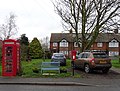 Elizabeth II postbox and telephone box on Main Street, Welwick (geograph 6376416).jpg 4,408 × 3,355; 3.68 MB
-
 Elizabeth II postbox and telephone box, North Ferriby Post Office (geograph 5658811).jpg 2,848 × 2,136; 1.46 MB
-
 Elizabeth II postbox on Anlaby Road, Hull - geograph.org.uk - 5684258.jpg 1,355 × 2,710; 754 KB
-
 Elizabeth II postbox on Beverley Parklands (geograph 6350693).jpg 1,776 × 3,030; 1.24 MB
-
 Elizabeth II postbox on Beverley Road, Whitedale (geograph 6362168).jpg 640 × 545; 166 KB
-
 Elizabeth II postbox on Boulevard, Hull - geograph.org.uk - 5684957.jpg 1,164 × 2,439; 519 KB
-
 Elizabeth II postbox on Evergreen Drive, Hull (geograph 6084389).jpg 3,600 × 3,390; 2.92 MB
-
 Elizabeth II postbox on Hall Road, Hull - geograph.org.uk - 6084353.jpg 2,759 × 4,930; 3.41 MB
-
-
 Elizabeth II postbox on Hull Road, Withernsea (geograph 6373500).jpg 351 × 640; 63 KB
-
 Elizabeth II postbox on Hull Road, Woodmansey (geograph 6350257).jpg 480 × 640; 96 KB
-
 Elizabeth II postbox on Ings Lane, Dunswell (geograph 6084270).jpg 4,693 × 3,342; 4.88 MB
-
 Elizabeth II postbox on Kingston Road, Willerby (geograph 6117377).jpg 2,448 × 4,210; 2.32 MB
-
 Elizabeth II postbox on Lincoln Way, Beverley (geograph 6358198).jpg 327 × 640; 56 KB
-
 Elizabeth II postbox on Main Street, Wawne (geograph 6085167).jpg 1,733 × 3,086; 1.28 MB
-
 Elizabeth II postbox on Main Street, Welwick (geograph 6376414).jpg 2,056 × 4,033; 1.43 MB
-
 Elizabeth II postbox on Maplewood Avenue, Hull (geograph 6080809).jpg 3,005 × 4,961; 3.57 MB
-
 Elizabeth II postbox on Middlehowe Green, Walkington (geograph 6358087).jpg 3,096 × 2,268; 1.77 MB
-
 Elizabeth II postbox on Mill Lane, Kirk Ella (geograph 6116528).jpg 2,349 × 4,373; 2.93 MB
-
 Elizabeth II postbox on Normandy Avenue, Beverley (geograph 6355977).jpg 2,316 × 3,923; 2.04 MB
-
 Elizabeth II postbox on Plantation Drive, North Ferriby (geograph 5658824).jpg 1,555 × 2,581; 869 KB
-
 Elizabeth II postbox on Plaxton Bridge Road, Woodmansey (geograph 6349188).jpg 2,611 × 3,595; 2.56 MB
-
 Elizabeth II postbox on Priory Road, Hull (geograph 6082283).jpg 5,184 × 3,888; 6.32 MB
-

-

-
 Elizabeth II postbox on Shopeth Way, Woodmansey (geograph 6349177).jpg 1,575 × 2,658; 821 KB
-

-
 Elizabeth II postbox on Snowdon Way, Hull (geograph 6085860).jpg 3,195 × 2,784; 2.84 MB
-
 Elizabeth II postbox on South Ella Way, Kirk Ella (geograph 6117405).jpg 2,660 × 4,693; 3.37 MB
-

-
 Elizabeth II postbox on the B1230, Broadgate (geograph 6355960).jpg 1,368 × 2,418; 1.17 MB
-
 Elizabeth II postbox on Well Lane, Willerby (geograph 6116552).jpg 5,184 × 3,888; 5.46 MB
-
 Elizabeth II postbox on Welton Low Road, Elloughton (geograph 5664599).jpg 1,322 × 2,727; 757 KB
-
 Elizabeth II postbox on Welton Low Road, Elloughton (geograph 5664600).jpg 2,848 × 2,136; 1.41 MB
-
 Elizabeth II postbox on Wiske Avenue, Brough (geograph 5664056).jpg 2,848 × 2,136; 1.46 MB
-
 Elizabeth II postbox on Wolfreton Road, Willerby (geograph 6116538).jpg 2,594 × 5,159; 2.12 MB
-

-
 Elizabeth II postbox on Wymersley Road, Hull (geograph 6082274).jpg 2,863 × 4,740; 3.2 MB
-
 Elizabeth II postbox, North Ferriby Post Office (geograph 5658809).jpg 1,464 × 2,051; 731 KB
-
 Elizabeth II postbox, supermarket, Anlaby (geograph 6117705).jpg 1,638 × 3,072; 894 KB
-
 Elizabeth II postbox, Thearne (geograph 6349350).jpg 2,317 × 3,560; 1.83 MB
-
 Elizabeth II postbox, Waitrose, Willerby (geograph 6117644).jpg 2,505 × 4,521; 2.4 MB
-
 Endike Lane, Hull - geograph.org.uk - 569788.jpg 640 × 454; 216 KB
-
 Endike Lane, Hull - geograph.org.uk - 6084894.jpg 4,828 × 3,581; 4.51 MB
-
 Endike Lane, Hull - geograph.org.uk - 6084895.jpg 5,184 × 3,888; 4.29 MB
-
 Entrance to Morrisons Supermarket, Beverley (geograph 6354105).jpg 4,343 × 3,526; 3.53 MB
-
 Etton Village Hall - geograph.org.uk - 1422278.jpg 640 × 480; 62 KB
-
 Evergreen Drive, Hull (geograph 6084399).jpg 5,184 × 3,888; 4.88 MB
-
 Ferry Lane, Thearne (geograph 6349358).jpg 3,945 × 3,022; 3.18 MB
-
 Finkle Street, Bishop Burton - geograph.org.uk - 1197406.jpg 640 × 496; 100 KB
-
 Footpath to the roundabout - geograph.org.uk - 1201261.jpg 640 × 427; 341 KB
-

-
 Former Post Office on Church Street, Welton (geograph 5664014).jpg 2,136 × 2,848; 1.14 MB
-

-
 George V Ludlow postbox on Church Street, Welton (geograph 5664012).jpg 952 × 1,509; 380 KB
-
 George V postbox on Anlaby Road, Hull - geograph.org.uk - 5033793.jpg 1,394 × 2,479; 774 KB
-
 George V postbox on Anlaby Road, Hull - geograph.org.uk - 5684546.jpg 1,050 × 2,054; 476 KB
-
 George V postbox on Anlaby Road, Hull - geograph.org.uk - 5684714.jpg 1,234 × 2,563; 569 KB
-
 George V postbox on Anlaby Road, Hull - geograph.org.uk - 6063065.jpg 2,055 × 3,481; 2.06 MB
-
 George V postbox on Beverley Road, Hull - geograph.org.uk - 5659255.jpg 1,302 × 2,612; 681 KB
-
 George V postbox on Beverley Road, Hull - geograph.org.uk - 6084690.jpg 2,581 × 5,153; 2.61 MB
-
 George V postbox on Beverley Road, Hull - geograph.org.uk - 6084881.jpg 2,365 × 5,115; 2.3 MB
-
 George V postbox on Biggin Avenue, Hull (geograph 6085824).jpg 2,263 × 4,084; 2.78 MB
-
 George V postbox on Chanterlands Avenue, Hull - geograph.org.uk - 6079025.jpg 2,761 × 5,006; 2.96 MB
-

-
 George V postbox on Downfield Avenue, Hull (geograph 6084301).jpg 1,998 × 4,089; 2.49 MB
-
 George V postbox on East End, Walkington (geograph 6355228).jpg 301 × 640; 53 KB
-
 George V postbox on Endike Lane, Hull - geograph.org.uk - 6084886.jpg 2,137 × 4,126; 1.9 MB
-
 George V postbox on Endike Lane, Hull - geograph.org.uk - 6084892.jpg 2,979 × 5,151; 3.99 MB
-
 George V postbox on George Street, Hull - geograph.org.uk - 5658205.jpg 1,510 × 2,848; 840 KB
-
 George V postbox on Gibson Lane North, Melton (geograph 5658786).jpg 2,848 × 2,136; 1.23 MB
-
 George V postbox on Greenwood Avenue, Hull - geograph.org.uk - 6084281.jpg 3,036 × 5,179; 3.3 MB
-
 George V postbox on Hessle Road, Hull - geograph.org.uk - 5685395.jpg 1,585 × 2,532; 862 KB
-
 George V postbox on Holderness Road, Hull - geograph.org.uk - 6341303.jpg 1,953 × 3,585; 1.43 MB
-
 George V postbox on Inglemire Lane, Hull - geograph.org.uk - 6084896.jpg 2,585 × 4,520; 2.77 MB
-
 George V postbox on Kingston Road (B1232) (geograph 6116056).jpg 2,312 × 4,361; 2.06 MB
-
 George V postbox on Kingston Road, Willerby (geograph 6117363).jpg 347 × 640; 61 KB
-
 George V postbox on Kingston Road, Willerby (geograph 6117389).jpg 2,496 × 4,537; 2.78 MB
-
 George V postbox on Main Street, Withernwick (geograph 6362406).jpg 1,956 × 3,601; 1.59 MB
-
 George V postbox on Marine Drive, North Ferriby (geograph 5658769).jpg 1,332 × 2,804; 787 KB
-
 George V postbox on Princes Avenue, Hull - geograph.org.uk - 5687508.jpg 1,301 × 1,733; 445 KB
-
 George V postbox on Queensgate, Beverley (geograph 6349704).jpg 2,754 × 5,118; 3.04 MB
-
 George V postbox on South Ella Drive, Kirk Ella (geograph 6117384).jpg 2,182 × 4,443; 2.11 MB
-
 George V postbox on Spring Bank West, Hull - geograph.org.uk - 6081619.jpg 2,868 × 4,923; 2.9 MB
-
 George V postbox on Spring Bank, Hull - geograph.org.uk - 5684939.jpg 988 × 2,015; 379 KB
-
 George V postbox on The Parkway, Willerby (geograph 6117648).jpg 2,368 × 4,357; 2.7 MB
-
 George V Postbox, Carr Lane - geograph.org.uk - 3390951.jpg 682 × 1,024; 160 KB
-
 George VI postbox and telephone box on Wold Road, Hull (geograph 6081750).jpg 5,184 × 3,888; 4.83 MB
-
 George VI postbox on Bricknell Avenue, Cottingham (geograph 6081774).jpg 2,522 × 4,709; 3.17 MB
-
 George VI postbox on Greenwood Avenue, Hull - geograph.org.uk - 6084900.jpg 2,298 × 4,290; 2.47 MB
-
 George VI postbox on Holderness Road, Hull - geograph.org.uk - 6340351.jpg 2,040 × 3,587; 1.38 MB
-
 George VI postbox on Howdale Road, Hull (geograph 6345697).jpg 2,218 × 4,012; 2.32 MB
-
 George VI postbox on North Road, Withernsea (geograph 6373520).jpg 305 × 640; 50 KB
-
 George VI postbox on Priory Road, Hull - geograph.org.uk - 6081737.jpg 2,628 × 4,496; 3.37 MB
-

-
 George VI Postbox on Willerby Road, Hull (geograph 5908903).jpg 1,064 × 1,600; 784 KB
-
 George VI postbox on Willerby Road, Hull (geograph 6081743).jpg 2,856 × 5,127; 3.87 MB
-
 George VI postbox on Wold Road, Hull (geograph 6081749).jpg 2,251 × 4,209; 2.55 MB
-
 Georgian postbox on Anlaby Road, Hull - geograph.org.uk - 4910674.jpg 799 × 1,200; 350 KB
-
 Gibson Lane North, Melton (geograph 5658789).jpg 2,848 × 2,136; 1.19 MB
-
 GR Letter Box, Welton - geograph.org.uk - 529246.jpg 594 × 640; 188 KB
-
 Greenwood Avenue, Hull - geograph.org.uk - 6084285.jpg 5,184 × 3,888; 4.65 MB
-
 Greenwood Avenue, Hull - geograph.org.uk - 6084365.jpg 640 × 480; 67 KB
-
 Grimston.jpg 640 × 480; 135 KB
-
 Grovehill Road, Beverley, Yorkshire - geograph.org.uk - 4674018.jpg 1,493 × 2,994; 1.73 MB
-
 Hairdressers on Queen Street, Withernsea (geograph 6372854).jpg 4,629 × 2,900; 2.37 MB
-
 Hall Road, Hull - geograph.org.uk - 6084357.jpg 5,184 × 3,888; 5.35 MB
-
 Hariff Lane, Burstwick (geograph 6366653).jpg 4,245 × 3,765; 3.1 MB
-
-
-

-
 High Street Cottages, North Ferriby - geograph.org.uk - 891221.jpg 640 × 480; 161 KB
-
 High Street pillar box, Hull - geograph.org.uk - 2406476.jpg 544 × 640; 208 KB
-
 High Street, Kingston upon Hull - geograph.org.uk - 3707251.jpg 2,392 × 3,224; 3.42 MB
-
 Holmpton Post Office - geograph.org.uk - 281736.jpg 640 × 470; 123 KB
-
 Holmpton Road, Withernsea (geograph 6373549).jpg 640 × 480; 106 KB
-
 Holmpton Road, Withernsea (geograph 6373550).jpg 4,644 × 3,397; 4.55 MB
-
 Hornsea Post Office - geograph.org.uk - 324275.jpg 640 × 378; 96 KB
-
 Hornsea Post Office, Newbegin - geograph.org.uk - 1317000.jpg 525 × 613; 352 KB
-
 House on Figham Springs Way, Beverley (geograph 6358215).jpg 800 × 612; 90 KB
-
 House on Holmpton Road, Withernsea (geograph 6373548).jpg 4,797 × 3,022; 2.51 MB
-
 House on Ings Lane, Dunswell (geograph 6084275).jpg 3,499 × 3,409; 3.89 MB
-
 House on Queen Street North, Withernsea (geograph 6372889).jpg 4,262 × 2,976; 1.86 MB
-
 House on Skeffling Road, Weeton (geograph 6376427).jpg 5,184 × 3,888; 5.83 MB
-
 Houses on Barmouth Close, Hull (geograph 6085864).jpg 4,170 × 3,216; 2.43 MB
-
 Houses on Beverley Parklands (geograph 6350694).jpg 4,356 × 3,335; 3.02 MB
-
 Houses on Beverley Parklands (geograph 6350696).jpg 5,184 × 3,888; 4.15 MB
-
 Houses on Beverley Parklands (geograph 6350698).jpg 5,184 × 3,888; 3.86 MB
-
 Houses on Beverley Road, Dunswell (geograph 6084274).jpg 4,596 × 3,157; 4.08 MB
-
 Houses on Biggin Avenue, Hull (geograph 6085826).jpg 2,883 × 2,140; 876 KB
-
 Houses on Downfield Avenue, Hull (geograph 6084303).jpg 640 × 480; 78 KB
-
 Houses on Downfield Avenue, Hull (geograph 6084304).jpg 5,184 × 3,888; 5.34 MB
-
 Houses on Evergreen Drive, Hull (geograph 6084395).jpg 640 × 497; 85 KB
-
 Houses on Greenhow Close, Hull (geograph 6345699).jpg 4,435 × 2,775; 2.31 MB
-
 Houses on Greenwood Avenue, Hull - geograph.org.uk - 6084284.jpg 4,227 × 3,218; 3.3 MB
-
 Houses on Greenwood Avenue, Hull - geograph.org.uk - 6084901.jpg 4,366 × 3,136; 2.36 MB
-
 Houses on Hull Road, Withernsea (geograph 6373502).jpg 3,971 × 2,808; 1.97 MB
-
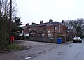
 Houses on Hull Road, Woodmansey (geograph 6350259).jpg 4,154 × 2,905; 2.29 MB


.jpg)
.jpg)
.jpg)


.jpg)
.jpg)
.jpg)
.jpg)
_(geograph_6355970).jpg)


.jpg)
.jpg)
_(geograph_6355963).jpg)
.jpg)

.jpg)

.jpg)
.jpg)
.jpg)
.jpg)
.jpg)
.jpg)
.jpg)
.jpg)
.jpg)
.jpg)
.jpg)
.jpg)
.jpg)


.jpg)


,_Walkington_(geograph_6355230).jpg)
.jpg)


.jpg)


.jpg)
.jpg)
.jpg)

.jpg)
.jpg)

.jpg)

.jpg)
.jpg)
.jpg)
.jpg)
.jpg)
.jpg)
.jpg)
.jpg)
.jpg)
.jpg)
.jpg)
.jpg)
.jpg)
.jpg)
.jpg)
.jpg)
.jpg)
.jpg)
.jpg)
.jpg)
.jpg)
.jpg)
.jpg)
.jpg)
.jpg)
.jpg)
.jpg)
.jpg)
.jpg)
.jpg)
.jpg)
.jpg)
.jpg)
.jpg)


.jpg)

.jpg)
.jpg)


.jpg)

.jpg)


.jpg)

.jpg)
.jpg)
.jpg)


.jpg)


_(geograph_6116056).jpg)
.jpg)
.jpg)
.jpg)
.jpg)

.jpg)
.jpg)


.jpg)

.jpg)
.jpg)


.jpg)
.jpg)

.jpg)
.jpg)
.jpg)
.jpg)

.jpg)


.jpg)

.jpg)


.jpg)
.jpg)


.jpg)
.jpg)
.jpg)
.jpg)
.jpg)
.jpg)
.jpg)
.jpg)
.jpg)
.jpg)
.jpg)
.jpg)
.jpg)
.jpg)
.jpg)


.jpg)
.jpg)