Category:Postcode maps covering London
Main Wikipedia article: London postal district.
Media in category "Postcode maps covering London"
The following 32 files are in this category, out of 32 total.
-
 BR postcode area map.svg 1,000 × 700; 235 KB
-
 Carte des codes postaux de Londres.gif 239 × 207; 11 KB
-
 Central London.PNG 192 × 156; 8 KB
-
 CR postcode area map.svg 1,000 × 1,000; 346 KB
-
 DA postcode area map.svg 1,000 × 1,000; 389 KB
-
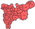
 E postcode area map.svg 600 × 1,000; 395 KB
-
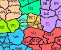
 EC postcode area map.svg 1,000 × 1,000; 114 KB
-
 ELondon.PNG 254 × 368; 11 KB
-
 EN postcode area map.svg 1,000 × 800; 263 KB
-
 HA postcode area map.svg 1,000 × 1,000; 269 KB
-
 IG postcode area map.svg 700 × 1,000; 299 KB
-
 KT postcode area map.svg 1,000 × 800; 559 KB
-
 LONDON post town inset map.svg 500 × 500; 367 KB
-
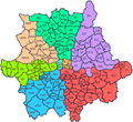
 LONDON post town map.svg 1,000 × 1,000; 1.62 MB
-
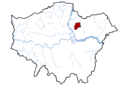
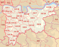
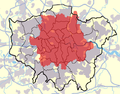 London Postal District.png 561 × 439; 467 KB
-
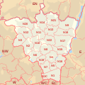
 London Postal Region Map.jpg 1,363 × 1,091; 273 KB
-
 London postcodes.png 630 × 575; 36 KB
-
 Map of London with rivers with E11 Postcode.png 1,000 × 750; 51 KB
-
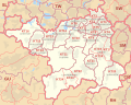
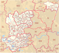 Middlesex former postal county.svg 1,099 × 995; 752 KB
-
 N postcode area map.svg 1,000 × 1,000; 549 KB
-
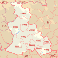 NW postcode area map.svg 1,000 × 1,000; 490 KB
-
 RM postcode area map.svg 1,000 × 1,000; 401 KB
-
 SE postcode area map.svg 1,000 × 800; 632 KB
-
 SELondon.PNG 360 × 293; 14 KB
-
 SM postcode area map.svg 800 × 1,000; 267 KB
-
 SM1 3-SM1 4.png 413 × 250; 22 KB
-
 SW postcode area map.svg 1,000 × 1,000; 564 KB
-
 TN postcode area map.svg 1,000 × 1,000; 1.4 MB
-
 TW postcode area map.svg 800 × 480; 353 KB
-
 UB postcode area map.svg 1,000 × 1,000; 333 KB
-
 W postcode area map.svg 1,000 × 500; 429 KB
-
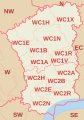 WC postcode area map.svg 700 × 1,000; 115 KB


