Category:Postweg 2, Putten
| Object location | | View all coordinates using: OpenStreetMap |
|---|
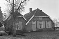
farmhouse in Putten, Netherlands  | |||||
| Upload media | |||||
| Instance of | |||||
|---|---|---|---|---|---|
| Location | Putten, Gelderland, Netherlands | ||||
| Street address |
| ||||
| Located on street |
| ||||
| Heritage designation |
| ||||
 | |||||
|
This is a category about rijksmonument number 32228
|
| Address |
|
Media in category "Postweg 2, Putten"
The following 4 files are in this category, out of 4 total.
-
 Aanzicht - Putten - 20183796 - RCE.jpg 1,200 × 798; 216 KB
-
 Boerderij achtergevel - Putten - 20183798 - RCE.jpg 1,200 × 955; 256 KB
-
 Boerderij Postweg 2 - Putten.jpg 3,648 × 2,736; 4.42 MB
-
 Boerderij voorgevel - Putten - 20183797 - RCE.jpg 1,200 × 950; 246 KB


