Category:Potsgrove
village and civil parish in Bedfordshire, UK  | |||||
| Upload media | |||||
| Instance of | |||||
|---|---|---|---|---|---|
| Location | Central Bedfordshire, Bedfordshire, East of England, England | ||||
 | |||||
English: Potsgrove is a village and civil parish located in the Central Bedfordshire district of Bedfordshire, England. The parish includes the hamlet of Sheep Lane.
Subcategories
This category has the following 2 subcategories, out of 2 total.
M
- St Mary's church, Potsgrove (7 F)
T
- The Hoult, Potsgrove (22 F)
Media in category "Potsgrove"
The following 65 files are in this category, out of 65 total.
-
 Arable land near Bushycommon Wood - geograph.org.uk - 2776693.jpg 640 × 480; 68 KB
-
 Barns, Old Farm - geograph.org.uk - 370504.jpg 640 × 480; 152 KB
-
 Bedfordshire countryside - geograph.org.uk - 370534.jpg 640 × 333; 197 KB
-
 Brick box in a field - geograph.org.uk - 3182318.jpg 1,600 × 1,068; 591 KB
-
 Brick building in the field - geograph.org.uk - 2776702.jpg 640 × 480; 79 KB
-
 British Telecom House - geograph.org.uk - 3108450.jpg 1,600 × 1,067; 444 KB
-
 Cattle grid and road at Potsgrove - geograph.org.uk - 1989929.jpg 640 × 480; 134 KB
-
 Central Bedfordshire , Sheep Lane - geograph.org.uk - 5733047.jpg 6,000 × 4,000; 7.18 MB
-
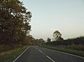
 Country road near Woburn - geograph.org.uk - 3190684.jpg 640 × 480; 62 KB
-
 Countryside near Potsgrove - geograph.org.uk - 1989933.jpg 640 × 480; 133 KB
-
 Deer on a path in the Woburn estate - geograph.org.uk - 3090793.jpg 1,200 × 1,600; 747 KB
-
 Dry stream bed - geograph.org.uk - 370737.jpg 480 × 640; 190 KB
-
 Evidence of animals ^ - geograph.org.uk - 370747.jpg 640 × 480; 186 KB
-
 Flying Fox - corner view - geograph.org.uk - 370754.jpg 640 × 480; 199 KB
-
 Footpath and brick outbuildings - geograph.org.uk - 370487.jpg 640 × 238; 55 KB
-
 Footpath towards Bushycommon woods - geograph.org.uk - 3182433.jpg 1,600 × 1,068; 529 KB
-
 Footpath, what footpath^ - geograph.org.uk - 837442.jpg 640 × 480; 89 KB
-
 Gate on the path to Woburn - geograph.org.uk - 3108454.jpg 1,200 × 1,600; 799 KB
-
 Gate onto Sheep Lane - geograph.org.uk - 3108481.jpg 1,600 × 1,067; 696 KB
-
 Greensand Ridge Walk - geograph.org.uk - 3108479.jpg 1,200 × 1,600; 854 KB
-
 Greensand Ridge walk going east - geograph.org.uk - 3114136.jpg 1,200 × 1,600; 642 KB
-
 Home Wood - geograph.org.uk - 3182360.jpg 1,600 × 1,067; 534 KB
-
 Just a trickle - geograph.org.uk - 370750.jpg 640 × 480; 195 KB
-
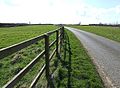 Lane near Old Farm - geograph.org.uk - 370499.jpg 640 × 467; 191 KB
-
 London Road south of Woburn - geograph.org.uk - 5570635.jpg 2,032 × 1,514; 783 KB
-
 London Road, Milton Bryan - geograph.org.uk - 5579155.jpg 2,014 × 1,490; 1.04 MB
-
 New Head-dress for the Rut - geograph.org.uk - 1612482.jpg 628 × 437; 94 KB
-
 Oak tree by the path to Hill Farm - geograph.org.uk - 3182349.jpg 1,600 × 1,067; 591 KB
-
 Old Farm - geograph.org.uk - 370521.jpg 640 × 480; 180 KB
-
 Paris House - geograph.org.uk - 2359491.jpg 2,272 × 1,704; 1.63 MB
-
 Paris House - geograph.org.uk - 2775469.jpg 640 × 480; 93 KB
-
 Path across the field to the moat - geograph.org.uk - 3108457.jpg 1,600 × 1,068; 648 KB
-
 Path through the plantation - geograph.org.uk - 3182436.jpg 1,200 × 1,600; 941 KB
-
 Path to Bushycommon wood - geograph.org.uk - 3182316.jpg 1,600 × 1,067; 599 KB
-
 Path to Hill Farm - geograph.org.uk - 3182346.jpg 1,200 × 1,600; 575 KB
-
 Path to Old Farm - geograph.org.uk - 3114140.jpg 1,200 × 1,600; 656 KB
-
 Path towards Woburn - geograph.org.uk - 3114147.jpg 1,200 × 1,600; 705 KB
-
 Potsgrove Cattle Grid - geograph.org.uk - 837463.jpg 640 × 425; 90 KB
-
 Potsgrove Village - geograph.org.uk - 371497.jpg 640 × 480; 201 KB
-
 Public Footpath - geograph.org.uk - 2359481.jpg 2,272 × 1,704; 1.74 MB
-
 Public Footpath - geograph.org.uk - 2359486.jpg 2,272 × 1,704; 1.71 MB
-
 Public Footpath - geograph.org.uk - 809433.jpg 640 × 480; 121 KB
-
 Road from near Potsgrove Trig Pillar - geograph.org.uk - 3248488.jpg 3,264 × 2,448; 1.34 MB
-
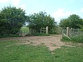
 Sheep guard the moat - geograph.org.uk - 367543.jpg 640 × 419; 158 KB
-
 Silvery trees by Old Farm - geograph.org.uk - 3182437.jpg 1,600 × 1,068; 503 KB
-
 Stream across a field - geograph.org.uk - 367549.jpg 640 × 470; 195 KB
-
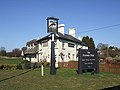
 The Flying Fox - geograph.org.uk - 367553.jpg 640 × 480; 186 KB
-
 The Moat, Potsgrove - geograph.org.uk - 371490.jpg 640 × 312; 110 KB
-
 The road to Potsgrove off London Road - geograph.org.uk - 5570240.jpg 2,032 × 1,514; 866 KB
-
 Track to Battlesden - geograph.org.uk - 370601.jpg 640 × 480; 200 KB
-
 Track to farm buildings - geograph.org.uk - 3114142.jpg 1,600 × 1,067; 646 KB
-
 Trees by the Potsgrove path - geograph.org.uk - 3182357.jpg 1,600 × 1,068; 539 KB
-
 Verge, hedge and tree - geograph.org.uk - 367461.jpg 480 × 640; 150 KB
-
 View towards Old Farm - geograph.org.uk - 370537.jpg 640 × 480; 200 KB
-
 Woburn Sands and Aspley Wood - geograph.org.uk - 4549068.jpg 3,264 × 2,448; 4.09 MB
-
 Woburn Telephone Exchange, Beds - geograph.org.uk - 2596121.jpg 3,072 × 2,304; 1.82 MB
-
 Wood yard near Hill Farm - geograph.org.uk - 2776677.jpg 640 × 480; 92 KB
-
 Aspen Farm - geograph.org.uk - 809417.jpg 640 × 480; 77 KB
-
 Fourne Hill - geograph.org.uk - 221174.jpg 640 × 176; 35 KB
-
 Hay bales at Fourne Hill Farm - geograph.org.uk - 219521.jpg 640 × 480; 64 KB
-
 Leighton Buzzard, Double Arches quarry - geograph.org.uk - 96993.jpg 640 × 464; 103 KB
-
 Looking towards the ancient moat - geograph.org.uk - 367532.jpg 640 × 377; 161 KB
-
 Old Tree, Ancient Moat - geograph.org.uk - 370730.jpg 640 × 480; 204 KB
-
 Small pool inside the moat - geograph.org.uk - 370727.jpg 640 × 346; 183 KB
-
 Trees behind moat, Potsgrove - geograph.org.uk - 371495.jpg 640 × 440; 174 KB


