Category:Poynings

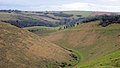
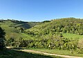
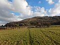
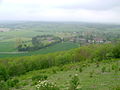
English: Poynings is a village and civil parish in the Mid Sussex District of West Sussex, England. It is located on the north side of the South Downs near Devil's Dyke, five miles (8 km) north-west of Brighton. The civil parish covers an area of and has a population of 287 persons (2001 census).
village in United Kingdom  | |||||
| Upload media | |||||
| Instance of | |||||
|---|---|---|---|---|---|
| Location | Mid Sussex, West Sussex, South East England, England | ||||
| Area |
| ||||
| Said to be the same as | Poynings (Wikimedia duplicated page, civil parish) | ||||
| official website | |||||
 | |||||
Subcategories
This category has the following 4 subcategories, out of 4 total.
Media in category "Poynings"
The following 200 files are in this category, out of 281 total.
(previous page) (next page)-
 A Lone Armchair at Devil's Dyke - geograph.org.uk - 51056.jpg 640 × 480; 82 KB
-
 A new way to make a living - geograph.org.uk - 2433865.jpg 640 × 451; 73 KB
-
 A Pond near Poynings - geograph.org.uk - 3865756.jpg 3,072 × 2,048; 1.31 MB
-
 A281 east to Poynings Crossways - geograph.org.uk - 2264646.jpg 4,000 × 3,000; 2.5 MB
-
 A281 goes eastwards to bend - geograph.org.uk - 5266914.jpg 800 × 600; 130 KB
-
 Access road to Devil's Dyke Farm - geograph.org.uk - 3349549.jpg 800 × 485; 116 KB
-
 Adders Bottom - geograph.org.uk - 2432047.jpg 640 × 480; 60 KB
-
 Advertising flags - geograph.org.uk - 2433864.jpg 640 × 454; 59 KB
-
 Afternoon Tea - geograph.org.uk - 1038087.jpg 479 × 640; 81 KB
-
 Approaching Devil's Dyke Hotel - geograph.org.uk - 2434008.jpg 4,320 × 3,240; 3.89 MB
-
 Archway in Poynings - geograph.org.uk - 2563240.jpg 768 × 1,024; 248 KB
-
 Barns north of Park Wood - geograph.org.uk - 5811383.jpg 1,024 × 768; 265 KB
-
 Beer Garden - Royal Oak Inn - geograph.org.uk - 1831229.jpg 1,600 × 1,200; 612 KB
-
 Beggar's Lane, near Poynings - geograph.org.uk - 54896.jpg 640 × 479; 251 KB
-
 Bostal Road - geograph.org.uk - 376953.jpg 479 × 640; 198 KB
-
 Bridleway 24P, Summer Down - geograph.org.uk - 5861969.jpg 640 × 480; 59 KB
-
 Bridleway and Footpath Junction - geograph.org.uk - 5861944.jpg 480 × 640; 66 KB
-
 Bridleway approaching Saddlescombe Road - geograph.org.uk - 1749222.jpg 1,600 × 1,200; 408 KB
-
 Bridleway connecting Poynings Grange Farm to the A281 - geograph.org.uk - 2264639.jpg 4,000 × 3,000; 2.47 MB
-
 Bridleway down Varncombe Hill - geograph.org.uk - 1749197.jpg 1,600 × 1,200; 447 KB
-

-
 Bridleway junction on Varncombe Hill - geograph.org.uk - 1749152.jpg 1,600 × 1,200; 466 KB
-
 Bridleway Junction, Varncombe Hill - geograph.org.uk - 1640380.jpg 640 × 480; 86 KB
-
 Bridleway to Poynings - geograph.org.uk - 377077.jpg 479 × 640; 219 KB
-
 Bridleway to Poynings enters woodland - geograph.org.uk - 2563524.jpg 768 × 1,024; 281 KB
-
 Bridleway to West Hill - geograph.org.uk - 1628568.jpg 640 × 480; 84 KB
-
 Bridleway towards Newtimber Hill - geograph.org.uk - 5266926.jpg 800 × 600; 117 KB
-
 Bridleway west of Devil's Dyke - geograph.org.uk - 2563306.jpg 768 × 1,024; 204 KB
-
 Bridleway with a name - geograph.org.uk - 1524463.jpg 640 × 480; 150 KB
-

-
 Building, Devil's Dyke - geograph.org.uk - 5861957.jpg 640 × 557; 73 KB
-
 Bus stop at Devil's Dyke - geograph.org.uk - 2480687.jpg 600 × 800; 108 KB
-
 Cattle picnic area on Varncombe Hill - geograph.org.uk - 1749217.jpg 1,600 × 1,200; 630 KB
-
 Cemetery gates at Poynings - geograph.org.uk - 2558729.jpg 1,024 × 768; 320 KB
-
 Clappers Lane - geograph.org.uk - 2016614.jpg 480 × 640; 151 KB
-
 Clappers Lane - geograph.org.uk - 2016682.jpg 640 × 480; 158 KB
-
 Clappers Lane junction with the A281 - geograph.org.uk - 2264655.jpg 4,000 × 3,000; 2.62 MB
-
-
 Cold horse feeding, Devil's Dyke - geograph.org.uk - 3349545.jpg 800 × 485; 145 KB
-
 Cora's Corner - geograph.org.uk - 377036.jpg 640 × 479; 147 KB
-
 Cora's Corner - geograph.org.uk - 3873110.jpg 574 × 383; 68 KB
-
 Cora's Path near the garage in Poynings - geograph.org.uk - 2563274.jpg 768 × 1,024; 297 KB
-
 Cottages near Devil's Dyke - geograph.org.uk - 3275828.jpg 640 × 480; 62 KB
-
 Crossways Cottages - geograph.org.uk - 1639473.jpg 640 × 480; 60 KB
-
 Cycle Route from Devils Dyke - geograph.org.uk - 1449400.jpg 640 × 480; 72 KB
-
 Cycle route to Devil's Dyke - geograph.org.uk - 692369.jpg 640 × 480; 89 KB
-
 Cycle Track by Devils Dyke Road - geograph.org.uk - 3077000.jpg 1,600 × 1,200; 490 KB
-
 Dead tree near path to Clappers Lane - geograph.org.uk - 1525009.jpg 640 × 480; 95 KB
-
 Devil's Dyke - geograph.org.uk - 3338231.jpg 2,592 × 1,944; 1.81 MB
-
 Devil's Dyke - geograph.org.uk - 4361533.jpg 1,600 × 901; 273 KB
-
 Devil's Dyke - geograph.org.uk - 5861607.jpg 640 × 480; 75 KB
-
 Devil's Dyke - geograph.org.uk - 5861967.jpg 640 × 480; 50 KB
-
 Devil's Dyke - remnants of cable car pylon bases - geograph.org.uk - 4700907.jpg 1,237 × 1,000; 1.13 MB
-
 Devil's Dyke - southwestern end - geograph.org.uk - 4700723.jpg 1,333 × 1,000; 1.13 MB
-
 Devil's Dyke - Steep sloping sides - geograph.org.uk - 4700884.jpg 1,000 × 1,333; 1.17 MB
-
 Devil's Dyke - view eastwards - geograph.org.uk - 4700714.jpg 1,333 × 1,000; 1.14 MB
-
 Devil's Dyke Farm track, South Downs - geograph.org.uk - 3275834.jpg 640 × 480; 51 KB
-
 Devil's Dyke Farm, South Downs - geograph.org.uk - 3275818.jpg 640 × 480; 63 KB
-
 Devil's Dyke Farmhouse - geograph.org.uk - 2753201.jpg 4,000 × 3,000; 3.41 MB
-
 Devil's Dyke in snow - geograph.org.uk - 3349547.jpg 1,600 × 866; 223 KB
-
 Devil's Dyke Road, South Downs - geograph.org.uk - 3275815.jpg 640 × 480; 69 KB
-
 Devil's Dyke Road, South Downs - geograph.org.uk - 3275870.jpg 640 × 480; 57 KB
-
 Devil's Dyke, South Downs - geograph.org.uk - 3275883.jpg 640 × 480; 62 KB
-
 Devil's Dyke, South Downs, West Sussex - geograph.org.uk - 5220129.jpg 3,264 × 2,448; 1.51 MB
-
 Devil's Dyke, South Downs, West Sussex - geograph.org.uk - 5220132.jpg 3,264 × 2,448; 1.58 MB
-
 Devils Dyke - geograph.org.uk - 3076984.jpg 1,600 × 1,200; 497 KB
-
 Devils Dyke - geograph.org.uk - 4542488.jpg 1,600 × 1,200; 393 KB
-
 Devil’s Dyke - geograph.org.uk - 5619787.jpg 1,024 × 589; 113 KB
-
 Devil’s Dyke - geograph.org.uk - 5620061.jpg 1,024 × 635; 119 KB
-
 Devil’s Dyke - geograph.org.uk - 6162576.jpg 4,032 × 2,822; 4.44 MB
-
 Disused pit on North Hill - geograph.org.uk - 2557873.jpg 1,024 × 768; 296 KB
-

-
 Downmere at Poynings - geograph.org.uk - 2563260.jpg 1,024 × 768; 175 KB
-

-
 Dyke Farm in Poynings - geograph.org.uk - 2563270.jpg 1,024 × 768; 181 KB
-
 Eighth Hole, The Dyke Golf Course - geograph.org.uk - 1640521.jpg 640 × 480; 48 KB
-
 Enclosed and carpeted pew in Poynings church - geograph.org.uk - 2558751.jpg 768 × 1,024; 196 KB
-
 Entrance to Dyke Farm north of Brighton - geograph.org.uk - 2125788.jpg 1,600 × 1,200; 619 KB
-
 Entrance to Rushfields Garden Centre, Poynings - geograph.org.uk - 1965488.jpg 1,600 × 1,200; 382 KB
-
 Entranceway next to Poynings churchyard - geograph.org.uk - 2558762.jpg 1,024 × 768; 253 KB
-
 Escarpment near Devils Dyke - geograph.org.uk - 495564.jpg 640 × 479; 102 KB
-
 Evening Mist - geograph.org.uk - 4449758.jpg 2,399 × 1,599; 703 KB
-

-
 Farmyard, Poynings Grange Farm - geograph.org.uk - 2324315.jpg 640 × 480; 105 KB
-
 Field before Devil's Dyke Farm - geograph.org.uk - 5122864.jpg 800 × 600; 79 KB
-

-
 Field edge, Poynings - geograph.org.uk - 2191283.jpg 640 × 480; 156 KB
-
 Fields and Escarpment South of Poynings - geograph.org.uk - 5221424.jpg 4,608 × 3,456; 6.4 MB
-
 Fields between Poynings and Fulking - geograph.org.uk - 2557679.jpg 1,024 × 768; 156 KB
-
 Fields near Dyke Golf Course - geograph.org.uk - 1449436.jpg 640 × 341; 87 KB
-
 Fields near Poynings - geograph.org.uk - 5811326.jpg 1,024 × 768; 345 KB
-
 Fields South of Crossways Cottages - geograph.org.uk - 5221659.jpg 4,608 × 3,456; 6.49 MB
-
 First Hole, The Dyke Golf Course - geograph.org.uk - 1640517.jpg 640 × 480; 77 KB
-
 Five Acres by Common - geograph.org.uk - 3961806.jpg 640 × 480; 61 KB
-
 Follymead, Mill Lane - geograph.org.uk - 1038003.jpg 479 × 640; 151 KB
-
 Footpath 12P, Devil's Dyke - geograph.org.uk - 5861942.jpg 640 × 480; 61 KB
-

-
 Footpath gate at Poynings - geograph.org.uk - 2563273.jpg 1,024 × 768; 286 KB
-

-
 Footpath junction west of Poynings - geograph.org.uk - 2557627.jpg 1,024 × 768; 214 KB
-
 Footpath near Brook House leading to Poynings - geograph.org.uk - 5221940.jpg 4,608 × 3,456; 6.5 MB
-

-
 Footpath north of Poynings - geograph.org.uk - 2563263.jpg 1,024 × 768; 234 KB
-
 Footpath on top of the South Downs - geograph.org.uk - 5221366.jpg 4,608 × 3,456; 6.07 MB
-
 Footpath on top of the South Downs Northern Escarpment - geograph.org.uk - 5221382.jpg 4,608 × 3,456; 6.26 MB
-
 Footpath sign, Devil's Dyke - geograph.org.uk - 3349548.jpg 1,600 × 1,176; 211 KB
-
 Footpath to the Devil's Dyke Road - geograph.org.uk - 2753192.jpg 4,000 × 3,000; 3.6 MB
-
 Footpath towards Locks Green Farm - geograph.org.uk - 5811395.jpg 1,024 × 768; 214 KB
-
 Footpath with View of High Beeches and Newtimber Hill - geograph.org.uk - 5221661.jpg 4,608 × 3,456; 6.51 MB
-
 Forge Garage, The Street - geograph.org.uk - 377017.jpg 640 × 479; 141 KB
-
 Former Telephone Box at Poynings - geograph.org.uk - 6192643.jpg 3,715 × 4,953; 4.32 MB
-
 Frederick Tully Lott Poynings from Devil's Dyke 1863.jpg 1,200 × 847; 680 KB
-
 Fulking Hill (1) - geograph.org.uk - 5243104.jpg 640 × 480; 151 KB
-
 Fulking Hill (2) - geograph.org.uk - 5243109.jpg 604 × 640; 162 KB
-
 Fulking Road - geograph.org.uk - 376965.jpg 479 × 640; 118 KB
-
 Gate and short muddy track - geograph.org.uk - 5811355.jpg 1,024 × 768; 431 KB
-
 Grassland at Devils Dyke - geograph.org.uk - 3076929.jpg 1,600 × 1,200; 477 KB
-
 Grazing land west of Poynings - geograph.org.uk - 2557651.jpg 1,024 × 768; 180 KB
-
 Hang glider, Devil's Dyke - geograph.org.uk - 5240063.jpg 1,280 × 695; 256 KB
-
 Hang Gliding on The South Downs - geograph.org.uk - 5219537.jpg 3,264 × 2,448; 1.62 MB
-
 Holy Trinity Church, Poynings - geograph.org.uk - 6192630.jpg 4,933 × 3,031; 6.4 MB
-
 Homemade road sign - geograph.org.uk - 1525866.jpg 640 × 480; 146 KB
-
 Iron Fort from Summer Down - geograph.org.uk - 377170.jpg 640 × 479; 118 KB
-
 Junction of Holmbush Lane and Clappers Lane, Woodmancote - geograph.org.uk - 1964378.jpg 1,600 × 1,200; 755 KB
-
 Last Bus to Brighton, Devil's Dyke - geograph.org.uk - 5861964.jpg 480 × 640; 39 KB
-
 Lone walker in snow, Devil's Dyke - geograph.org.uk - 3349550.jpg 1,600 × 999; 146 KB
-
 Long rear garden of house at Poynings - geograph.org.uk - 1523793.jpg 640 × 480; 113 KB
-
 Looking NE from stubble field near the Devil's Dyke Road - geograph.org.uk - 1749237.jpg 1,600 × 1,200; 515 KB
-

-
 Make shift viewing gallery - geograph.org.uk - 2433871.jpg 640 × 447; 69 KB
-
 Marl Field - geograph.org.uk - 1639488.jpg 640 × 480; 71 KB
-
 Mill Close - geograph.org.uk - 1038007.jpg 640 × 487; 93 KB
-
 Mill House, Mill Lane - geograph.org.uk - 958171.jpg 479 × 640; 116 KB
-
 Minor road, Poynings - geograph.org.uk - 3534993.jpg 1,600 × 1,070; 556 KB
-
 Muddy track to Stonestaples Wood - geograph.org.uk - 5266920.jpg 800 × 600; 128 KB
-

-

-
 Near the Foot of the South Downs - geograph.org.uk - 1037934.jpg 640 × 479; 85 KB
-
 New signpost - geograph.org.uk - 2557684.jpg 1,024 × 768; 299 KB
-
 New signpost on the South Downs Way - geograph.org.uk - 2557862.jpg 1,024 × 768; 199 KB
-
 Northern approach road into Poynings - geograph.org.uk - 2264623.jpg 4,000 × 3,000; 2.59 MB
-
 Not quite Piccadilly Circus - geograph.org.uk - 4289789.jpg 640 × 480; 146 KB
-
 Notice on path gate in Poynings - geograph.org.uk - 2563267.jpg 1,024 × 768; 211 KB
-
 Novel warning sign on Clappers Lane - geograph.org.uk - 2563383.jpg 768 × 1,024; 53 KB
-

-
 On the ridge near Devils Dyke - geograph.org.uk - 4595909.jpg 1,142 × 857; 339 KB
-
 On The Street between Poynings and Fulking 01.jpg 5,067 × 3,801; 2.89 MB
-
 On The Street between Poynings and Fulking 02.jpg 3,600 × 4,848; 3.46 MB
-

-
 Orb 360 at Adders Bottom - geograph.org.uk - 2432049.jpg 800 × 574; 78 KB
-
 Orbing (1) - geograph.org.uk - 495507.jpg 479 × 640; 125 KB
-
 Orbing (2) - Adders Bottom - geograph.org.uk - 495523.jpg 640 × 395; 79 KB
-
 Orbing (3) - Adders Bottom - geograph.org.uk - 495530.jpg 640 × 479; 91 KB
-
 Orbing (4) - Adders Bottom - geograph.org.uk - 495544.jpg 640 × 479; 94 KB
-
 Orbing (5) - Adders Bottom - geograph.org.uk - 495552.jpg 640 × 479; 107 KB
-
 Park Cottages - geograph.org.uk - 1038058.jpg 640 × 382; 52 KB
-
 Park Wood - geograph.org.uk - 1038051.jpg 479 × 640; 161 KB
-
 Parking at Devils Dyke pub - geograph.org.uk - 2433854.jpg 640 × 467; 44 KB
-
 Path at Devils Dyke - geograph.org.uk - 3076940.jpg 1,600 × 1,200; 591 KB
-
 Path junction south of Poynings - geograph.org.uk - 2558722.jpg 1,024 × 768; 301 KB
-
 Path near Devil's Dyke, South Downs - geograph.org.uk - 3275808.jpg 640 × 480; 70 KB
-
 Path on route of Former Dyke Railway - geograph.org.uk - 4542470.jpg 1,600 × 1,178; 553 KB
-
 Path over Summer Down, South Downs - geograph.org.uk - 3275877.jpg 640 × 480; 117 KB
-
 Path to Devils Dyke - geograph.org.uk - 4542474.jpg 1,600 × 1,200; 473 KB
-
 Pond near Poynings - geograph.org.uk - 377067.jpg 640 × 479; 146 KB
-
 Pondtail Wood - geograph.org.uk - 3962544.jpg 640 × 480; 142 KB
-
 Power lines across downland - geograph.org.uk - 2753214.jpg 4,000 × 3,000; 3.45 MB
-
 Powered parachute passes Poynings - geograph.org.uk - 4700688.jpg 1,000 × 1,303; 840 KB
-
 Poynings - Fields North of the Village School - geograph.org.uk - 5221667.jpg 4,608 × 3,456; 6.43 MB
-
 Poynings - geograph.org.uk - 376920.jpg 640 × 479; 139 KB
-
 Poynings - Houses on Poynings Road - geograph.org.uk - 5221663.jpg 4,608 × 3,456; 6.38 MB
-
 Poynings - Victorian Cottages Opposite the Village Church - geograph.org.uk - 5221427.jpg 4,608 × 3,456; 6.36 MB
-
 Poynings Cemetery - geograph.org.uk - 958136.jpg 640 × 479; 115 KB
-
 Poynings Crossways - geograph.org.uk - 3961815.jpg 640 × 480; 98 KB
-
 Poynings Crossways looking east north-east from A281 - geograph.org.uk - 5519571.jpg 1,257 × 1,004; 546 KB
-
 Poynings from Newtimber Hill - geograph.org.uk - 2234094.jpg 640 × 480; 106 KB
-
 Poynings from Newtimber Hill - geograph.org.uk - 4785868.jpg 2,399 × 1,599; 525 KB
-
 Poynings from Newtimber Hill - geograph.org.uk - 958056.jpg 640 × 479; 71 KB
-
 Poynings from North Hill - geograph.org.uk - 5986879.jpg 1,024 × 768; 328 KB
-
 Poynings from the downs - geograph.org.uk - 4793298.jpg 640 × 428; 155 KB
-
 Poynings from the Downs.jpg 4,608 × 3,456; 3.81 MB
-
 Poynings from the South Downs.JPG 4,608 × 3,456; 5.52 MB
-
 Poynings Grange Cottages - geograph.org.uk - 1038011.jpg 465 × 640; 93 KB
-
 Poynings Recreation Ground - geograph.org.uk - 1038009.jpg 640 × 479; 78 KB
-
 Poynings Road - geograph.org.uk - 2016539.jpg 640 × 480; 50 KB
-

-
 Poynings Stream - geograph.org.uk - 377000.jpg 640 × 463; 219 KB
-
 Poynings Village Sign - geograph.org.uk - 6192626.jpg 3,617 × 2,627; 3.98 MB
-
 Poynings, Brighton BN45, UK - panoramio.jpg 3,264 × 2,448; 1.35 MB
-
 Poynings, from S Downs.JPG 1,632 × 1,224; 931 KB
-
 Poynings, from the Devil's Dyke.png 1,042 × 1,236; 1.23 MB
-
 Poynings, West Sussex, England - May 2010.jpg 5,852 × 3,368; 7.23 MB
-
 Preparing to launch - geograph.org.uk - 2002051.jpg 640 × 427; 202 KB
-
 Preston Nomads Cricket Club at Fulking - geograph.org.uk - 3020841.jpg 1,600 × 901; 290 KB
-
 Pylons in the snow, near Devil's Dyke - geograph.org.uk - 3349551.jpg 1,600 × 1,163; 254 KB
-
 Rainbow over Poynings Common - geograph.org.uk - 1038105.jpg 479 × 640; 66 KB
-
 Reclining tree - geograph.org.uk - 5809335.jpg 1,024 × 768; 267 KB
-
 Remains of Dyke Steep Grade Railway - geograph.org.uk - 2480691.jpg 800 × 600; 136 KB
-
 Rheas, Holmbush Lane - geograph.org.uk - 1038195.jpg 479 × 640; 149 KB
-
 Road junction near Devil's Dyke - geograph.org.uk - 3275838.jpg 640 × 480; 62 KB


_-_geograph.org.uk_-_5243104.jpg)
_-_geograph.org.uk_-_5243109.jpg)


_-_geograph.org.uk_-_495507.jpg)
_-_Adders_Bottom_-_geograph.org.uk_-_495523.jpg)
_-_Adders_Bottom_-_geograph.org.uk_-_495530.jpg)
_-_Adders_Bottom_-_geograph.org.uk_-_495544.jpg)
_-_Adders_Bottom_-_geograph.org.uk_-_495552.jpg)


