Category:Prescot
town in Metropolitan Borough of Knowsley, Merseyside, England  | |||||
| Upload media | |||||
| Instance of | |||||
|---|---|---|---|---|---|
| Location | Knowsley, Merseyside, North West England, England | ||||
| Population |
| ||||
 | |||||
Subcategories
This category has the following 16 subcategories, out of 16 total.
- Benchmarks in Prescot (2 F)
!
- Quality images of Prescot (8 F)
- Valued images of Prescot (22 F)
K
P
W
Media in category "Prescot"
The following 87 files are in this category, out of 87 total.
-
 30 Eccleston Street, Prescot - geograph.org.uk - 5943029.jpg 1,024 × 768; 160 KB
-

-
 4 High Street, Prescot L34 - geograph.org.uk - 5428329.jpg 4,320 × 2,432; 2.22 MB
-
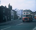 A Double-decker Bus in Prescot - geograph.org.uk - 3240653.jpg 1,468 × 1,232; 289 KB
-
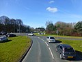
 A58 Prescot by-pass - geograph.org.uk - 3386957.jpg 640 × 480; 76 KB
-
 Approach to junction 2 on the M57 at Prescot - geograph.org.uk - 4388323.jpg 1,024 × 768; 166 KB
-
 BICC War Memorial, St Mary's Churchyard - geograph.org.uk - 6472968.jpg 589 × 640; 146 KB
-
-
 Burrow's Lane, Prescot - geograph.org.uk - 127897.jpg 640 × 480; 59 KB
-
 Cables Retail Park Prescot - geograph.org.uk - 2033851.jpg 1,600 × 1,198; 276 KB
-

-
 Church Street, Prescot - geograph.org.uk - 5943103.jpg 1,024 × 743; 193 KB
-
 Churchyard path, Prescot - geograph.org.uk - 5943112.jpg 1,024 × 768; 290 KB
-
 Crown of India, Kemble Street, Prescot - geograph.org.uk - 4489529.jpg 640 × 427; 256 KB
-
 Deanes House, Prescot - geograph.org.uk - 5943107.jpg 1,024 × 768; 189 KB
-
 Disused water tower - geograph.org.uk - 172225.jpg 480 × 640; 44 KB
-
 East side of the Market Place, Prescot - geograph.org.uk - 5943057.jpg 1,024 × 737; 134 KB
-
 Entrance of Our Lady Immaculate & St Joseph, Prescot.jpg 4,032 × 3,024; 4.91 MB
-

-
 Entrance to the Vicarage, Prescot - geograph.org.uk - 5943128.jpg 1,024 × 768; 317 KB
-
 Field, South Avenue, Prescot.JPG 4,320 × 3,240; 3.68 MB
-
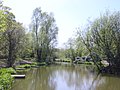
 Fishing Pond, Carr Lane, Prescot - geograph.org.uk - 131331.jpg 640 × 480; 60 KB
-
 Footpath to Wood Lane - geograph.org.uk - 5943092.jpg 1,024 × 768; 286 KB
-
 Former chapel, Aspinal Street, Prescot - geograph.org.uk - 5927353.jpg 1,024 × 768; 202 KB
-
 Hall Lane-Kingsway junction - geograph.org.uk - 2288646.jpg 640 × 480; 37 KB
-
 HSBC bank, Prescot.jpg 4,320 × 3,240; 3.11 MB
-
 King George V Play Space, Prescot.JPG 4,320 × 3,240; 4.4 MB
-
 Kingsway, Prescot.JPG 4,320 × 3,240; 3.21 MB
-
 Knowsley sister stone at Prescot.jpg 3,240 × 4,320; 3.88 MB
-
 Lathum Close - geograph.org.uk - 2288650.jpg 640 × 480; 77 KB
-
 Liverpool Road, Prescot.jpg 5,168 × 2,891; 16.08 MB
-

-
 Lucy box on Bridge Street, Prescot.jpg 3,167 × 4,586; 20.11 MB
-
 M57 motorway from Huyton Lane (1).jpg 4,320 × 3,240; 3.16 MB
-
 M57 North from Huyton Lane - geograph.org.uk - 280188.jpg 640 × 480; 64 KB
-
 Memorial plaque to The Liverpool Pals - geograph.org.uk - 5428414.jpg 4,320 × 2,432; 2.41 MB
-
 Mersey Estuary from the Air - geograph.org.uk - 3153428.jpg 3,968 × 2,232; 4.99 MB
-
 On St Helens Road, Prescot - geograph.org.uk - 5115233.jpg 3,775 × 5,033; 3.74 MB
-
 Paddock Road - geograph.org.uk - 3260470.jpg 4,550 × 2,935; 7.86 MB
-

-
 Pheasant on Warrington Road, Prescot.jpg 5,198 × 3,462; 24.42 MB
-
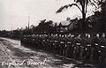 Polish II Corps (60) - 1946-07-03 - Prescot.jpg 3,893 × 2,492; 635 KB
-
 Prescot 1905.jpg 990 × 1,583; 443 KB
-
 Prescot Bus Station - geograph.org.uk - 333566.jpg 640 × 469; 81 KB
-
 Prescot By-pass - geograph.org.uk - 3465363.jpg 3,954 × 2,617; 2.26 MB
-
 Prescot Elizabethan Fayre 2013.JPG 3,648 × 2,736; 3.56 MB
-
 Prescot from Carr Lane Playing fields - geograph.org.uk - 280181.jpg 640 × 480; 73 KB
-
 Prescot Knowsley Sister Stone.jpg 3,577 × 3,432; 15.87 MB
-

-
 Prescot railway station - geograph.org.uk - 2904098.jpg 761 × 1,024; 197 KB
-
 Prescot railway station, Merseyside - geograph.org.uk - 4737433.jpg 1,600 × 1,200; 380 KB
-
 Prescot School - geograph.org.uk - 6473078.jpg 640 × 480; 57 KB
-
 Prescot Town Council June 2024.svg 512 × 263; 4 KB
-
 Prescot War Memorial - geograph.org.uk - 6472996.jpg 480 × 640; 70 KB
-
 Prescot, Chester Street - geograph.org.uk - 4489343.jpg 640 × 480; 261 KB
-
 Prescot, Sewell Street - geograph.org.uk - 4489525.jpg 640 × 481; 278 KB
-
 Prescot, Station Road - geograph.org.uk - 4489535.jpg 640 × 481; 277 KB
-
 Prescott railway station, Merseyside, 2009 - geograph.org.uk - 3444222.jpg 1,024 × 705; 164 KB
-
 Railway cutting north east of Scotchbarn Lane - geograph.org.uk - 4737411.jpg 1,600 × 1,200; 508 KB
-
 Red Lion Hotel, Prescot - geograph.org.uk - 4489518.jpg 640 × 427; 279 KB
-
 Scotchbarn Leisure Centre - all boarded up - geograph.org.uk - 2743944.jpg 4,592 × 3,056; 6.71 MB
-

-
-
 St Helens Road, Prescot - geograph.org.uk - 2333304.jpg 640 × 480; 154 KB
-
 St Mary's Churchyard - geograph.org.uk - 6472976.jpg 640 × 480; 133 KB
-
 St Paul's Church, Prescot - geograph.org.uk - 5203663.jpg 800 × 600; 111 KB
-
 St. Mary's church, Prescot - geograph.org.uk - 5943120.jpg 1,024 × 768; 181 KB
-
 Summer at the Fishing Pond, Carr Lane - geograph.org.uk - 216671.jpg 640 × 480; 111 KB
-
 Tesco Extra, Prescot Cables Retail Park - geograph.org.uk - 4489521.jpg 640 × 480; 250 KB
-
 The Bath Springs, Prescot - geograph.org.uk - 4489332.jpg 640 × 480; 295 KB
-
 The British Army in the United Kingdom 1939-45 H2530.jpg 800 × 612; 65 KB
-
 The Duchess Of Stadt Moers.jpg 5,360 × 2,497; 6.69 MB
-
 The Great Wall of Knowsley running outside the paddocks - geograph.org.uk - 3260507.jpg 4,589 × 2,907; 6.77 MB
-
 The Hare and Hounds or Tommy Halls - geograph.org.uk - 6473055.jpg 640 × 480; 104 KB
-
 Two Buses in Prescot - geograph.org.uk - 3217360.jpg 1,471 × 1,232; 298 KB
-
 Valerie Park Stadium Prescot.jpg 700 × 400; 70 KB
-
 Vicarage Place, Prescot - geograph.org.uk - 5943133.jpg 1,024 × 768; 268 KB
-
 Whiston from Bridge Road - geograph.org.uk - 5203668.jpg 800 × 600; 90 KB
-
 Autumn at the Fishing Pond, Carr Lane - geograph.org.uk - 282297.jpg 640 × 480; 103 KB
-
 Cables Retail Park, Prescot - geograph.org.uk - 149865.jpg 640 × 480; 59 KB
-
 Carr Lane Pond, Prescot - geograph.org.uk - 280174.jpg 640 × 480; 106 KB
-

-
 Forest Farm, Liverpool Rd, Prescot - geograph.org.uk - 280168.jpg 640 × 480; 143 KB
-
 Zion Independent Methodist Church - geograph.org.uk - 4489545.jpg 640 × 480; 325 KB
-
 Knowsley Park - geograph.org.uk - 131510.jpg 640 × 421; 164 KB
-
 Prescot Merseyside - geograph.org.uk - 298933.jpg 640 × 427; 83 KB
-


.jpg)


.jpg)


_-_1946-07-03_-_Prescot.jpg)


