Category:Priestcliffe
English: Priestcliffe is a hamlet in the civil parish of Taddington, in the Derbyshire Dales district, in the county of Derbyshire, England.
hamlet in Taddington, Derbyshire Dales, Derbyshire, England, UK  | |||||
| Upload media | |||||
| Instance of | |||||
|---|---|---|---|---|---|
| Location | Taddington, Derbyshire Dales, Derbyshire, East Midlands, England | ||||
 | |||||
Media in category "Priestcliffe"
The following 34 files are in this category, out of 34 total.
-
 Broad Lane approaching Priestcliffe - geograph.org.uk - 3138836.jpg 600 × 800; 163 KB
-
 Broadway Lane towards Priestcliffe - geograph.org.uk - 2839849.jpg 1,024 × 768; 211 KB
-
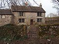
 Cottages in Priestcliffe - geograph.org.uk - 1449438.jpg 640 × 480; 94 KB
-
 Entering Priestcliffe from Broadway Lane - geograph.org.uk - 2839856.jpg 1,024 × 754; 214 KB
-
 Entering the Hamlet of Priestcliffe - geograph.org.uk - 2289529.jpg 3,296 × 2,472; 1.05 MB
-
 Farmhouse and buildings in Priestcliffe - geograph.org.uk - 2839862.jpg 1,024 × 808; 306 KB
-
 Farmland view to Priestcliffe from Bull Tor - geograph.org.uk - 3948739.jpg 1,024 × 768; 176 KB
-
 Field patterns near Priestcliffe - geograph.org.uk - 3948487.jpg 1,024 × 768; 199 KB
-
 Footpath below Priestcliffe Lees quarry - geograph.org.uk - 5324404.jpg 1,800 × 1,350; 612 KB
-
 Footpath in Priestcliffe - geograph.org.uk - 5307875.jpg 1,800 × 1,350; 600 KB
-
 Hamlet of Priestcliffe Ditch - geograph.org.uk - 2839869.jpg 1,024 × 763; 240 KB
-
 Highcliffe Farm, Priestcliffe - geograph.org.uk - 2829597.jpg 2,358 × 1,769; 1.36 MB
-
 House in Priestcliffe - geograph.org.uk - 2829596.jpg 2,390 × 1,793; 1.02 MB
-
-
 Lane from Priestcliffe - geograph.org.uk - 4955476.jpg 640 × 480; 82 KB
-
 Lane junction near Priestcliffe - geograph.org.uk - 619339.jpg 640 × 427; 84 KB
-
 Lane to Priestcliffe - geograph.org.uk - 2839866.jpg 1,024 × 768; 238 KB
-
 Limestone Way sign near Priestcliffe - geograph.org.uk - 2829599.jpg 640 × 479; 61 KB
-
 Looking Towards Priestcliffe - geograph.org.uk - 1863255.jpg 640 × 526; 98 KB
-
 Lydgate Farm, Priestcliffe - geograph.org.uk - 5307876.jpg 1,800 × 1,350; 341 KB
-
 Meadow and trees near Priestcliffe - geograph.org.uk - 3948453.jpg 1,024 × 768; 333 KB
-

-
 Part of Lydgate Farm - geograph.org.uk - 2848760.jpg 3,872 × 2,592; 4.97 MB
-
 Priestcliffe - geograph.org.uk - 2848344.jpg 3,872 × 2,592; 4.99 MB
-
 Priestcliffe - geograph.org.uk - 89098.jpg 640 × 480; 126 KB
-
 Priestcliffe from afar - geograph.org.uk - 2748610.jpg 3,648 × 2,736; 4.23 MB
-

-
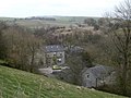
 Priestcliffe Lees Viewed from New Barn - geograph.org.uk - 2289499.jpg 3,296 × 2,472; 1.08 MB
-
 Priestcliffe, a hamlet - geograph.org.uk - 1767005.jpg 640 × 480; 65 KB
-
 Public Footpath near Priestcliffe Ditch - geograph.org.uk - 2289553.jpg 3,296 × 2,472; 1.06 MB
-
 Puddly farm track north of Priestcliffe - geograph.org.uk - 2849454.jpg 3,872 × 2,592; 5.01 MB
-
 Remains of horse gin, Priestcliffe Lees - geograph.org.uk - 2404050.jpg 640 × 427; 107 KB
-
 Ruined limestone house in Priestcliffe - geograph.org.uk - 2829593.jpg 2,337 × 1,753; 1.54 MB
-
 View to Priestcliffe - geograph.org.uk - 3948422.jpg 1,024 × 767; 178 KB


