Category:Prohibitory road signs in the United Kingdom
Countries of Europe: Albania · Andorra · Armenia‡ · Austria · Azerbaijan‡ · Belarus · Belgium · Bosnia and Herzegovina · Bulgaria · Croatia · Cyprus‡ · Czech Republic · Denmark · Estonia · Finland · France‡ · Georgia‡ · Germany · Greece · Hungary · Iceland · Republic of Ireland · Italy · Kazakhstan‡ · Latvia · Lithuania · Luxembourg · Malta · Moldova · Montenegro · Netherlands‡ · North Macedonia · Norway · Poland · Portugal‡ · Romania · Russia‡ · Serbia · Slovakia · Slovenia · Spain‡ · Sweden · Switzerland · Turkey‡ · Ukraine · United Kingdom
Specific status: Faroe Islands · Gibraltar – Limited recognition: Kosovo · Northern Cyprus‡
‡: partly located in Europe
Specific status: Faroe Islands · Gibraltar – Limited recognition: Kosovo · Northern Cyprus‡
‡: partly located in Europe
Subcategories
This category has the following 8 subcategories, out of 8 total.
N
P
Media in category "Prohibitory road signs in the United Kingdom"
The following 15 files are in this category, out of 15 total.
-
 40mh zone reminder sign on Park Lane (geograph 4399918).jpg 1,600 × 1,062; 735 KB
-
 Bradmore Lane railway bridge - geograph.org.uk - 2696127.jpg 1,280 × 959; 349 KB
-
 Clowne - Gapstick Lane - geograph.org.uk - 1583896.jpg 640 × 480; 70 KB
-
 Don't try this at home - Flickr - JohnnyEnglish.jpg 1,600 × 1,200; 327 KB
-
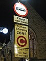 Durham congestion charge.JPG 2,304 × 3,072; 4.49 MB
-
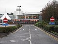 Frankie ^ Benny's at Sarn Park - geograph.org.uk - 4227208.jpg 3,264 × 2,448; 4.16 MB
-
 Grass Airstrip - geograph.org.uk - 361581.jpg 640 × 480; 119 KB
-
 Hill Road, Hill Top, Newmillerdam - geograph.org.uk - 1779424.jpg 640 × 480; 195 KB
-
 No cars and motorcycles Belgium sign.jpg 3,208 × 3,296; 3.69 MB
-
 No Motor Vehicles - geograph.org.uk - 2251349.jpg 800 × 532; 47 KB
-
 NView Westbury Pk jct.jpg 3,888 × 2,592; 3.99 MB
-
 Parrys Ln Saville Rd Jct.jpg 3,888 × 2,592; 3.69 MB
-
 Red-Route-Bus-Stop-Sign.jpg 3,072 × 2,304; 1.72 MB
-
 Stoke Gabriel, axle limit at Port Bridge - geograph.org.uk - 1468596.jpg 640 × 480; 114 KB
-
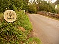
 The top of Muckle Gate Lane - geograph.org.uk - 2712199.jpg 1,280 × 959; 373 KB
.jpg)


