Category:Puʻu Huluhulu (Hamakua district)
volcanic cone in the Island of Hawaii .jpg) | |||||
| Upload media | |||||
| Instance of | |||||
|---|---|---|---|---|---|
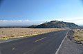
| Location | Hamakua, Hawaii County, Hawaii | ||||
| Different from | |||||
 | |||||
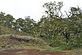
English: Cinder cone in Hamakua district, near the center of the Island of Hawaii in the State of Hawaii. It is located on the southern side of Hawaii Route 200.
Media in category "Puʻu Huluhulu (Hamakua district)"
The following 10 files are in this category, out of 10 total.
-
 Acacia koa study 1.jpg 4,608 × 2,592; 3.16 MB
-
 Acacia koa study 3.jpg 4,608 × 2,592; 3.09 MB
-
 Acacia koa study 4.jpg 4,608 × 2,592; 3.03 MB
-
 Flowers at Puʻu Huluhulu - panoramio.jpg 3,264 × 4,928; 4.62 MB
-
 Puu Huluhulu11.jpg 3,216 × 2,136; 1.32 MB
-
 Puu Huluhulu13.jpg 3,216 × 2,136; 1.39 MB
-
 Puʻu Huluhulu - panoramio (1).jpg 4,928 × 3,264; 5.57 MB
-
 Puʻu Huluhulu - panoramio (2).jpg 4,928 × 3,264; 5.16 MB
-
 Puʻu Huluhulu - panoramio.jpg 4,928 × 3,264; 6.86 MB
-
 Puʻu Huluhulu from Mauna Kea - panoramio.jpg 4,928 × 3,264; 4.61 MB


.jpg)

