Category:Public Land Survey System
system of dividing most of the U.S. into squares  | |||||
| Upload media | |||||
| Instance of |
| ||||
|---|---|---|---|---|---|
| Location |
| ||||
| Inception |
| ||||
| |||||
Subcategories
This category has only the following subcategory.
Media in category "Public Land Survey System"
The following 5 files are in this category, out of 5 total.
-
 Derby-mine-highland-pines-thumb-butte-prescott.jpg 2,626 × 1,582; 3.66 MB
-
 Point identification standards for the Public Land Survey System - draft (IA pointidentificatwaan).pdf 635 × 831, 152 pages; 12.86 MB
-
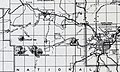
 Public Land Survey System.png 3,508 × 2,304; 1.21 MB
-
 Strategic plan for managing the Public Land Survey System (IA strategicplanforunit).pdf 635 × 829, 40 pages; 3.57 MB
-
 Systemic numbering in the Public Land Survey System.svg 386 × 269; 69 KB

