Category:Public footpaths in Halifax, West Yorkshire
Subcategories
This category has the following 80 subcategories, out of 80 total.
0
- Halifax Footpath 72 (9 F)
- Halifax Footpath 73 (6 F)
- Halifax Footpath 75 (1 F)
- Halifax Footpath 77 (2 F)
- Halifax Footpath 84 (4 F)
- Halifax Footpath 86 (5 F)
- Halifax Footpath 91 (3 F)
- Halifax Footpath 93 (2 F)
1
- Halifax Footpath 145 (2 F)
- Halifax Footpath 148 (4 F)
- Halifax Footpath 171 (1 F)
- Halifax Footpath 180 (13 F)
- Halifax Footpath 182 (3 F)
- Halifax Footpath 183 (6 F)
- Halifax Footpath 185 (2 F)
- Halifax Footpath 186 (4 F)
- Halifax Footpath 195 (6 F)
- Halifax Footpath 199 (7 F)
2
- Halifax Footpath 205 (4 F)
- Halifax Footpath 211 (4 F)
- Halifax Footpath 247 (5 F)
- Halifax Footpath 249 (5 F)
- Halifax Footpath 286 (8 F)
- Halifax Footpath 288 (3 F)
3
- Halifax Footpath 309 (3 F)
- Halifax Footpath 313 (9 F)
- Halifax Footpath 314 (3 F)
- Halifax Footpath 315 (3 F)
- Halifax Footpath 316 (4 F)
- Halifax Footpath 317 (1 F)
- Halifax Footpath 318 (1 F)
- Halifax Footpath 324 (7 F)
- Halifax Footpath 325 (7 F)
- Halifax Footpath 357 (2 F)
- Halifax Footpath 361 (7 F)
- Halifax Footpath 363 (5 F)
- Halifax Footpath 364 (2 F)
- Halifax Footpath 365 (4 F)
- Halifax Footpath 384 (8 F)
- Halifax Footpath 385 (1 F)
- Halifax Footpath 394 (3 F)
- Halifax Footpath 399 (9 F)
4
- Halifax Footpath 400 (6 F)
- Halifax Footpath 401 (6 F)
- Halifax Footpath 427 (3 F)
- Halifax Footpath 440 (2 F)
- Halifax Footpath 441 (2 F)
- Halifax Footpath 444 (4 F)
- Halifax Footpath 445 (3 F)
- Halifax Footpath 447 (3 F)
- Halifax Footpath 449 (2 F)
- Halifax Footpath 490 (4 F)
- Halifax Footpath 491 (10 F)
- Halifax Footpath 493 (5 F)
5
- Halifax Footpath 527 (8 F)
- Halifax Footpath 584 (5 F)
- Halifax Footpath 587 (4 F)
- Halifax Footpath 593 (4 F)
- Halifax Footpath 594 (2 F)
6
- Halifax Footpath 671 (5 F)
- Halifax Footpath 675 (4 F)
- Halifax Footpath 681 (3 F)
- Halifax Footpath 682 (3 F)
- Halifax Footpath 690 (4 F)
- Halifax Footpath 691 (3 F)
7
- Halifax Footpath 720 (7 F)
- Halifax Footpath 729 (2 F)
- Halifax Footpath 736 (7 F)
- Halifax Footpath 737 (4 F)
- Halifax Footpath 741 (2 F)
- Halifax Footpath 749 (6 F)
- Halifax Footpath 751 (6 F)
B
- Birks Hall Lane (9 F)
C
- Canker Lane, Halifax (7 F)
S
- Shibden Fold Footpath (4 F)
- Spring Lane, Halifax (5 F)
W
- White Hall Lane, Mixenden (6 F)
Media in category "Public footpaths in Halifax, West Yorkshire"
The following 200 files are in this category, out of 261 total.
(previous page) (next page)-
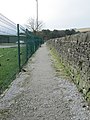
 A corner on Waterside Footpath, Halifax - geograph.org.uk - 5218444.jpg 1,492 × 2,000; 774 KB
-
 Adopted footpath, Skircoat - geograph.org.uk - 5877164.jpg 2,000 × 1,500; 951 KB
-
 Adopted footpath, Skircoat, Halifax - geograph.org.uk - 5877178.jpg 1,500 × 2,000; 1.1 MB
-

-
 Barbed wire on a stile on Halifax FP230, Illingworth - geograph.org.uk - 5993494.jpg 1,500 × 2,000; 863 KB
-
 Blocked footpath at Mixenden Lodge - geograph.org.uk - 5439779.jpg 2,000 × 1,500; 1.08 MB
-
 Blocked stile on Halifax FP417 at Ringby Lane - geograph.org.uk - 5956965.jpg 2,000 × 1,500; 712 KB
-
 Buckley lane at Ovenden Wood Lane - geograph.org.uk - 5452637.jpg 1,726 × 2,000; 1.25 MB
-

-
 Claremont Road Footpath at Range Bank, Halifax - geograph.org.uk - 5377042.jpg 2,000 × 1,500; 1.19 MB
-
 Continuation of Rye Lane - geograph.org.uk - 4044010.jpg 480 × 640; 116 KB
-
 Emscote Street South Footpath, Skircoat, Halifax - geograph.org.uk - 5877214.jpg 1,500 × 2,000; 833 KB
-

-

-
 Flagged Footpath beside Ramsden Wood - geograph.org.uk - 6511375.jpg 5,184 × 3,456; 6.96 MB
-
 Footbridge on Halifax FP101 in Mixenden Plantation - geograph.org.uk - 5438186.jpg 1,566 × 2,000; 1.16 MB
-
 Footpath - Beechwood Road - geograph.org.uk - 3701844.jpg 480 × 640; 113 KB
-
 Footpath - Bracewell Drive - geograph.org.uk - 3852013.jpg 480 × 640; 89 KB
-
 Footpath - Central Park - geograph.org.uk - 3688222.jpg 480 × 640; 96 KB
-
 Footpath - Central Park - geograph.org.uk - 3688276.jpg 480 × 640; 103 KB
-
 Footpath - Church Lane, Pellon - geograph.org.uk - 1884076.jpg 480 × 640; 133 KB
-
 Footpath - Clough Lane - geograph.org.uk - 4352357.jpg 480 × 640; 93 KB
-
 Footpath - Crag Lane - geograph.org.uk - 4099911.jpg 480 × 640; 145 KB
-
 Footpath - Dryclough Lane - geograph.org.uk - 3700869.jpg 480 × 640; 98 KB
-
 Footpath - end of Clover Hill Road - geograph.org.uk - 3688425.jpg 480 × 640; 131 KB
-
 Footpath - Field Head Lane - geograph.org.uk - 3866242.jpg 480 × 640; 90 KB
-
 Footpath - Godfrey Road - geograph.org.uk - 3486522.jpg 480 × 640; 105 KB
-
 Footpath - Greenroyd Close - geograph.org.uk - 3700798.jpg 480 × 640; 118 KB
-
 Footpath - Heath Road - geograph.org.uk - 3475145.jpg 480 × 640; 95 KB
-
 Footpath - Heathmoor Park Road - geograph.org.uk - 4046455.jpg 640 × 479; 99 KB
-
 Footpath - Heathmoor Park Road - geograph.org.uk - 4046466.jpg 640 × 480; 100 KB
-
 Footpath - Heathmoor Park Road - geograph.org.uk - 4046468.jpg 480 × 640; 117 KB
-
 Footpath - Keighley Road - geograph.org.uk - 3861621.jpg 480 × 640; 76 KB
-
 Footpath - Keighley Road - geograph.org.uk - 4046607.jpg 640 × 480; 64 KB
-
 Footpath - Manor Heath Road - geograph.org.uk - 3700534.jpg 480 × 640; 102 KB
-
 Footpath - Meadow Drive - geograph.org.uk - 3851091.jpg 480 × 640; 96 KB
-
 Footpath - Mount Tabor Road - geograph.org.uk - 4341376.jpg 480 × 640; 100 KB
-
 Footpath - Myrtle Place - geograph.org.uk - 3812634.jpg 480 × 640; 104 KB
-
 Footpath - New Lane - geograph.org.uk - 3463959.jpg 640 × 480; 107 KB
-
 Footpath - Newlands Road - geograph.org.uk - 4334306.jpg 640 × 480; 87 KB
-
 Footpath - Newlands Road - geograph.org.uk - 4334308.jpg 640 × 480; 95 KB
-
 Footpath - Newlands Road - geograph.org.uk - 4334311.jpg 480 × 640; 122 KB
-
 Footpath - Ovenden Avenue - geograph.org.uk - 3650961.jpg 480 × 640; 97 KB
-
 Footpath - Rochdale Road - geograph.org.uk - 3804086.jpg 480 × 640; 104 KB
-
 Footpath - Roils Head Road - geograph.org.uk - 4333590.jpg 559 × 640; 80 KB
-
 Footpath - Rye Croft - geograph.org.uk - 3860772.jpg 480 × 640; 93 KB
-
 Footpath - Rye Croft - geograph.org.uk - 3860775.jpg 480 × 640; 114 KB
-
 Footpath - School Lane - geograph.org.uk - 3866003.jpg 480 × 640; 101 KB
-
 Footpath - School Lane - geograph.org.uk - 3866008.jpg 480 × 640; 77 KB
-
 Footpath - top of Brickfield Lane - geograph.org.uk - 3701858.jpg 480 × 640; 104 KB
-
 Footpath - Whitegate - geograph.org.uk - 3463950.jpg 480 × 640; 119 KB
-
 Footpath - Whitehill Road - geograph.org.uk - 3860768.jpg 617 × 640; 114 KB
-
 Footpath - Winterburn Lane - geograph.org.uk - 4324419.jpg 480 × 640; 89 KB
-
 Footpath 755 approaching Heath Road, Skircoat, Halifax - geograph.org.uk - 5217886.jpg 1,500 × 2,000; 1.06 MB
-
 Footpath 755 at Back Glen Terrace, Skircoat, Halifax - geograph.org.uk - 5217493.jpg 1,447 × 2,000; 818 KB
-
 Footpath above Ogden Clough approaching Back Lane - geograph.org.uk - 5368041.jpg 4,000 × 3,000; 2.77 MB
-
 Footpath across Crow Wood Park - geograph.org.uk - 4004738.jpg 640 × 480; 110 KB
-

-

-

-

-
 Footpath beside Ramsden Wood - geograph.org.uk - 4320541.jpg 1,920 × 1,440; 775 KB
-
 Footpath beside Ramsden Wood - geograph.org.uk - 4320621.jpg 1,920 × 1,440; 789 KB
-
 Footpath beside Ramsden Wood - geograph.org.uk - 4320633.jpg 1,920 × 1,440; 741 KB
-
 Footpath beside Ramsden Wood - geograph.org.uk - 4320698.jpg 1,920 × 1,440; 1.01 MB
-
 Footpath beside Ramsden Wood - geograph.org.uk - 4320720.jpg 1,920 × 1,440; 1,022 KB
-
 Footpath beside Roils Head Playing Fields - geograph.org.uk - 6511347.jpg 5,184 × 3,456; 6.54 MB
-
 Footpath from Binns Hole to Mixenden, Ovenden - geograph.org.uk - 5025416.jpg 2,000 × 1,469; 876 KB
-

-
 Footpath from Darcey Hey Lane to Rochdale Road - geograph.org.uk - 3841928.jpg 2,403 × 3,953; 2.35 MB
-
 Footpath from Dean House Farm approaching Brook Terrace - geograph.org.uk - 4809109.jpg 1,536 × 2,048; 980 KB
-

-

-
 Footpath from Shibden Park to Whitehall Road (A58) - geograph.org.uk - 3979766.jpg 4,608 × 3,456; 3.59 MB
-
 Footpath from Slippy Lane to Jumples, Mixenden - geograph.org.uk - 6054372.jpg 2,000 × 1,491; 1.04 MB
-
 Footpath heading towards Mount Tabor - geograph.org.uk - 6511362.jpg 5,184 × 3,456; 4.79 MB
-
 Footpath in Long Wood, Skircoat - geograph.org.uk - 4762504.jpg 1,536 × 2,048; 1.4 MB
-
 Footpath in Ramsden Wood - geograph.org.uk - 6511395.jpg 5,184 × 3,456; 7.45 MB
-
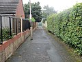
 Footpath in the Ovenden Wood housing estate, Halifax - geograph.org.uk - 5447007.jpg 2,000 × 1,500; 650 KB
-
 Footpath northwards from the top of Medley Lane, Northowram - geograph.org.uk - 6462176.jpg 1,601 × 2,000; 1.58 MB
-
 Footpath off Broomfield Avenue, Skircoat. Halifax - geograph.org.uk - 5877186.jpg 2,000 × 1,500; 919 KB
-
 Footpath off Mill Lane, Warley - geograph.org.uk - 4809020.jpg 1,500 × 2,001; 909 KB
-
 Footpath on Barms Hill, Northowram - geograph.org.uk - 6463195.jpg 2,000 × 1,500; 1.41 MB
-
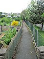
 Footpath past allotments, Skircoat, Halifax - geograph.org.uk - 5217573.jpg 2,000 × 1,500; 957 KB
-
 Footpath to Baldwin Terrace off Bailey Hall Bank, Halifax - geograph.org.uk - 5691131.jpg 1,500 × 2,000; 1.09 MB
-
 Footpath to Dean House Farm, Midgley - geograph.org.uk - 4809117.jpg 1,536 × 2,048; 902 KB
-
 Footpath towards Moor End Road - geograph.org.uk - 4326643.jpg 1,600 × 1,200; 483 KB
-
 Footpaths and an entrance to King Cross Cemetery, Skircoat - geograph.org.uk - 5873353.jpg 2,000 × 1,483; 1.08 MB
-
 Former gateway on Halifax FP408 - geograph.org.uk - 5340987.jpg 2,000 × 1,500; 1,011 KB
-
 FP686, Skircoat, Halifax - geograph.org.uk - 5216776.jpg 1,500 × 2,000; 1.03 MB
-
 FP686, Skircoat, Halifax - geograph.org.uk - 5216800.jpg 1,500 × 2,000; 905 KB
-
 FP687, Skircoat, Halifax - geograph.org.uk - 5216789.jpg 2,000 × 1,500; 1.2 MB
-

-
 Gate and narrow stile on FP183, Warley, Halifax - geograph.org.uk - 5340314.jpg 2,048 × 1,536; 956 KB
-
 Gate into Mixenden Plantation off Hays Lane - geograph.org.uk - 5438263.jpg 1,500 × 2,000; 1.19 MB
-
 Gate of FP183, Warley, Halifax - geograph.org.uk - 5340317.jpg 1,500 × 2,022; 837 KB
-
 Gate on Halifax FP89 - geograph.org.uk - 5446144.jpg 2,000 × 1,476; 980 KB
-
 Gate on Halifax FP96 at White Hall Lane, Mixenden - geograph.org.uk - 5347638.jpg 2,000 × 1,477; 903 KB
-
 Greenroyd Lane - geograph.org.uk - 4057995.jpg 1,920 × 2,445; 1.82 MB
-
 Halifax Footpath 213, Illingworth - geograph.org.uk - 6024247.jpg 2,000 × 1,500; 1.09 MB
-
 Halifax Footpath 217 at Mixenden Lane - geograph.org.uk - 6026897.jpg 2,000 × 1,500; 1.15 MB
-
 Halifax Footpath 252 entering the Tar Hill woodland - geograph.org.uk - 6024240.jpg 2,000 × 1,500; 1.04 MB
-

-
 Halifax FP 424 at Nab End, Boothtown - geograph.org.uk - 5956933.jpg 2,000 × 1,471; 1.15 MB
-
 Halifax FP100 in Mixenden Plantation - geograph.org.uk - 5348644.jpg 2,000 × 1,500; 1.36 MB
-
 Halifax FP101 in Mixenden Plantation - geograph.org.uk - 5348608.jpg 2,000 × 1,500; 1.43 MB
-
 Halifax FP102 at the junction with FP100, Mixenden - geograph.org.uk - 5438211.jpg 2,000 × 1,500; 1.37 MB
-
 Halifax FP104 - geograph.org.uk - 5446131.jpg 2,000 × 1,500; 1.03 MB
-
 Halifax FP118 approaching Spring Farm - geograph.org.uk - 5944847.jpg 2,000 × 1,479; 914 KB
-

-
 Halifax FP16 on a track to Coal Lane - geograph.org.uk - 6713124.jpg 2,000 × 1,500; 1.24 MB
-
-
 Halifax FP178 at a broken field wall - geograph.org.uk - 5389766.jpg 2,000 × 1,500; 1.07 MB
-
 Halifax FP178 at a broken field wall, and a spring - geograph.org.uk - 5389775.jpg 2,000 × 1,500; 931 KB
-
 Halifax FP216 approaching White Gate, Illingworth - geograph.org.uk - 6028403.jpg 2,000 × 1,500; 1.33 MB
-
 Halifax FP216 at White Gate, Illingworth - geograph.org.uk - 6028406.jpg 2,000 × 1,500; 1.37 MB
-
 Halifax FP226 approaching West Scausby Farm, Bradshaw - geograph.org.uk - 5999764.jpg 2,000 × 1,488; 773 KB
-
 Halifax FP227 on a lane, Illingworth - geograph.org.uk - 5993691.jpg 2,000 × 1,500; 1.01 MB
-

-
 Halifax FP245 going across the fields, Illingworth - geograph.org.uk - 5992469.jpg 2,000 × 1,500; 917 KB
-
 Halifax FP246, Illingworth - geograph.org.uk - 5993488.jpg 2,000 × 1,500; 1.55 MB
-
 Halifax FP283 at Riding Farm - geograph.org.uk - 5452651.jpg 2,000 × 1,500; 1.06 MB
-
 Halifax FP283 on driveway at Riding Farm - geograph.org.uk - 5452642.jpg 2,000 × 1,500; 734 KB
-
 Halifax FP408 at Hollin Greaves Lane - geograph.org.uk - 5340986.jpg 1,462 × 2,000; 1,005 KB
-
 Halifax FP409 - geograph.org.uk - 5340975.jpg 2,000 × 1,500; 1.65 MB
-
 Halifax FP409 at Turner Lane - geograph.org.uk - 5340964.jpg 1,517 × 2,000; 1.4 MB
-
 Halifax FP410 - geograph.org.uk - 5340569.jpg 2,000 × 1,491; 996 KB
-
 Halifax FP412 at Ploughcroft Lane, Boothtown - geograph.org.uk - 5957010.jpg 2,000 × 1,500; 1.06 MB
-
 Halifax FP413 at Ploughcroft Lane - geograph.org.uk - 5956974.jpg 2,000 × 1,500; 1.09 MB
-
-

-
 Halifax FP425 almost at the top of the climb - geograph.org.uk - 5396440.jpg 2,048 × 1,536; 996 KB
-
 Halifax FP429 on the driveway of White Birk Farm - geograph.org.uk - 5379424.jpg 2,000 × 1,500; 964 KB
-
 Halifax FP434 - geograph.org.uk - 5383976.jpg 1,490 × 2,000; 1.17 MB
-
 Halifax FP438 at Wells Close - geograph.org.uk - 5397132.jpg 2,000 × 1,445; 918 KB
-
 Halifax FP460, Ovenden - geograph.org.uk - 6028412.jpg 2,000 × 1,500; 702 KB
-

-
 Halifax FP488, Ovenden Wood - geograph.org.uk - 5446653.jpg 1,854 × 2,000; 1.35 MB
-
 Halifax FP492 - geograph.org.uk - 5445080.jpg 2,000 × 1,500; 1.19 MB
-
 Halifax FP492 on the driveway to Ramsden Wood Reservoir - geograph.org.uk - 5445096.jpg 2,000 × 1,482; 770 KB
-

-
 Halifax FP575 descending from Angel Road - geograph.org.uk - 6074120.jpg 2,000 × 1,500; 1.19 MB
-
 Halifax FP63 at Brookhouse, Mixenden - geograph.org.uk - 5443160.jpg 2,000 × 1,500; 1.11 MB
-
 Halifax FP635 crossing FP636 - geograph.org.uk - 5454993.jpg 2,000 × 1,500; 1.02 MB
-
 Halifax FP636 approaching Winterburn Lane, Warley - geograph.org.uk - 5457390.jpg 1,983 × 1,452; 1.19 MB
-
 Halifax FP653, Skircoat - geograph.org.uk - 5873347.jpg 2,000 × 1,500; 1.03 MB
-
 Halifax FP664 off Savile Park Road, Skircoat - geograph.org.uk - 5877217.jpg 1,468 × 1,980; 828 KB
-
 Halifax FP665 off Ivy Street, Skircoat - geograph.org.uk - 5877211.jpg 1,512 × 2,000; 1.17 MB
-
 Halifax FP666, Skircoat - geograph.org.uk - 5877206.jpg 2,000 × 1,500; 1.06 MB
-
 Halifax FP666, Skircoat - geograph.org.uk - 5877207.jpg 2,000 × 1,481; 995 KB
-
 Halifax FP669 at Wakefield Gate, Skircoat - geograph.org.uk - 5873351.jpg 2,000 × 1,477; 1.02 MB
-
 Halifax FP670 at Wakefield Gate, Skircoat - geograph.org.uk - 5874571.jpg 2,968 × 2,192; 1.82 MB
-
 Halifax FP674 approaching Delph Hill Road, Skircoat - geograph.org.uk - 5874651.jpg 2,000 × 1,500; 1.39 MB
-
 Halifax FP674 leaving Scar Bottom Road, Skircoat - geograph.org.uk - 5874596.jpg 1,500 × 2,000; 1.34 MB
-
 Halifax FP679 at Wakefield Road, Skircoat - geograph.org.uk - 4762367.jpg 1,536 × 2,048; 991 KB
-
 Halifax FP679 between back gardens, Skircoat - geograph.org.uk - 4762372.jpg 1,536 × 2,048; 1.17 MB
-
 Halifax FP680 in Spring Wood, Skircoat - geograph.org.uk - 4762378.jpg 1,536 × 2,048; 1.56 MB
-
 Halifax FP71, Brookhouse, Mixenden - geograph.org.uk - 5443113.jpg 2,000 × 1,500; 1.12 MB
-
 Halifax FP71, Mixenden - geograph.org.uk - 5452716.jpg 2,000 × 1,500; 1.3 MB
-
 Halifax FP726, Skircoat - geograph.org.uk - 5877230.jpg 2,000 × 1,500; 1.07 MB
-
 Halifax FP733 leaving Pellon Lane - geograph.org.uk - 6074044.jpg 2,000 × 1,471; 976 KB
-

-
 Halifax FP74 approaching Stud Fold, Mixenden - geograph.org.uk - 5442794.jpg 2,000 × 1,500; 1.09 MB
-
 Halifax FP752 at Swan Bank Lane - geograph.org.uk - 5278367.jpg 2,968 × 2,140; 1.84 MB
-
 Halifax FP79, Illingworth - geograph.org.uk - 6028399.jpg 2,000 × 1,465; 983 KB
-
 Halifax FP80, Mixenden - geograph.org.uk - 6028393.jpg 2,000 × 1,500; 852 KB
-
 Halifax FP82, Mixenden - geograph.org.uk - 5442698.jpg 2,000 × 1,500; 1,002 KB
-
 Halifax FP85 approaching FP84 - geograph.org.uk - 5945649.jpg 2,000 × 1,500; 1.09 MB
-
 Halifax FP86 towards Slaughter Gap, Ovenden - geograph.org.uk - 5025244.jpg 2,000 × 1,500; 874 KB
-
 Halifax FP96, Mixenden - geograph.org.uk - 5347681.jpg 2,000 × 1,500; 864 KB
-
 Halifax FP99 descending to Mixenden Plantation - geograph.org.uk - 5348599.jpg 2,000 × 1,500; 1.14 MB
-
 Halifax FP99 where it enters Mixenden Plantation - geograph.org.uk - 5446122.jpg 2,000 × 1,500; 1.41 MB
-
 Halifax FP99, Mixenden - geograph.org.uk - 5438197.jpg 2,000 × 1,500; 1.15 MB
-

-
 Junction of paths, Cunnery Wood Nature Reserve, Halifax - geograph.org.uk - 5368401.jpg 2,000 × 1,500; 1.3 MB
-
 Ladder stile on FP183, Warley, Halifax - geograph.org.uk - 5340323.jpg 2,048 × 1,536; 1.15 MB
-
 Leaning and fractured churchyard wall, Skircoat, Halifax - geograph.org.uk - 4750644.jpg 1,536 × 2,048; 1.07 MB
-
 Lee Bank Footpath at Ovenden Road, Halifax - geograph.org.uk - 5378215.jpg 2,000 × 1,500; 951 KB
-
 Lilly Lane Footpath at Navigation Road, Halifax - geograph.org.uk - 5218470.jpg 2,000 × 1,500; 757 KB
-
 Lilly Lane Footpath, Halifax - geograph.org.uk - 5218394.jpg 1,500 × 2,000; 806 KB
-
 Locked gate on Halifax FP413 at Bradford Old Road - geograph.org.uk - 5956997.jpg 2,000 × 1,452; 982 KB
-
 Looking for Halifax FP229, Illingworth - geograph.org.uk - 5993485.jpg 2,000 × 1,500; 1.21 MB
-
 Nab End Lane near Nab End, Halifax - geograph.org.uk - 5956831.jpg 2,000 × 1,500; 1.74 MB
-
 Not quite on Halifax FP104 - geograph.org.uk - 5446152.jpg 2,000 × 1,500; 1.04 MB
-
 Old Lee Bank Footpath 1 at Old Lee Bank, Halifax - geograph.org.uk - 5378188.jpg 2,000 × 1,500; 1.24 MB
-
 Old Lee Bank Footpath 2 at Old Lee Bank, Halifax - geograph.org.uk - 5378193.jpg 1,500 × 2,000; 1.01 MB
-
 Old Lee Bank Footpath 2 at Ovenden Road, Halifax - geograph.org.uk - 5378205.jpg 2,000 × 1,372; 1.05 MB
-
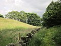
 Old track across the moor - geograph.org.uk - 3911612.jpg 4,315 × 2,360; 1.94 MB
-
 Ovenden Close Footpath, Lee Mount, Halifax - geograph.org.uk - 5378150.jpg 1,500 × 2,000; 1.14 MB
-
 Path along the hillside below The Bank, Illingworth - geograph.org.uk - 6026895.jpg 2,000 × 1,500; 1.33 MB
-
 Path along the top of Cunnery Wood Nature Reserve, Halifax - geograph.org.uk - 5368405.jpg 2,000 × 1,500; 1.37 MB
-

-
 Path at top of Ramsden Wood - geograph.org.uk - 4320722.jpg 1,920 × 1,336; 621 KB
-
 Path beside Providence Row - geograph.org.uk - 4334256.jpg 1,920 × 1,440; 759 KB
-
 Path by Brackenbed Sports Park - geograph.org.uk - 4318742.jpg 1,920 × 1,340; 748 KB
-
 Path from Beacon Hill to Green Lane - geograph.org.uk - 6759207.jpg 1,934 × 2,000; 4.35 MB
-
 Path in Mixenden Plantation - geograph.org.uk - 5438217.jpg 2,000 × 1,500; 1.43 MB
-
 Path in Snake Hill Wood - geograph.org.uk - 4318647.jpg 1,920 × 1,440; 1.04 MB
-
 Path in Snake Hill Wood - geograph.org.uk - 4318723.jpg 1,920 × 1,440; 1.18 MB
-
 Path into Cunnery Wood Nature Reserve, Halifax - geograph.org.uk - 5368385.jpg 2,000 × 1,500; 1.59 MB


_-_geograph.org.uk_-_189083.jpg)


_-_geograph.org.uk_-_3979766.jpg)


