Category:Public footpaths in Market Weighton
Media in category "Public footpaths in Market Weighton"
The following 27 files are in this category, out of 27 total.
-
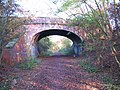 Bridge over the Hudson Way - geograph.org.uk - 1567976.jpg 640 × 480; 132 KB
-
 Disused Railway - Market Weighton. - geograph.org.uk - 136.jpg 640 × 480; 58 KB
-

-
 Footbridge on the Wolds Way path - geograph.org.uk - 1568009.jpg 480 × 640; 138 KB
-
 House near Weighton Common - geograph.org.uk - 234186.jpg 640 × 426; 130 KB
-
 Hudson Way approaching Market Weighton - geograph.org.uk - 814005.jpg 478 × 640; 341 KB
-
 Market Weighton Canal, towpath nr. River Head - geograph.org.uk - 1751693.jpg 2,304 × 1,728; 1.65 MB
-
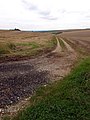
 Minor road into Goodmanham - geograph.org.uk - 1432069.jpg 640 × 480; 82 KB
-
 Minor road junction near Goodmanham - geograph.org.uk - 1432330.jpg 640 × 480; 74 KB
-
 On the Wolds Way near Market Weighton - geograph.org.uk - 1568004.jpg 640 × 480; 100 KB
-
 Red Lane Bridge, Market Weighton - geograph.org.uk - 739655.jpg 640 × 516; 153 KB
-
 The Footpath to Sancton - geograph.org.uk - 930991.jpg 480 × 640; 107 KB
-
 The Hudson Way - geograph.org.uk - 544576.jpg 640 × 480; 145 KB
-
 The Hudson Way, Market Weighton - geograph.org.uk - 739697.jpg 640 × 454; 99 KB
-
 The Kissing Gate - geograph.org.uk - 631370.jpg 640 × 638; 130 KB
-
 The track to Sancton - geograph.org.uk - 1372095.jpg 640 × 480; 66 KB
-
 The Wolds Way - geograph.org.uk - 238080.jpg 640 × 480; 100 KB
-
 The Wolds Way - geograph.org.uk - 244077.jpg 640 × 480; 87 KB
-
 The Wolds' Way at Arras - geograph.org.uk - 931003.jpg 640 × 480; 157 KB
-

-
 The Yorkshire Wolds Way - geograph.org.uk - 631380.jpg 640 × 243; 45 KB
-

-
 The Yorkshire Wolds Way, above Weighton - geograph.org.uk - 661824.jpg 640 × 480; 119 KB
-
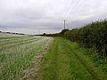
 Weighton Common footpath - geograph.org.uk - 1275363.jpg 640 × 474; 208 KB
-
 Wolds view - geograph.org.uk - 1372023.jpg 640 × 480; 47 KB
-
 Woodside, Market Weighton - geograph.org.uk - 140.jpg 640 × 480; 42 KB
-
 Yorkshire Wolds Way near Arras - geograph.org.uk - 1003988.jpg 640 × 614; 187 KB


