Category:Public footpaths in Marsden, West Yorkshire
Media in category "Public footpaths in Marsden, West Yorkshire"
The following 16 files are in this category, out of 16 total.
-
 A footpath on Warcock Hill heading towards Mount Road - geograph.org.uk - 5790311.jpg 4,000 × 3,000; 4.05 MB
-

-
 Boardwalk on the old route of the Colne Valley Circular Walk - geograph.org.uk - 3726742.jpg 1,536 × 2,048; 1.17 MB
-
 Colne Valley Circular Walk towards Meltham Road - geograph.org.uk - 5896634.jpg 1,600 × 1,087; 843 KB
-

-
 Pack Horse Road heading for Marsden - geograph.org.uk - 2738587.jpg 1,600 × 1,200; 260 KB
-
 Packhorse Track to Marsden Lane, Slaithwaite (geograph 6582974).jpg 2,000 × 1,501; 1.63 MB
-
 Path between the Standedge Tunnel air shafts on Marsden Moor - geograph.org.uk - 6276833.jpg 3,419 × 1,635; 1.21 MB
-
 Path junction on the Colne Valley Circular Walk - geograph.org.uk - 3606058.jpg 2,000 × 1,500; 1.41 MB
-

-
 Path to March Hill crossing Dan Clough, Marsden - geograph.org.uk - 5843342.jpg 2,000 × 1,500; 1.04 MB
-
 The original route of the Pennine Way - geograph.org.uk - 5573607.jpg 2,000 × 1,500; 855 KB
-
 The original route of the Pennine Way, Marsden - geograph.org.uk - 5573612.jpg 2,000 × 1,476; 810 KB
-
 The original route of the Pennine Way, Marsden - geograph.org.uk - 5573634.jpg 2,000 × 1,500; 1,022 KB
-

-
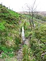
 View of the head of the Blackmoorfoot Conduit, from Scout - geograph.org.uk - 3606033.jpg 2,000 × 1,500; 1.09 MB


.jpg)


