Category:Public footpaths in Stanley, West Yorkshire
Media in category "Public footpaths in Stanley, West Yorkshire"
The following 74 files are in this category, out of 74 total.
-
 A footpath leading to Lofthouse Gate - geograph.org.uk - 2762376.jpg 800 × 600; 130 KB
-
 A footpath leading to Lofthouse Gate - geograph.org.uk - 2762382.jpg 800 × 600; 126 KB
-
 Detour off the towpath - geograph.org.uk - 1828814.jpg 640 × 480; 384 KB
-
 Fenced path, Smalley Bight farm (1) - geograph.org.uk - 2468124.jpg 768 × 1,024; 546 KB
-
 Fenced path, Smalley Bight farm (2) - geograph.org.uk - 2468138.jpg 1,024 × 768; 793 KB
-
 Fenced path, Smalley Bight farm (3) - geograph.org.uk - 2468159.jpg 768 × 1,024; 718 KB
-
 Fenced path, Smalley Bight farm (4) - geograph.org.uk - 2468174.jpg 1,024 × 768; 743 KB
-
 Fenced path, Smalley Bight farm (5) - geograph.org.uk - 2468187.jpg 768 × 1,024; 798 KB
-
 Ferryboat Fields footpath, heading south to Welbeck Lane - geograph.org.uk - 6446103.jpg 1,600 × 1,200; 678 KB
-

-
 Ferryboat Fields woodland - geograph.org.uk - 6437302.jpg 1,600 × 1,200; 784 KB
-
 Footbridge over unnamed stream - geograph.org.uk - 1832799.jpg 640 × 480; 361 KB
-
 Footpath - Aberford Road - geograph.org.uk - 4008462.jpg 480 × 640; 117 KB
-
 Footpath - Aberford Road - geograph.org.uk - 4321556.jpg 480 × 640; 96 KB
-
 Footpath - Aberford Road - geograph.org.uk - 4321559.jpg 480 × 640; 87 KB
-
 Footpath - Aberford Road - geograph.org.uk - 4321566.jpg 480 × 640; 80 KB
-
 Footpath - Aberford Road - geograph.org.uk - 4321733.jpg 480 × 640; 96 KB
-
 Footpath - Aberford Road - geograph.org.uk - 759964.jpg 555 × 640; 92 KB
-
 Footpath - Broadmeadows - geograph.org.uk - 3805320.jpg 480 × 640; 114 KB
-
 Footpath - Clifton Avenue - geograph.org.uk - 4030939.jpg 640 × 480; 92 KB
-
 Footpath - Ferry Lane - geograph.org.uk - 4008640.jpg 480 × 640; 139 KB
-
 Footpath - geograph.org.uk - 1832972.jpg 480 × 640; 370 KB
-
 Footpath - geograph.org.uk - 1832980.jpg 480 × 640; 397 KB
-
 Footpath - Lake Lock Drive - geograph.org.uk - 4321749.jpg 480 × 640; 78 KB
-
 Footpath - Lake Lock Drive - geograph.org.uk - 4321751.jpg 480 × 640; 96 KB
-
 Footpath - Lee Moor Road - geograph.org.uk - 4039366.jpg 480 × 640; 130 KB
-
 Footpath - Mount Road - geograph.org.uk - 4321807.jpg 480 × 640; 95 KB
-
 Footpath - off Aberford Road - geograph.org.uk - 4008876.jpg 480 × 640; 97 KB
-
 Footpath - viewed from Ridings Lane - geograph.org.uk - 3680178.jpg 640 × 480; 99 KB
-
 Footpath near Clark Hall - Aberford Road - geograph.org.uk - 759957.jpg 556 × 640; 104 KB
-
 Footpath off Bottom Boat Lane - geograph.org.uk - 2013431.jpg 1,024 × 768; 216 KB
-
 Footpath off Rook's Nest Road - geograph.org.uk - 5654618.jpg 1,024 × 683; 264 KB
-
 Footpath to Ash Crescent, Stanley - geograph.org.uk - 3885307.jpg 1,024 × 768; 146 KB
-
 Footpath to the river - geograph.org.uk - 2935297.jpg 1,024 × 768; 231 KB
-
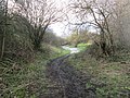
 Footpath towards Lee Moor - geograph.org.uk - 2740821.jpg 640 × 480; 130 KB
-
 Footpath, Southern Washlands - geograph.org.uk - 2797343.jpg 1,024 × 768; 857 KB
-
 Footpath, Trans Pennine Trail - geograph.org.uk - 1833034.jpg 480 × 640; 395 KB
-

-
 Gate and path off Ferry Lane - geograph.org.uk - 5660176.jpg 1,024 × 683; 435 KB
-
 Hedgehog by the path, Stanley Marsh local nature reserve - geograph.org.uk - 6423970.jpg 1,600 × 1,200; 894 KB
-
 House near Trans Pennine Trail - geograph.org.uk - 1833062.jpg 640 × 480; 320 KB
-

-
 Park Lodge Lane - geograph.org.uk - 1501058.jpg 480 × 640; 129 KB
-

-

-
 Path through a strip of woodland, off Aberford Road - geograph.org.uk - 6431660.jpg 1,824 × 2,432; 2.06 MB
-
 Perimeter path, Stanley Marsh local nature reserve - geograph.org.uk - 6423946.jpg 1,600 × 1,200; 881 KB
-
 Permissive footpath, Normanton Golf Club - geograph.org.uk - 6423985.jpg 1,483 × 1,112; 875 KB
-
 Pollution monitor detail - geograph.org.uk - 2464487.jpg 640 × 480; 319 KB
-
 Pollution monitors - geograph.org.uk - 2464481.jpg 1,024 × 768; 886 KB
-
 Public footpath - geograph.org.uk - 1837970.jpg 480 × 640; 336 KB
-
 Public Footpath - geograph.org.uk - 2358052.jpg 768 × 1,024; 836 KB
-
 Public footpath from Bottomboat to Lake Yard - geograph.org.uk - 6479854.jpg 1,600 × 1,200; 467 KB
-
 Public footpath on a former mineral line - geograph.org.uk - 6431631.jpg 1,600 × 1,200; 773 KB
-
 Section of the old tram road, TPT 67 (1) - geograph.org.uk - 2294884.jpg 480 × 640; 127 KB
-
 Section of the old tram road, TPT 67 (2) - geograph.org.uk - 2294896.jpg 480 × 640; 145 KB
-
 Section of the old tram road, TPT 67 - geograph.org.uk - 2202535.jpg 768 × 1,024; 1,013 KB
-
 Swollen River Calder (5) - geograph.org.uk - 3033365.jpg 768 × 1,024; 965 KB
-
 The Naggers Line, near Meadowcroft Road - geograph.org.uk - 6423343.jpg 1,600 × 1,199; 585 KB
-
 The Trans Pennine trail. - geograph.org.uk - 5976534.jpg 1,024 × 683; 262 KB
-
 TPT Jungle^ - geograph.org.uk - 2468217.jpg 768 × 1,024; 862 KB
-
 TPT67 signpost - geograph.org.uk - 2470546.jpg 1,024 × 768; 584 KB
-
 Track - Bottom Boat Road - geograph.org.uk - 4321573.jpg 640 × 480; 131 KB
-
 Track - Bottom Boat Road - geograph.org.uk - 4321722.jpg 640 × 480; 101 KB
-
 Track - geograph.org.uk - 1277859.jpg 480 × 640; 387 KB
-
 Track - Sheridan Street - geograph.org.uk - 3805472.jpg 640 × 480; 113 KB
-
 Track into dangerous land - geograph.org.uk - 2015390.jpg 1,024 × 768; 181 KB
-
 Track to Langley Farm - geograph.org.uk - 1877487.jpg 480 × 640; 382 KB
-
 Unsigned footpath (1) - geograph.org.uk - 2402502.jpg 768 × 1,024; 698 KB
-
 Unsigned footpath (5) - geograph.org.uk - 2402521.jpg 1,024 × 768; 660 KB
-
 Walking group - geograph.org.uk - 1832843.jpg 480 × 640; 397 KB
-
 Walking group - geograph.org.uk - 1832865.jpg 480 × 640; 334 KB
-
 Wind damage, broken branch - geograph.org.uk - 2358042.jpg 768 × 1,024; 1,008 KB
-
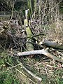 Wind damage, smashed tree - geograph.org.uk - 2358033.jpg 480 × 640; 144 KB


_-_geograph.org.uk_-_2468124.jpg)
_-_geograph.org.uk_-_2468138.jpg)
_-_geograph.org.uk_-_2468159.jpg)
_-_geograph.org.uk_-_2468174.jpg)
_-_geograph.org.uk_-_2468187.jpg)


_-_geograph.org.uk_-_2294884.jpg)
_-_geograph.org.uk_-_2294896.jpg)

_-_geograph.org.uk_-_3033365.jpg)


_-_geograph.org.uk_-_2402502.jpg)
_-_geograph.org.uk_-_2402521.jpg)


