Category:Public transport maps of Bangalore
Media in category "Public transport maps of Bangalore"
The following 10 files are in this category, out of 10 total.
-
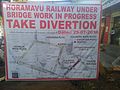 AlternateRoutes Horamavu.jpg 3,264 × 2,448; 1.3 MB
-
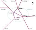 Bangalore city railway schematic.jpg 1,044 × 871; 104 KB
-
 Bangalore Railway Map.png 15,869 × 13,137; 5.49 MB
-
 Bangalore Suburban Rail map 20130928.png 989 × 697; 106 KB
-
 CRS route map - Schematic.jpg 1,152 × 714; 69 KB
-
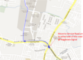 KR Puram to Manyata 1.png 863 × 627; 413 KB
-
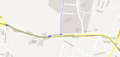 KR Puram to Manyata 2.png 1,090 × 521; 106 KB
-
 NID Bangalore Campus bus route map.png 595 × 842; 34 KB
-
 Phase 2A with WFD line (Apr 2023).jpg 15,890 × 15,361; 6.82 MB
-
 Ramamurthy Nagar Bus route- Schematic diagram.png 1,352 × 796; 172 KB


.jpg)
