Category:Public transport maps of Bielefeld
Media in category "Public transport maps of Bielefeld"
The following 10 files are in this category, out of 10 total.
-
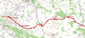
 Bahnstrecke Haller-Willelm.png 1,200 × 849; 885 KB
-
 Begatalbahn.svg 1,063 × 479; 5.22 MB
-
 Bielefeld - Stadtbahn - Baureihe M8C (7859749902).jpg 4,096 × 3,072; 2.27 MB
-
 Geografischer Netzplan.jpg 2,806 × 3,973; 1.99 MB
-
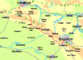 Haller Wilhelm2.png 851 × 620; 32 KB
-
 Karte Bahnhalte Bielefeld 2016.png 416 × 476; 409 KB
-
 Routenplan Bus Bahn Eisenbahn Bielefeld.svg 1,024 × 768; 578 KB
-
 Routenplan BVO und moBiel Bielefeld.svg 1,024 × 768; 554 KB
-
 Schematischer Netzplan.jpg 3,454 × 2,384; 1.4 MB
-
 Senne-Bahn.png 1,400 × 1,685; 1.48 MB


.jpg)


