Category:Public transport maps of Reims
Subcategories
This category has the following 2 subcategories, out of 2 total.
T
Media in category "Public transport maps of Reims"
The following 10 files are in this category, out of 10 total.
-
CituraReseau2011.png 3,326 × 2,566; 8.75 MB
-
CituraReseau2011.svg 4,550 × 4,900; 2.25 MB
-
CituraReseau2011Soir.png 2,166 × 2,245; 4.23 MB
-
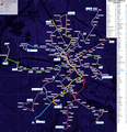
Railway map of France - Reims - animated - fr.gif 1,553 × 1,998; 9.74 MB
-
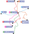
ReseauTUR nuit.png 307 × 359; 31 KB
-
ReseauTUR.gif 625 × 641; 47 KB
-
Réseau Citura 2013.png 4,612 × 3,780; 15.85 MB
-
Réseau Citura 2015-2016.png 1,120 × 1,556; 840 KB
-
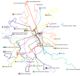
Tur2007.svg 1,300 × 1,200; 507 KB
-
Tur2010.svg 744 × 1,052; 536 KB


