Category:Public transport maps of Tychy
Media in category "Public transport maps of Tychy"
The following 14 files are in this category, out of 14 total.
-
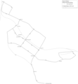
 Map of trolleybus system in Tychy.svg 1,865 × 1,654; 149 KB
-
 OBusLeitungsplanTychy2018.png 3,252 × 3,037; 480 KB
-
 OBusLeitungsplanTychy2019.png 3,252 × 3,514; 561 KB
-
 OBusNetzentwicklungTychy.png 2,439 × 2,634; 382 KB
-
 Siec trolejbusowa Tychy.svg 998 × 860; 582 KB
-
 Trolleybus line A, Tychy.svg 1,865 × 1,654; 16 KB
-
 Trolleybus line B, Tychy.svg 1,865 × 1,654; 14 KB
-
 Trolleybus line C, Tychy.svg 1,865 × 1,654; 15 KB
-
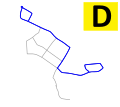 Trolleybus line D, Tychy.svg 1,865 × 1,654; 14 KB
-
 Trolleybus line E, Tychy.svg 1,865 × 1,654; 14 KB
-
 Trolleybus line F, Tychy.svg 1,865 × 1,654; 15 KB
-
 Trolleybus line G, Tychy.svg 1,865 × 1,654; 15 KB
-
 Trolleybus system in Tychy.svg 800 × 641; 700 KB
-
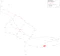
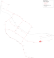
 Upper Silesia public transport system map (with stations).png 10,357 × 9,249; 41.93 MB


.png)