Category:Pubs in the London Borough of Camden
Boroughs of London: City of London · City of Westminster · Barking and Dagenham · Barnet · Bexley · Brent · Bromley · Camden · Croydon · Ealing · Enfield · Greenwich · Hackney · Hammersmith and Fulham · Haringey · Harrow · Havering · Hillingdon · Hounslow · Islington · Kensington and Chelsea · Kingston · Lambeth · Lewisham · Merton · Newham · Redbridge · Richmond · Southwark · Sutton · Tower Hamlets · Waltham Forest · Wandsworth
Wikimedia category | |||||
| Upload media | |||||
| Instance of | |||||
|---|---|---|---|---|---|
| Category combines topics | |||||
| London | |||||
capital and largest city of England and the United Kingdom     .svg)   | |||||
| Pronunciation audio | |||||
| Instance of |
| ||||
| Location |
| ||||
| Located in or next to body of water | |||||
| Official language | |||||
| Head of government |
| ||||
| Inception |
| ||||
| Significant event |
| ||||
| Highest point |
| ||||
| Population |
| ||||
| Area |
| ||||
| Elevation above sea level |
| ||||
| IATA airport code |
| ||||
| Different from | |||||
| official website | |||||
 | |||||
Subcategories
This category has the following 37 subcategories, out of 37 total.
B
C
- The Camden Eye (16 F)
D
E
- Exmouth Arms, Euston (17 F)
F
- Fitzrovia Belle (4 F)
- Freemasons' Tavern (3 F)
G
- Pubs in Gospel Oak (11 F)
H
K
P
R
- The Rugby Tavern (9 F)
S
- Pubs in St Giles, London (4 F)
T
- The Angel Inn, Highgate (5 F)
- The Jack Horner (4 F)
- Tower Tavern (4 F)
Y
- Ye Olde Swiss Cottage (11 F)
Media in category "Pubs in the London Borough of Camden"
The following 200 files are in this category, out of 350 total.
(previous page) (next page)-
 "Betsey Trotwood" public house, Clerkenwell - geograph.org.uk - 2008627.jpg 2,008 × 2,528; 645 KB
-
 "Carpenters Arms", Whitfield Street - geograph.org.uk - 5428566.jpg 1,600 × 1,578; 762 KB
-
 "Prince of Wales" public house, Highgate Village - geograph.org.uk - 5285920.jpg 1,311 × 1,600; 626 KB
-
 "The Apple Tree" public house, Mount Pleasant - geograph.org.uk - 5272289.jpg 3,002 × 4,565; 1.37 MB
-
 2 Haverstock Hill, Chalk Farm.jpg 4,159 × 3,148; 10.28 MB
-
 3one7, Finchley Road - geograph.org.uk - 528500.jpg 640 × 480; 94 KB
-
 Bar notice board, Delancey Street - geograph.org.uk - 1560702.jpg 480 × 640; 77 KB
-
-

-
 Bricklayers Arms, Gresse Street (3).jpg 3,000 × 4,000; 4.2 MB
-
 Bricklayers Arms, Gresse Street - geograph.org.uk - 398230.jpg 479 × 640; 149 KB
-
 Camden's daughter pub on the corner of Holmes Road - geograph.org.uk - 5504235.jpg 1,200 × 1,600; 459 KB
-
 Camden, The Victoria - geograph.org.uk - 1202888.jpg 640 × 480; 70 KB
-
 Capper Street - geograph.org.uk - 796129.jpg 1,566 × 2,071; 2.94 MB
-

-
 Carpenters Arms pub, Fitzrovia.JPG 4,000 × 3,000; 3.96 MB
-
 Carpenters Arms pub, Whitfield Street, London.JPG 4,000 × 3,000; 4.35 MB
-

-
 Coffee Lounge, Chalk Farm, NW1 (7285468974).jpg 3,306 × 2,223; 3.23 MB
-
 Coronet (257529638).jpg 1,066 × 1,600; 278 KB
-
 Crown and Anchor sign - geograph.org.uk - 6132358.jpg 3,373 × 4,497; 883 KB
-
 Elixir Bar, Eversholt Street, NW1 - IMG 0782.JPG 3,240 × 4,320; 3.33 MB
-

-

-
 Flickr - Duncan~ - The Garden Gate, South End Green.jpg 4,000 × 3,000; 1.97 MB
-
 Flickr - Duncan~ - The Holly Bush.jpg 2,838 × 3,315; 2.84 MB
-
 Flutes, Highgate, N6 (4803831275).jpg 3,147 × 2,098; 2.51 MB
-
 Former "Bree Louise" public house - April 2018 - geograph.org.uk - 5749773.jpg 1,024 × 1,250; 1.45 MB
-

-
 Former "Camden Stores" public house - geograph.org.uk - 4299686.jpg 590 × 549; 127 KB
-
 Former "Hope and Anchor" public house, Camden Town - geograph.org.uk - 5007078.jpg 1,600 × 1,032; 474 KB
-
 Former "Prince Albert" public house, King's Cross - geograph.org.uk - 4581230.jpg 1,215 × 1,612; 498 KB
-
 Former "The Marmelon Tower" public house - geograph.org.uk - 4962393.jpg 1,600 × 1,350; 521 KB
-
 Former Southampton House Academy, Highgate Road - geograph.org.uk - 5265447.jpg 1,600 × 1,064; 350 KB
-

-
 Friend at Hand PH - geograph.org.uk - 3566839.jpg 1,600 × 1,200; 363 KB
-
 Golden Lion - geograph.org.uk - 4028038.jpg 640 × 480; 386 KB
-
 Goodge Street, London - geograph.org.uk - 584968.jpg 640 × 521; 111 KB
-
 Grand Union pub, Camden.jpg 4,000 × 3,000; 3.9 MB
-
 Gray's Inn and the Cittie of Yorke.jpg 2,992 × 4,000; 4.61 MB
-
 Great Turnstile and Penderel's Oak.jpg 3,452 × 2,451; 2.63 MB
-
 Happy, happy times - geograph.org.uk - 1106743.jpg 480 × 640; 80 KB
-
 Highgate , "The Gatehouse" public house - geograph.org.uk - 6140245.jpg 1,600 × 1,204; 573 KB
-
 Holborn (S) Dane Street Eagle Street The Bountiful Cow (26698475504).jpg 4,608 × 3,456; 4.21 MB
-
 Holborn (S) Eagle Street The Bountiful Cow (26698478274).jpg 4,608 × 3,456; 3.54 MB
-
 Holborn (S) Eagle Street The Bountiful Cow (27235767421).jpg 4,608 × 3,456; 3.91 MB
-
 Holborn Whippet, Holborn - geograph.org.uk - 4693266.jpg 2,272 × 1,704; 801 KB
-
 Holly Bush Public House, Hampstead, London NW3 - geograph.org.uk - 1927847.jpg 3,008 × 2,000; 2.23 MB
-
 Hope and Anchor, Crowndale Road NW1 - geograph.org.uk - 2557256.jpg 640 × 482; 62 KB
-
 Hope ^ Anchor pub, Plender Street - geograph.org.uk - 1975305.jpg 640 × 494; 74 KB
-
 Hope ^ Anchor, Camden - geograph.org.uk - 4777475.jpg 2,272 × 1,704; 740 KB
-
 Information board outside The Ship - geograph.org.uk - 1651600.jpg 480 × 640; 102 KB
-

-

-

-
 London, UK - panoramio - IIya Kuzhekin (42).jpg 4,000 × 3,000; 3.2 MB
-
 Looking along Warner Street. Clerkenwell - geograph.org.uk - 5709710.jpg 1,600 × 1,200; 332 KB
-
 Lord John Russell - geograph.org.uk - 6155101.jpg 2,592 × 1,936; 2.12 MB
-
 Lord Nelson - geograph.org.uk - 4376980.jpg 3,456 × 4,608; 4.32 MB
-
 Lord Stanley pub near Camden Town - geograph.org.uk - 6033741.jpg 1,024 × 768; 173 KB
-
 Mabel's Tavern - geograph.org.uk - 2172046.jpg 640 × 458; 74 KB
-
 Mabel's Tavern - geograph.org.uk - 5316719.jpg 1,536 × 1,536; 1.14 MB
-
 Mabel's Tavern in Mabledon Place - geograph.org.uk - 779913.jpg 640 × 480; 122 KB
-
 Mabel's Tavern, Bloomsbury - geograph.org.uk - 4095791.jpg 2,616 × 3,488; 2.14 MB
-
 Mabel's Tavern, Flaxman Terrace (2).jpg 3,000 × 4,000; 4.23 MB
-
 Mabel's Tavern, Flaxman Terrace.jpg 4,000 × 3,000; 4.2 MB
-
 Mabel's Tavern, Mableton Place, St Pancras - geograph.org.uk - 4771367.jpg 1,024 × 768; 172 KB
-
 Mabels Tavern - geograph.org.uk - 1856513.jpg 1,494 × 1,411; 546 KB
-
 Marquis Cornwallis pub Coram Street, Marchmont Street.jpg 4,000 × 3,000; 4.08 MB
-
 Marquis of Granby. Covent Garden - geograph.org.uk - 1121389.jpg 640 × 480; 100 KB
-
 Mc Glynn's, Kings Cross, London - geograph.org.uk - 6219254.jpg 600 × 800; 142 KB
-
 McGlynn's free house - geograph.org.uk - 2339427.jpg 640 × 427; 111 KB
-
 McGlynn's public house - geograph.org.uk - 1868262.jpg 640 × 480; 118 KB
-
 McGlynn's public house - geograph.org.uk - 1868265.jpg 480 × 640; 121 KB
-

-
 McGlynn's, Whidborne Street, WC1 (2) - geograph.org.uk - 1219772.jpg 640 × 480; 102 KB
-
 McGlynn's, Whidborne Street, WC1 (3) - geograph.org.uk - 3634374.jpg 640 × 480; 60 KB
-
 McGlynn's, Whidborne Street, WC1 - geograph.org.uk - 1219765.jpg 640 × 480; 94 KB
-
-

-
 Museum Tavern, Bloomsbury - geograph.org.uk - 4934189.jpg 2,448 × 3,264; 1.8 MB
-
 Newman Street Tavern - Goodge Street, London.JPG 4,000 × 3,000; 3.92 MB
-
 Newman Street Tavern, Goodge Street, London.JPG 3,000 × 4,000; 4.08 MB
-
 Northumberland Arms - geograph.org.uk - 6110568.jpg 4,032 × 3,024; 3.17 MB
-
 Northumberland Arms pub 119 Tottenham Court Road.jpg 3,000 × 4,000; 4.02 MB
-
 Northumberland Arms, Kings Cross - geograph.org.uk - 4405360.jpg 2,272 × 1,704; 759 KB
-
 O' Neills Pub ^ Grill, Kings Cross - geograph.org.uk - 6219842.jpg 640 × 552; 78 KB
-
 O'neill's, Euston Road - geograph.org.uk - 977054.jpg 640 × 480; 84 KB
-
 Old Nick in Sandland Street - geograph.org.uk - 1656247.jpg 480 × 640; 75 KB
-
 Pakenham Street - geograph.org.uk - 3370656.jpg 1,024 × 768; 208 KB
-
 Prince Arthur, Euston - geograph.org.uk - 4085530.jpg 2,448 × 3,264; 4 MB
-
 Prince Arthur, Euston.jpg 3,205 × 2,595; 2.75 MB
-
 Prince of Wales Feathers, Warren Street, London.jpg 3,000 × 4,000; 4.01 MB
-
 Pub, Hatton Wall - geograph.org.uk - 5415352.jpg 640 × 426; 38 KB
-
 Public house advertising signs, Holloway - geograph.org.uk - 3892944.jpg 615 × 1,024; 716 KB
-
 Public house sign - geograph.org.uk - 4269139.jpg 768 × 1,024; 127 KB
-
 Public house sign - geograph.org.uk - 4269153.jpg 768 × 1,024; 190 KB
-
 Rear of Hawley Arms, Camden Town - geograph.org.uk - 700915.jpg 640 × 480; 129 KB
-
 Regent's Park, Queen's Head ^ Artichoke - geograph.org.uk - 4228932.jpg 1,024 × 768; 167 KB
-
 Regents Canal at Primrose Hill - geograph.org.uk - 5018733.jpg 1,198 × 1,600; 531 KB
-
 Rosie McCann's Public House, Camden - geograph.org.uk - 3370871.jpg 4,288 × 3,216; 4.36 MB
-
 Royal George Pub Euston - geograph.org.uk - 2027593.jpg 3,296 × 2,472; 1.98 MB
-
 Sculpture at the Ice Wharf Public House - geograph.org.uk - 6384370.jpg 3,632 × 5,456; 2.49 MB
-
 Sign at Dingwalls Public House, Camden Town - geograph.org.uk - 6383523.jpg 5,456 × 3,632; 2.5 MB
-
 Sign for Mc Glynn's, Kings Cross, London - geograph.org.uk - 6219256.jpg 571 × 800; 106 KB
-
-

-

-
-

-

-

-

-

-

-

-
 Sign for the Gypsy Queen public house - geograph.org.uk - 5203140.jpg 535 × 640; 101 KB
-

-

-

-
 Sign for the Lucas Arms, London - geograph.org.uk - 5488843.jpg 473 × 640; 72 KB
-

-

-

-

-

-

-
-

-

-
-
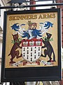
 Sign for the Skinners Arms, Kings Cross - geograph.org.uk - 6219265.jpg 608 × 800; 107 KB
-

-
 Sign for Ye Olde Swiss Cottage - geograph.org.uk - 5378975.jpg 480 × 640; 116 KB
-

-
 Sir Christopher Hatton, Leather Lane - geograph.org.uk - 4374462.jpg 960 × 1,280; 269 KB
-
 Sir Christopher Hatton, Leather Lane - geograph.org.uk - 4374474.jpg 960 × 1,280; 296 KB
-
 Skinners Arms - geograph.org.uk - 1702004.jpg 480 × 640; 88 KB
-
 Skinners Arms, Kings Cross - geograph.org.uk - 4095765.jpg 2,616 × 3,488; 2.12 MB
-
 Smoker friendly - geograph.org.uk - 485774.jpg 480 × 640; 95 KB
-

-
 Smugglers Tavern, Warren Street, London.JPG 3,000 × 4,000; 4.14 MB
-
 SpiegelMirrorCeiling.jpg 3,648 × 2,736; 3.56 MB
-
 St Martin's Tavern (49445647616).jpg 3,888 × 5,184; 3.18 MB
-
 St Pancras (Euston Rd & Somerstown) Tolmers Square Square Tavern (27513168843).jpg 4,608 × 3,456; 4.05 MB
-
 St. Pancras, Mabels Tavern - geograph.org.uk - 4228761.jpg 1,024 × 768; 149 KB
-
 Star of Kings pub - geograph.org.uk - 5087453.jpg 4,000 × 3,000; 3.53 MB
-
 Terraced buildings on Mount Pleasant, Clerkenwell - geograph.org.uk - 5709691.jpg 1,600 × 1,200; 546 KB
-
 The Abbey Tavern, Kentish Town - geograph.org.uk - 4190298.jpg 960 × 720; 91 KB
-
 The Abbey Tavern, Kentish Town Road - panoramio.jpg 2,644 × 2,122; 2.58 MB
-
 The Adelaide, on Adelaide Road - geograph.org.uk - 3741431.jpg 4,912 × 3,264; 6.41 MB
-
 The Admiral Mann pub (as was) - geograph.org.uk - 5469347.jpg 916 × 1,632; 368 KB
-
 The Admiral Mann, Hargrave Place - panoramio.jpg 2,905 × 2,910; 2.25 MB
-
 The Anchor (49445772527).jpg 3,456 × 4,608; 2.6 MB
-
 The Angel pub - geograph.org.uk - 1975109.jpg 800 × 600; 276 KB
-
 The Argyle Public House - geograph.org.uk - 6380816.jpg 5,456 × 3,632; 2.15 MB
-
 The Argyle Public House - geograph.org.uk - 6380817.jpg 1,821 × 1,854; 414 KB
-
 The Armoury, Pond Street, NW3 - geograph.org.uk - 2003680.jpg 640 × 480; 83 KB
-
 The Assembly House pub, Kentish Town - geograph.org.uk - 6023078.jpg 1,064 × 1,600; 292 KB
-

-

-
 The Blues Kitchen in Camden - geograph.org.uk - 3898713.jpg 1,500 × 999; 212 KB
-
 The Boot public house - geograph.org.uk - 1868252.jpg 640 × 480; 137 KB
-
 The Boot, Cromer Street, King's Cross - geograph.org.uk - 1621503.jpg 640 × 482; 169 KB
-
 The Brewdog Camden - geograph.org.uk - 3898708.jpg 986 × 1,500; 206 KB
-
 The Bricklayers Arms on Cresse Street - geograph.org.uk - 3112011.jpg 600 × 800; 150 KB
-
 The Bricklayers Arms on Cresse Street - geograph.org.uk - 3112014.jpg 600 × 800; 133 KB
-
 The Bricklayers Arms, Gresse Street - geograph.org.uk - 1154599.jpg 480 × 640; 86 KB
-
 The Britannia (49445768557).jpg 1,728 × 2,304; 352 KB
-
 The Bucks Head - geograph.org.uk - 1008074.jpg 480 × 640; 71 KB
-
 The Bull and Last - geograph.org.uk - 5364811.jpg 3,410 × 2,587; 1.58 MB
-
 The Bull ^ Gate on Highgate Road - geograph.org.uk - 3875450.jpg 1,200 × 798; 363 KB
-
 The Bull ^ Gate, Highgate Road - geograph.org.uk - 6023422.jpg 1,064 × 1,600; 379 KB
-
 The Bull ^ Last - geograph.org.uk - 4872869.jpg 6,000 × 4,000; 3.32 MB
-
 The Calthorpe Arms, London - geograph.org.uk - 5488835.jpg 480 × 640; 91 KB
-
 The Cambridge - geograph.org.uk - 2172992.jpg 768 × 1,024; 254 KB
-
 The Cambridge, Cambridge Circus London - geograph.org.uk - 3197450.jpg 3,240 × 4,320; 4.55 MB
-
 The Camden Assembly Pub.jpg 4,272 × 3,164; 9.67 MB
-
 The Camden Stores (49445546341).jpg 2,304 × 1,728; 422 KB
-
 The Cape of Good Hope - geograph.org.uk - 3010980.jpg 1,024 × 683; 258 KB
-
 The Carob Tree - geograph.org.uk - 5363822.jpg 3,595 × 2,242; 1.42 MB
-
 The Carpenters Arms on Whitfield Street - geograph.org.uk - 3111187.jpg 800 × 600; 185 KB
-
-
 The Carpenters, Kings Cross - geograph.org.uk - 4405371.jpg 2,272 × 1,704; 768 KB
-
 THE CIDER TAP EUSTON STATION LONDON SEP 2012 (8060653021).jpg 3,692 × 2,768; 4.57 MB
-
 The Clerk and Well, London - geograph.org.uk - 5488796.jpg 480 × 640; 114 KB
-
 The Clerk ^ Well, Clerkenwell - geograph.org.uk - 4697110.jpg 2,272 × 1,704; 1.03 MB
-
 The Coach and Horses, Clerkenwell - geograph.org.uk - 3557513.jpg 960 × 1,280; 325 KB
-
 The Coach ^ Horses, Clerkenwell - geograph.org.uk - 4697118.jpg 1,704 × 2,272; 860 KB
-
 The Cobden Arms, Camden - geograph.org.uk - 4777488.jpg 1,704 × 2,272; 705 KB
-
 The Cock Tavern, Chalton St, London - geograph.org.uk - 4106241.jpg 3,264 × 2,448; 1.91 MB
-
 The Colonel Fawcett pub, Camden.jpg 4,000 × 3,000; 4.29 MB
-
 The Constitution, St Pancras Way, London N1 - geograph.org.uk - 4956115.jpg 700 × 1,050; 581 KB
-
 The Cork and Bottle Pub near Hampstead Heath.jpg 3,871 × 2,894; 7.15 MB
-
 The Crescent, Mornington Crescent NW1 - geograph.org.uk - 1259788.jpg 640 × 423; 260 KB
-
 The Crown and Goose public house - geograph.org.uk - 3642922.jpg 3,456 × 4,608; 6.85 MB
-
 The Crown pub, New Oxford Street.jpg 3,000 × 4,000; 4.01 MB
-
 The Crown sign - geograph.org.uk - 6132586.jpg 2,883 × 3,843; 644 KB
-
 The Crown, New Oxford Street, WC1 - geograph.org.uk - 1293987.jpg 480 × 640; 78 KB
-
 The Dartmouth Arms, York Rise, NW5 - geograph.org.uk - 1446924.jpg 640 × 484; 66 KB


.jpg)


.jpg)
.jpg)


.jpg)


_Dane_Street_Eagle_Street_The_Bountiful_Cow_(26698475504).jpg)
_Eagle_Street_The_Bountiful_Cow_(26698478274).jpg)
_Eagle_Street_The_Bountiful_Cow_(27235767421).jpg)


.jpg)


.jpg)


_-_geograph.org.uk_-_1219772.jpg)
_-_geograph.org.uk_-_3634374.jpg)


.jpg)
_Tolmers_Square_Square_Tavern_(27513168843).jpg)


_-_geograph.org.uk_-_5469347.jpg)

.jpg)


_-_geograph.org.uk_-_1930168.jpg)


.jpg)


.jpg)


.jpg)


