Category:Puits de la Touche-Berthelot
| Object location | | View all coordinates using: OpenStreetMap |
|---|
|
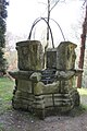
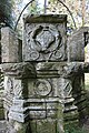
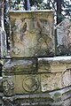
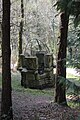
This building is inscrit au titre des monuments historiques de la France. It is indexed in the base Mérimée, a database of architectural heritage maintained by the French Ministry of Culture, under the reference PA00091544
|
| Object location | | View all coordinates using: OpenStreetMap |
|---|
 | |||||
| Upload media | |||||
| Instance of | |||||
|---|---|---|---|---|---|
| Location | Plumelec, canton of Saint-Jean-Brévelay | ||||
| Street address |
| ||||
| Heritage designation |
| ||||
 | |||||
Media in category "Puits de la Touche-Berthelot"
The following 8 files are in this category, out of 8 total.
-
 126 Puits Callac Plumelec.jpg 2,304 × 3,072; 4.77 MB
-
 Callac StJosephFontaineXVI° 3844.JPG 4,752 × 3,168; 7.39 MB
-
 Callac StJosephFontaineXVI° 3846.JPG 800 × 1,200; 713 KB
-
 W0091-CallacStJosephFontaineXVI° 3845.JPG 3,168 × 4,752; 6.47 MB
-
 W0092-CallacStJosephFontaineXVI° 3847.JPG 3,168 × 4,752; 6.66 MB
-
 W0093-CallacStJosephFontaineXVI° 3848.JPG 3,168 × 4,752; 5.26 MB
-
 W0094-CallacStJosephFontaineXVI° 3849.JPG 3,168 × 4,752; 5.62 MB
-
 W0095-CallacStJosephFontaineXVI° 3878.JPG 3,168 × 4,752; 6.6 MB


