Category:Punta Straldi
|
Punta Straldi has an entry on OpenStreetMap (show). |
Mountain of the Ligurian Alps  | |||||
| Upload media | |||||
| Instance of | |||||
|---|---|---|---|---|---|
| Location |
| ||||
| Mountain range | |||||
| Topographic prominence |
| ||||
| Topographic isolation |
| ||||
| Elevation above sea level |
| ||||
 | |||||
Media in category "Punta Straldi"
The following 9 files are in this category, out of 9 total.
-
 Bric dell'Omo.png 5,095 × 3,417; 23.22 MB
-
 Colla Piana di Malaberga e Punta Straldi.png 3,547 × 2,539; 14.71 MB
-
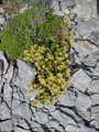
 Leontopodium alpinum Punta Straldi.png 3,000 × 4,000; 22.9 MB
-
 Punta Straldi cavità naturale presso la sommità.png 3,000 × 4,000; 19.67 MB
-
 Punta Straldi cippo di confine.png 3,168 × 2,108; 11.02 MB
-
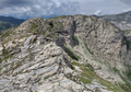
 Punta Straldi da pendici Testa Ciaudon.png 3,309 × 2,092; 8.21 MB
-
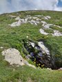
 Punta Straldi lo scosceso versante padano.png 3,590 × 2,516; 16.37 MB
-
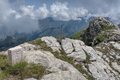
 Punta Straldi zona sommitale sfondo Marguareis.png 3,851 × 2,277; 14.53 MB
-
 Saxifraga exarata Punta Straldi.png 3,000 × 4,000; 20.81 MB


