Category:Quarries in Lincolnshire
Subcategories
This category has the following 6 subcategories, out of 6 total.
Media in category "Quarries in Lincolnshire"
The following 52 files are in this category, out of 52 total.
-
 'Pots and Pans', Grimsthorpe Park - geograph.org.uk - 289645.jpg 640 × 480; 70 KB
-
 Ancaster Stone Quarry - geograph.org.uk - 130274.jpg 640 × 427; 90 KB
-
 Full Again - geograph.org.uk - 10561.jpg 640 × 480; 60 KB
-
 Chalk Pit - geograph.org.uk - 179624.jpg 640 × 427; 76 KB
-
 Chalk quarry - geograph.org.uk - 390247.jpg 640 × 480; 146 KB
-

-
 Conveyor system, Baston Pits - geograph.org.uk - 1373371.jpg 640 × 480; 102 KB
-
 Creeton Quarry from Counthorpe Lane.jpg 4,000 × 3,000; 2.72 MB
-
 Disused Chalk Pit - geograph.org.uk - 302945.jpg 640 × 482; 105 KB
-
 Disused Chalk Quarry - geograph.org.uk - 289467.jpg 640 × 396; 118 KB
-

-
 Disused Quarry near Manton - geograph.org.uk - 138427.jpg 640 × 480; 123 KB
-
 Grasby Quarry - geograph.org.uk - 1566578.jpg 640 × 426; 73 KB
-
-
 Greetwell quarry - geograph.org.uk - 1061624.jpg 640 × 427; 62 KB
-
 Greetwell quarry - geograph.org.uk - 1061641.jpg 640 × 427; 81 KB
-
 Greetwell quarry - geograph.org.uk - 1061645.jpg 640 × 427; 81 KB
-
 Greetwell Quarry - geograph.org.uk - 605830.jpg 640 × 426; 91 KB
-
 Mineral extraction - geograph.org.uk - 773348.jpg 640 × 427; 55 KB
-
 Quarry beside A180 - geograph.org.uk - 373798.jpg 640 × 423; 62 KB
-
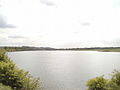
 Quarry Pond - geograph.org.uk - 293561.jpg 640 × 480; 103 KB
-
 Quarry workings, Morkery woods - geograph.org.uk - 269765.jpg 640 × 480; 176 KB
-
 Raking mown hay - geograph.org.uk - 868682.jpg 640 × 428; 124 KB
-
 Ravendale chalk quarry - geograph.org.uk - 1231916.jpg 640 × 427; 112 KB
-
 Ravendale Quarry - geograph.org.uk - 450825.jpg 640 × 427; 84 KB
-
 Hole in the Ground - geograph.org.uk - 159360.jpg 640 × 480; 105 KB
-
 Small limestone pit near Irnham - geograph.org.uk - 328287.jpg 640 × 427; 69 KB
-
 Old Quarry - geograph.org.uk - 158343.jpg 640 × 480; 143 KB
-
 The Disused Quarry - geograph.org.uk - 50343.jpg 640 × 427; 112 KB
-
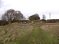
 Entrance to the Disused Quarry - geograph.org.uk - 1432509.jpg 640 × 421; 90 KB
-

-
 Very deep quarry - geograph.org.uk - 1049004.jpg 640 × 480; 89 KB
-
 Abandoned Chalk Quarry - geograph.org.uk - 245951.jpg 640 × 427; 108 KB
-
 Buried for the Future - geograph.org.uk - 10286.jpg 640 × 480; 47 KB
-
 Chalk Exposure and Cow - geograph.org.uk - 192163.jpg 640 × 480; 192 KB
-
 Disused Quarry - geograph.org.uk - 200924.jpg 640 × 426; 187 KB
-
 Fetch^ - geograph.org.uk - 10478.jpg 640 × 480; 107 KB
-
 Flooded Quarry - geograph.org.uk - 184075.jpg 640 × 480; 98 KB
-
 Gravel Quarry - geograph.org.uk - 595412.jpg 640 × 480; 61 KB
-
 Limestone quarry, near Buckminster - geograph.org.uk - 38271.jpg 640 × 480; 146 KB
-
 Mansgate Chalk Quarry - geograph.org.uk - 149920.jpg 640 × 480; 114 KB
-
 Old sand pits behind Warren Cottage - geograph.org.uk - 176230.jpg 640 × 480; 73 KB
-
 On Sudbrook Moor - geograph.org.uk - 269476.jpg 640 × 427; 90 KB
-
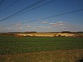
 Quarry debitage in a field near Dyke - geograph.org.uk - 116337.jpg 640 × 480; 129 KB
-
 Quarry on Scopwick Heath - geograph.org.uk - 166794.jpg 640 × 427; 53 KB
-
 Red Barn Quarry - geograph.org.uk - 121724.jpg 640 × 480; 65 KB
-
 South Witham Quarry - geograph.org.uk - 196031.jpg 640 × 480; 76 KB
-
 Stone Quarry - geograph.org.uk - 182162.jpg 640 × 480; 102 KB
-
 Swallow Vale Quarry, Lincs - geograph.org.uk - 543162.jpg 640 × 480; 124 KB
-
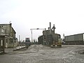
 Waste facilities - geograph.org.uk - 430102.jpg 640 × 477; 86 KB
-
 Weighbridge - geograph.org.uk - 179623.jpg 640 × 427; 76 KB
-
 Whisby Quarry from Jobs Lane - geograph.org.uk - 183602.jpg 640 × 427; 53 KB


