Category:Quarter Bach
Cymraeg: Cymuned yn Sir Gaerfyrddin yw Cwarter Bach, weithiai Chwarter Bach (Saesneg: Quarter Bach). Saif y gymuned ger ffîn ddwyreiniol Sir Gaerfyrddin, ar lethrau deheuol y Mynydd Du.
community in Carmarthenshire  | |||||
| Upload media | |||||
| Instance of | |||||
|---|---|---|---|---|---|
| Location | Carmarthenshire, Wales | ||||
| Population |
| ||||
| Area |
| ||||
 | |||||
Subcategories
This category has the following 3 subcategories, out of 3 total.
Media in category "Quarter Bach"
The following 200 files are in this category, out of 285 total.
(previous page) (next page)-
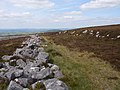
 A unknown cottage above the Afon Twrch - geograph.org.uk - 963224.jpg 640 × 480; 159 KB
-

-
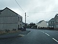
 A4068 at Rhosaman village boundary - geograph.org.uk - 3282030.jpg 640 × 480; 50 KB
-

-
 A4068 Cwmgarw Road looking west - geograph.org.uk - 3283472.jpg 640 × 480; 63 KB
-
 A4068 New Road - geograph.org.uk - 3282027.jpg 640 × 480; 54 KB
-
 A4069 above Tro'r Derlwyn - geograph.org.uk - 4672982.jpg 640 × 480; 41 KB
-
 A4069 at Brynamman village boundary - geograph.org.uk - 4672987.jpg 640 × 481; 52 KB
-
 A4069 descending north of Brynamman - geograph.org.uk - 4672973.jpg 640 × 480; 45 KB
-
 A4069 descends near Nant Gaws - geograph.org.uk - 4672952.jpg 640 × 481; 45 KB
-
 A4069 Looking North - geograph.org.uk - 6515834.jpg 1,024 × 614; 69 KB
-
 A4069 Looking South - geograph.org.uk - 6515837.jpg 1,021 × 1,024; 122 KB
-
 A4069 near Craig Derlwyn - geograph.org.uk - 4672979.jpg 640 × 480; 47 KB
-
 A4069 Station Road - geograph.org.uk - 3283480.jpg 640 × 481; 62 KB
-
 A4069 towards Brynaman - geograph.org.uk - 6459745.jpg 1,536 × 2,048; 872 KB
-
 Abandoned Coal Pit at Ynys Dawela Park - geograph.org.uk - 2774871.jpg 1,280 × 960; 405 KB
-
 Abandoned silica sand workings - geograph.org.uk - 3293936.jpg 1,024 × 768; 206 KB
-

-
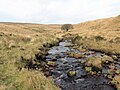
 Afon Aman Fach - geograph.org.uk - 6418965.jpg 1,024 × 767; 201 KB
-
 Afon Aman Fach - geograph.org.uk - 6418969.jpg 1,024 × 768; 237 KB
-
 Afon Aman Fach - geograph.org.uk - 6418972.jpg 1,024 × 768; 252 KB
-
 Afon Aman Fawr - geograph.org.uk - 6418982.jpg 1,024 × 768; 217 KB
-
 Afon Aman Fawr - geograph.org.uk - 6418988.jpg 1,024 × 768; 257 KB
-
 Afon Aman Fawr - geograph.org.uk - 6418991.jpg 1,024 × 768; 229 KB
-
 Afon Twrch - geograph.org.uk - 6445296.jpg 1,536 × 2,048; 1.64 MB
-
 Afon Twrch - geograph.org.uk - 6445432.jpg 2,048 × 1,536; 1.78 MB
-
 Afon Twrch ^ Bryn-hennlys Bridge - geograph.org.uk - 3543576.jpg 640 × 480; 133 KB
-
 Afon Twrch, Upper Cwmtwrch - geograph.org.uk - 3202770.jpg 640 × 480; 136 KB
-

-

-
 Ar lethrau Foel Deg - On the slopes of Foel Deg - geograph.org.uk - 6418960.jpg 1,024 × 768; 200 KB
-

-

-

-
 Armco and Potholes - geograph.org.uk - 478664.jpg 640 × 464; 74 KB
-
 Black Mountain Pass A4069 - geograph.org.uk - 5591261.jpg 4,048 × 2,029; 2.57 MB
-
 Blaenllynfell - geograph.org.uk - 4221361.jpg 640 × 480; 68 KB
-
 Blue sheep - geograph.org.uk - 6705076.jpg 2,048 × 1,536; 1.17 MB
-
 Boundary wall - geograph.org.uk - 6445402.jpg 2,048 × 1,536; 1.69 MB
-
 Bridge over the Twrch, Ystradowen - geograph.org.uk - 96884.jpg 640 × 480; 116 KB
-
 Bryn-hennlys Bridge - geograph.org.uk - 3543579.jpg 640 × 480; 103 KB
-
 Brynamman Public Hall and Institute - geograph.org.uk - 3270843.jpg 1,600 × 1,200; 343 KB
-
 Cae Newydd - geograph.org.uk - 6418925.jpg 1,024 × 768; 352 KB
-
 Cairn above Cwm Twrch - geograph.org.uk - 6445427.jpg 1,536 × 2,048; 1.47 MB
-
 Cairn on Eastern Slope of Foel De - geograph.org.uk - 6739934.jpg 1,600 × 900; 769 KB
-
 Carn Fadog - geograph.org.uk - 4172045.jpg 640 × 480; 83 KB
-
 Carn Foel Deg - Foel Deg Cairn - geograph.org.uk - 6418962.jpg 1,024 × 768; 231 KB
-
 Carn Pen-y-clogau - geograph.org.uk - 3523247.jpg 960 × 720; 125 KB
-
 Carn Pen-y-clogau - geograph.org.uk - 4165309.jpg 4,320 × 3,240; 4.06 MB
-
 Carn Pen-y-clogau - geograph.org.uk - 4165320.jpg 4,320 × 2,160; 1.93 MB
-
 Carn Pen-y-Clogau - geograph.org.uk - 6739480.jpg 1,600 × 900; 730 KB
-
 Carreg Siglo (Carreg Dis Mân) - Rocking stone - geograph.org.uk - 6534847.jpg 1,024 × 768; 231 KB
-
 Carreg Siglo (Carreg Dis Mân) - Rocking stone - geograph.org.uk - 6534849.jpg 1,024 × 768; 218 KB
-
 Cattle grid - geograph.org.uk - 6705105.jpg 2,048 × 1,536; 1.02 MB
-
 Cefnbrynbrain Cycle Path - geograph.org.uk - 3533715.jpg 960 × 720; 137 KB
-

-
 Colfen unig - Solitary tree - geograph.org.uk - 6415849.jpg 1,024 × 768; 191 KB
-
 Confluence of River Amman and Nant Garw - geograph.org.uk - 4300062.jpg 1,200 × 900; 274 KB
-
 Contrasting vegetation - geograph.org.uk - 6445889.jpg 2,048 × 1,536; 1.42 MB
-
 Cottage at Derlwyn Isaf - geograph.org.uk - 963235.jpg 640 × 480; 150 KB
-
 Cotton grass and peat - geograph.org.uk - 6461346.jpg 1,242 × 1,656; 1.1 MB
-
 Cwar Foel Fraith - Foel Fraith Quarry - geograph.org.uk - 6534875.jpg 1,024 × 768; 268 KB
-
 Cwar Foel Fraith - Foel Fraith Quarry - geograph.org.uk - 6534881.jpg 1,024 × 768; 244 KB
-
 Cwm Nant Melyn - geograph.org.uk - 6459739.jpg 2,048 × 1,536; 886 KB
-
 Cwm Pedol - geograph.org.uk - 3537383.jpg 640 × 480; 50 KB
-
 Cwm Pedol - geograph.org.uk - 4171431.jpg 640 × 480; 76 KB
-
 Cwm Twrch - geograph.org.uk - 6445186.jpg 1,536 × 2,048; 1.75 MB
-
 Cwm Twrch chimney - geograph.org.uk - 6445392.jpg 1,536 × 2,048; 1.17 MB
-
 Cwmgarw Road and church - geograph.org.uk - 3283477.jpg 640 × 479; 58 KB
-
 Cycle track 437 - geograph.org.uk - 6705026.jpg 1,536 × 2,048; 1.65 MB
-
 Cycle track at Rhosaman - geograph.org.uk - 6705029.jpg 1,536 × 2,048; 1.37 MB
-
 Cyclepath bridge over River Amman - geograph.org.uk - 5562049.jpg 1,200 × 900; 242 KB
-
 Cyffordd o lwybrau - A junction of paths - geograph.org.uk - 6534605.jpg 1,024 × 768; 221 KB
-
 Cyllie farmhouse - geograph.org.uk - 6445440.jpg 2,048 × 1,536; 1.21 MB
-
 Derlwyn Isaf - geograph.org.uk - 6445420.jpg 4,032 × 1,763; 2.09 MB
-
 Dewey bagging - geograph.org.uk - 2638239.jpg 640 × 480; 83 KB
-
 Disused chimney - geograph.org.uk - 3708123.jpg 600 × 800; 124 KB
-
 Disused quarries below Garreg Fraith - geograph.org.uk - 1125848.jpg 640 × 480; 116 KB
-

-

-
 Dramffordd Foel Fraith - Foel Fraith tramway - geograph.org.uk - 6464264.jpg 1,024 × 768; 217 KB
-
 Dude, Where's my car ^ - geograph.org.uk - 2201029.jpg 1,024 × 768; 172 KB
-
 Enclosure on Foel Deg ar Bedol - geograph.org.uk - 6739912.jpg 1,600 × 900; 739 KB
-
 Farm gate - geograph.org.uk - 6445182.jpg 4,032 × 3,024; 4.74 MB
-
 Farm track - geograph.org.uk - 6445179.jpg 2,048 × 1,536; 1.04 MB
-
 Farmers gate and kissing gate - geograph.org.uk - 2259140.jpg 640 × 430; 417 KB
-
 Fence line - geograph.org.uk - 6444468.jpg 1,536 × 2,048; 1.57 MB
-
 Ffarm y Bryn Farm - geograph.org.uk - 3821760.jpg 690 × 518; 217 KB
-
 Ffordd fynedfa Ddolgam - Ddolgam access road - geograph.org.uk - 6534644.jpg 1,024 × 768; 194 KB
-
 Ffrydiau Twrch - geograph.org.uk - 1473866.jpg 480 × 640; 135 KB
-
 Ffrydiau Twrch Chimney (Remains) - geograph.org.uk - 3751703.jpg 640 × 480; 127 KB
-
 Flooded quarry on Black Mountain - geograph.org.uk - 346344.jpg 640 × 480; 64 KB
-
 Footprints in peat - geograph.org.uk - 6461351.jpg 1,536 × 2,048; 2.13 MB
-
 Ford of the Aman - geograph.org.uk - 1125883.jpg 640 × 480; 102 KB
-
 Fragments of millstone grit - geograph.org.uk - 6461905.jpg 1,536 × 2,048; 1,001 KB
-
 G ^ L L Rhys - Welding Repairs - geograph.org.uk - 5775719.jpg 2,448 × 3,264; 2.48 MB
-
 Garreg Llwyd - geograph.org.uk - 2121585.jpg 2,288 × 1,712; 825 KB
-
 Garreg Lwyd (Moel Gornach) - geograph.org.uk - 3298092.jpg 1,600 × 1,200; 716 KB
-
 Garreg Lwyd - geograph.org.uk - 2942998.jpg 1,024 × 680; 227 KB
-
 Garreg Lwyd - geograph.org.uk - 2943314.jpg 1,024 × 680; 187 KB
-

-
 Gelliau Farm on the Afon Twrch - geograph.org.uk - 963216.jpg 640 × 480; 124 KB
-
 Gibea Chapel overflow cemetery - geograph.org.uk - 2257238.jpg 640 × 430; 234 KB
-
 Glimpse of opencast - geograph.org.uk - 6705109.jpg 3,024 × 4,032; 1.97 MB
-
 Golden moorland of Blaenpedol - geograph.org.uk - 1126292.jpg 640 × 480; 136 KB
-
 Gorse flower - geograph.org.uk - 6445438.jpg 1,536 × 2,048; 420 KB
-
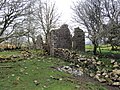
 Gweddillion ty hir - Remains of a long house - geograph.org.uk - 6534833.jpg 1,024 × 768; 265 KB
-
 Gweddillion ty hir - Remains of a long house - geograph.org.uk - 6534837.jpg 1,024 × 768; 260 KB
-
 Heather stems, roots and peat - geograph.org.uk - 6462043.jpg 1,536 × 2,048; 1.44 MB
-
 Hen ddramffordd - Old tramway - geograph.org.uk - 6534853.jpg 1,024 × 767; 280 KB
-
 Hen ddramffordd - Old tramway - geograph.org.uk - 6534857.jpg 1,024 × 768; 234 KB
-
 Hen ddramffordd - Old tramway - geograph.org.uk - 6534865.jpg 1,024 × 768; 273 KB
-
 Hen heol Brynaman old road - geograph.org.uk - 4171338.jpg 640 × 480; 88 KB
-
 Hen heol Mynydd Du old road - geograph.org.uk - 4171365.jpg 640 × 480; 90 KB
-
-

-
 Hen lociau defaid - Old sheepfolds - geograph.org.uk - 6418939.jpg 1,024 × 768; 201 KB
-
 Henllys Vale Kiln - geograph.org.uk - 4566356.jpg 1,200 × 1,600; 347 KB
-
 Henllys Vale Kilns - geograph.org.uk - 4566351.jpg 1,200 × 1,600; 379 KB
-
 Henllys Vale Tramroad Incline - geograph.org.uk - 4566372.jpg 1,200 × 1,600; 402 KB
-
 Legacy of the ice age - geograph.org.uk - 1125897.jpg 480 × 640; 124 KB
-
 Lichen on quartz - geograph.org.uk - 6444463.jpg 1,536 × 2,048; 1.29 MB
-
 Lichen on quartz - geograph.org.uk - 6445205.jpg 2,048 × 1,536; 836 KB
-
 Lichen on quartz - geograph.org.uk - 6445423.jpg 1,299 × 1,732; 928 KB
-
 Lime kilns - geograph.org.uk - 6445400.jpg 2,048 × 1,536; 1.52 MB
-
 Limestone crag - geograph.org.uk - 6445393.jpg 2,048 × 1,536; 1.77 MB
-
 Limestone outcrops on Garreg Lwyd - geograph.org.uk - 2948195.jpg 1,024 × 680; 287 KB
-
 Limestone wall - geograph.org.uk - 6445406.jpg 2,048 × 1,536; 1.56 MB
-
 Livestock pens - geograph.org.uk - 6445877.jpg 2,048 × 1,536; 1.73 MB
-
 Llangadock 11 Mile Stone - geograph.org.uk - 3524071.jpg 480 × 640; 82 KB
-

-
 Llethrau Foel Fraith - Slopes of Foel Fraith - geograph.org.uk - 6534925.jpg 1,024 × 768; 254 KB
-
 Llethrau Foel Fraith - Slopes of Foel Fraith - geograph.org.uk - 6534954.jpg 1,024 × 768; 274 KB
-

-

-
 Llwybr Amman View Path, Brynaman - geograph.org.uk - 3418313.jpg 690 × 518; 275 KB
-
 Llwybr Bryn - Bryn path - geograph.org.uk - 4167231.jpg 640 × 426; 77 KB
-
 Llwybr Cwm Aman Footpath - geograph.org.uk - 2188249.jpg 690 × 518; 140 KB
-
 Llwybr Ddolgam - Ddolgam path - geograph.org.uk - 6534598.jpg 1,024 × 768; 259 KB
-

-
 Llwybr i'r A4068 - Path to the A4068 - geograph.org.uk - 6418906.jpg 1,024 × 768; 193 KB
-
 Llwybr Rhosaman - Rhosaman Path - geograph.org.uk - 6415902.jpg 1,024 × 768; 231 KB
-
 Llwybr Seiclo Cefnbrynbrain Cycle Track - geograph.org.uk - 3414595.jpg 690 × 518; 173 KB
-
 Llwybr Ty'r Cwm Footpath, Brynaman - geograph.org.uk - 3418347.jpg 690 × 518; 265 KB
-

-

-
 Llwybr uwchben Nant Garw - Path above Nant Garw - geograph.org.uk - 6415827.jpg 1,024 × 768; 198 KB
-
 Llwybr y Bryn Footpath - geograph.org.uk - 4167229.jpg 640 × 480; 89 KB
-
 Llwybr yn gadael heol - Path exits a road - geograph.org.uk - 6539886.jpg 1,024 × 768; 226 KB
-
 Llwybr yn Rhosaman - Path in Rhosaman - geograph.org.uk - 6418900.jpg 1,024 × 768; 324 KB
-
 Llwybr Ynys Dawela Footpath - geograph.org.uk - 2188331.jpg 690 × 518; 260 KB
-
 Llwybr Ystradowen Path - geograph.org.uk - 4172903.jpg 640 × 480; 128 KB
-
 Llwyn y Moch - geograph.org.uk - 6705104.jpg 2,048 × 1,536; 932 KB
-

-
 Looking east along the Beacons Way - geograph.org.uk - 4161281.jpg 4,320 × 3,240; 2.27 MB
-
 Mangled remains of a footbridge - geograph.org.uk - 865372.jpg 640 × 480; 86 KB
-
 Mannequins - geograph.org.uk - 5775731.jpg 3,264 × 2,448; 2.28 MB
-
 Mineworking Pool - geograph.org.uk - 5775707.jpg 3,264 × 2,448; 3.51 MB
-
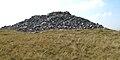
 Miniature cairn - geograph.org.uk - 6445338.jpg 3,370 × 2,528; 3.02 MB
-
 Moorland above Cwm Twrch - geograph.org.uk - 6445408.jpg 2,048 × 1,536; 1.8 MB
-
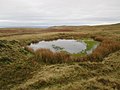
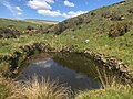
 Mountain Pool - geograph.org.uk - 55555.jpg 640 × 480; 165 KB
-
 Mountain Road, Upper Brynamman - geograph.org.uk - 4576777.jpg 800 × 572; 95 KB
-
 Mynediad i'r mynydd - Access to the mountain - geograph.org.uk - 6418898.jpg 1,024 × 768; 182 KB
-
 Mynediad i'r mynydd - Access to the mountain - geograph.org.uk - 6418917.jpg 1,024 × 768; 221 KB
-
 Nant Fydd - geograph.org.uk - 5775702.jpg 2,321 × 3,095; 2.62 MB
-
 Nant Fydd - geograph.org.uk - 6418963.jpg 1,024 × 768; 213 KB
-
 Nant Garw - geograph.org.uk - 5536371.jpg 3,264 × 2,448; 2.21 MB
-
 Nant Garw - geograph.org.uk - 6415844.jpg 1,024 × 768; 217 KB
-
 Nant Garw - geograph.org.uk - 6415870.jpg 1,024 × 768; 272 KB
-
 Nant Garw - geograph.org.uk - 6459726.jpg 2,048 × 1,536; 1.27 MB
-
 Nant Garw Valley - geograph.org.uk - 2345885.jpg 2,880 × 1,913; 3.44 MB
-
 Nant Garw Valley - geograph.org.uk - 2345892.jpg 2,880 × 1,913; 3.94 MB
-
 Nant Melyn (Yellow Brook) - geograph.org.uk - 2258262.jpg 640 × 430; 360 KB
-
 Nant Melyn (Yellow Brook) - geograph.org.uk - 2258301.jpg 640 × 430; 319 KB
-
 Narrow track - geograph.org.uk - 6445430.jpg 2,048 × 1,536; 1.28 MB
-
 New foot and cycle bridge - geograph.org.uk - 5405084.jpg 4,608 × 3,072; 3.01 MB
-
 New footbridge at Brynamman - geograph.org.uk - 4298865.jpg 1,200 × 800; 220 KB
-
 New footbridge over the Nant Melyn - geograph.org.uk - 1125847.jpg 640 × 480; 137 KB
-
 Not just a Brick - geograph.org.uk - 963272.jpg 640 × 480; 161 KB
-
 Old footbridge over River Amman - geograph.org.uk - 4300023.jpg 1,120 × 840; 227 KB
-

-
 Old quarry workings on Foel Fraith - geograph.org.uk - 2946335.jpg 680 × 1,024; 205 KB
-
 Old Roman Road - geograph.org.uk - 1716394.jpg 4,000 × 2,250; 2.35 MB
-
 Old School Building, Ystradowen - geograph.org.uk - 3543587.jpg 640 × 480; 64 KB
-
 On the slopes of Garreg Lwyd - geograph.org.uk - 2948218.jpg 1,024 × 680; 252 KB
-
 Ordnance Survey Cut Mark - geograph.org.uk - 3524063.jpg 640 × 480; 122 KB
-
 Ordnance Survey Cut Mark - geograph.org.uk - 3539729.jpg 640 × 480; 93 KB
-
 Ordnance Survey Cut Mark - geograph.org.uk - 3539731.jpg 640 × 480; 109 KB
-
 Ordnance Survey Cut Mark - geograph.org.uk - 3543550.jpg 640 × 480; 147 KB
-
 Ordnance Survey Cut Mark - geograph.org.uk - 3543554.jpg 640 × 480; 109 KB
-
 Ordnance Survey Cut Mark - geograph.org.uk - 3543582.jpg 640 × 480; 101 KB
-
 Ordnance Survey Cut Mark - geograph.org.uk - 3625567.jpg 480 × 640; 104 KB
-
 Ordnance Survey Cut Mark - geograph.org.uk - 6512414.jpg 1,024 × 669; 317 KB
-
 Ordnance Survey Cut Mark - geograph.org.uk - 6515782.jpg 1,024 × 600; 249 KB
-
 Ordnance Survey Flush bracket - geograph.org.uk - 3522323.jpg 480 × 640; 104 KB
-
 Ordnance Survey OSBM Bolt - geograph.org.uk - 6512406.jpg 1,024 × 669; 216 KB
-
 Ordnance Survey Pivot - geograph.org.uk - 6515776.jpg 1,024 × 796; 428 KB
-
 Ordnance Survey Rivet - geograph.org.uk - 3524031.jpg 480 × 640; 121 KB
-
 Ordnance Survey Rivet - geograph.org.uk - 3524050.jpg 480 × 640; 95 KB
-
 Ordnance Survey Rivet - geograph.org.uk - 3524078.jpg 640 × 480; 126 KB


_-_Rocking_stone_-_geograph.org.uk_-_6534847.jpg)
_-_Rocking_stone_-_geograph.org.uk_-_6534849.jpg)


_-_geograph.org.uk_-_3751703.jpg)


_-_geograph.org.uk_-_3298092.jpg)


_-_geograph.org.uk_-_2258262.jpg)
_-_geograph.org.uk_-_2258301.jpg)


