Category:Queens County, Prince Edward Island
county in Prince Edward Island, Canada  | |||||
| Upload media | |||||
| Instance of | |||||
|---|---|---|---|---|---|
| Location | Prince Edward Island, Canada | ||||
| Area |
| ||||
 | |||||
Subcategories
This category has the following 24 subcategories, out of 24 total.
A
- Argyle Shore Provincial Park (9 F)
B
- Bellevue Cove (4 F)
- Bonshaw Provincial Park (10 F)
- Breadalbane Nature Trail (3 F)
- Bubbling Springs Trail (4 F)
C
- Cavendish Beach (48 F)
- Covehead Bay (3 F)
D
- Dalvay Lake (6 F)
F
- Farmlands Trail (7 F)
G
- Gairloch Road Trail (2 F)
H
N
- New London Bay (11 F)
P
R
- Ross Lane Beach (3 F)
- Rustico Bay (5 F)
S
T
- Tracadie Harbour (3 F)
W
- Winter River Trail (4 F)
- Wood Islands Harbour (13 F)
Media in category "Queens County, Prince Edward Island"
The following 68 files are in this category, out of 68 total.
-
 Abandoned Train Station, PEI (5785352).jpg 600 × 400; 73 KB
-
 After the Blizzard - panoramio.jpg 3,819 × 2,542; 7.38 MB
-
 Bellevue Cove, Kinlock Rd, Kinlock - panoramio (1).jpg 2,048 × 1,151; 675 KB
-
 Bellevue Cove, Kinlock Rd, Kinlock - panoramio (2).jpg 2,048 × 1,152; 905 KB
-
 Bellevue Cove, Kinlock Rd, Kinlock - panoramio (3).jpg 2,048 × 1,151; 768 KB
-
 Bellevue Cove, Kinlock Rd, Kinlock - panoramio.jpg 2,048 × 1,151; 787 KB
-
 Blooming Point, PEI (48004326506).jpg 1,800 × 1,200; 332 KB
-
 Blooming Point, PEI (48146774071).jpg 1,800 × 1,200; 283 KB
-
 Blooming Point, PEI (48146860632).jpg 1,800 × 1,200; 297 KB
-
 Blooming Point, PEI (49189616883).jpg 4,000 × 3,000; 2.45 MB
-
 Blueberry fields near Wood Islands, PEI (28812460913).jpg 4,608 × 3,456; 3.57 MB
-
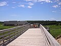 Boardwalk.JPG 2,288 × 1,712; 778 KB
-
 Brush Whaf Rd, Orwell Cove - panoramio.jpg 2,048 × 1,152; 698 KB
-
 Cleaning up the View - panoramio.jpg 2,681 × 2,044; 2.42 MB
-
 Clearing the Lot - panoramio.jpg 3,264 × 2,448; 2.36 MB
-
 Countryside Near Granville - Prince Edward Island (6428134505).jpg 3,888 × 2,592; 2.57 MB
-
 Doucet House, Rustico, PEI (25477401231).jpg 4,608 × 3,456; 4.52 MB
-
 Fields of Gold 2 (4339283934).jpg 2,048 × 1,536; 520 KB
-

-
 Flight from Charlottetown to Halifax. Over Prince Edward Island (471472) (9448058949).jpg 3,410 × 1,918; 1.46 MB
-
 Former Victoria United Church- The Grand Victorian.jpg 2,160 × 3,840; 1.45 MB
-
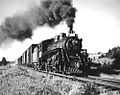 Freight traffic on the Prince Edward Island Railway.jpg 500 × 396; 34 KB
-
 Golden Field 3 (4338541555).jpg 2,048 × 1,536; 630 KB
-
 Great Blue Heron - panoramio (2).jpg 1,626 × 990; 2.83 MB
-
 Inlet Near Granville - Prince Edward Island (6428135175).jpg 3,774 × 2,592; 4.49 MB
-
 Iona, PEI (1159076611).jpg 600 × 400; 83 KB
-
 Iona, PEI (36057051021).jpg 4,608 × 3,456; 4.81 MB
-
 Jubilee 1.jpg 3,173 × 2,419; 2.52 MB
-
 Last Cruise ship for 2014 - panoramio.jpg 2,831 × 1,873; 1.68 MB
-
 Lobster Pots Ready to Go - panoramio.jpg 2,816 × 1,596; 1.14 MB
-
 Marsh near Bedford, PEI (7767298340).jpg 3,648 × 2,736; 1.86 MB
-
 Marsh near Clarkin, PEI (9702454472).jpg 4,608 × 3,456; 12.63 MB
-
 Marsh near Lake Verde, PEI (9702268180).jpg 4,608 × 3,456; 13.4 MB
-
 Marsh near Lake Verde, PEI (9702298490).jpg 4,608 × 3,456; 15.5 MB
-
 Marsh near Mount Stewart, PEI (5846745678).jpg 600 × 400; 97 KB
-
 Marsh, Confederation Trail, PEI (5857678411).jpg 600 × 400; 64 KB
-
 Marshes near Mount Stewart, PEI (14129590820).jpg 4,608 × 3,456; 6.04 MB
-
 Marshes near Mount Stewart, PEI (27659455253).jpg 4,608 × 3,456; 4.17 MB
-
 Marshes near Mount Stewart, PEI (28170936682).jpg 4,608 × 3,456; 3.88 MB
-
 Marshes near Mount Stewart, PEI (9384410138).jpg 4,608 × 3,456; 5.39 MB
-
 Marshes near Wood Islands, PEI (28109582142).jpg 4,608 × 3,456; 6.07 MB
-
 Moon over Holland Cove - panoramio.jpg 1,291 × 1,124; 1.83 MB
-
 Mount Stewart Marshes, PEI (15203213002).jpg 4,608 × 3,456; 12.05 MB
-
 Near Wood Islands, PEI (14759980544).jpg 4,608 × 3,456; 5.97 MB
-
 New Glasgow Rd, Bungay (471189) (9447930117).jpg 4,320 × 2,432; 1.8 MB
-
 New Glasgow Rd, Bungay (471190) (9450713880).jpg 4,188 × 2,356; 2.14 MB
-
 New section of Confederation Trail, PEI (9698983197).jpg 4,608 × 3,456; 4.87 MB
-
 On the way to Cavendish (1817162426).jpg 1,600 × 1,200; 253 KB
-
 PEI (11377414684).jpg 4,272 × 2,848; 977 KB
-
 PEI oyster farm 06.JPG 2,288 × 1,712; 683 KB
-
 PEI-002 - Red Fox (2015).jpg 3,805 × 2,059; 1.48 MB
-
 PEI-003 - Red Fox (2015).jpg 6,000 × 4,000; 20.86 MB
-
 Point Prim Coast, Point Prim - panoramio (1).jpg 3,722 × 2,092; 2.89 MB
-
 Point Prim Coast, Point Prim - panoramio.jpg 4,066 × 2,288; 3.17 MB
-
 Prince Edward Island 023 (7893583810).jpg 3,264 × 2,448; 1.71 MB
-
 Salt Marsh, Mount Stewart, PEI (34911455576).jpg 4,608 × 3,456; 3.68 MB
-
 Salt Marsh, Mount Stewart, PEI (34911456966).jpg 4,608 × 3,456; 3.81 MB
-
 Sun and Fog - panoramio.jpg 4,320 × 3,240; 4.67 MB
-
 Sunset on the road to Charlottetown.JPG 3,888 × 2,592; 2.59 MB
-
 TheOldRedmondHouse.jpg 3,264 × 2,448; 2 MB
-
 Three Oaks Axemen vs the Bluefield Bobcats.jpg 310 × 205; 16 KB
-
 Trail Detail (5858231054).jpg 600 × 400; 105 KB
-
 Vertically-hanged flags of Canada.jpg 1,042 × 1,389; 353 KB
-
 Veteran's Memorial Hwy, Bedford Corner - panoramio.jpg 2,048 × 1,152; 784 KB
-
 Veteran's Memorial Hwy, Bedford Corner, Prince Edward Island (471389) (9448030535).jpg 3,766 × 2,118; 2.32 MB
-
 View Near Old Lighthouse (22098608478).jpg 6,069 × 4,105; 15.84 MB
-
 Wood Islands Branch Trail, PEI (28748911120).jpg 4,608 × 3,456; 4.9 MB
-
 Wood Islands Provincial Parks, Prince Edward Island (471009) (9447843925).jpg 3,800 × 2,136; 2.17 MB
.jpg)

.jpg)
.jpg)
.jpg)

.jpg)
.jpg)
.jpg)
.jpg)
.jpg)


.jpg)
.jpg)
.jpg)
_(9450841744).jpg)
_(9448058949).jpg)


.jpg)
.jpg)
.jpg)
.jpg)
.jpg)


.jpg)
.jpg)
.jpg)
.jpg)
.jpg)
.jpg)
.jpg)
.jpg)
.jpg)
.jpg)
.jpg)

.jpg)
.jpg)
_(9447930117).jpg)
_(9450713880).jpg)
.jpg)
.jpg)
.jpg)

.jpg)
.jpg)
.jpg)

.jpg)
.jpg)
.jpg)


.jpg)


_(9448030535).jpg)
.jpg)
.jpg)
_(9447843925).jpg)