Category:Quendon and Rickling

civil parish in Essex, England, UK | |||||
| Upload media | |||||
| Instance of | |||||
|---|---|---|---|---|---|
| Named after | |||||
| Location | Uttlesford, Essex, East of England, England | ||||
 | |||||
English: Quendon and Rickling is a civil parish in the Uttlesford district, in the county of Essex, England.
Subcategories
This category has the following 4 subcategories, out of 4 total.
Q
R
- Rickling Hall (2 F)
Media in category "Quendon and Rickling"
The following 77 files are in this category, out of 77 total.
-
 All Saints Church - geograph.org.uk - 6123918.jpg 1,024 × 768; 211 KB
-
 All Saints Rickling - geograph.org.uk - 5236579.jpg 1,024 × 768; 257 KB
-
 Alongside the B1383 - geograph.org.uk - 4627676.jpg 4,000 × 3,000; 4.08 MB
-
 Alpacas at Rickling Hall - geograph.org.uk - 3626179.jpg 640 × 480; 117 KB
-
 Approaching Rickling Green - geograph.org.uk - 3626270.jpg 640 × 480; 116 KB
-
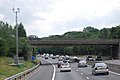 B1383 bridge over the M11 - geograph.org.uk - 1970070.jpg 640 × 428; 81 KB
-
 B1383 bridge, M11 - geograph.org.uk - 2587267.jpg 640 × 397; 63 KB
-
 B1383 Bridge, M11 - geograph.org.uk - 2722459.jpg 640 × 491; 60 KB
-
 B1383 Bridge, M11 - geograph.org.uk - 3765587.jpg 640 × 443; 56 KB
-
 B1383, M11 - geograph.org.uk - 3759075.jpg 640 × 430; 51 KB
-
 Barn conversions at Rickling - geograph.org.uk - 3637835.jpg 640 × 480; 118 KB
-
 Bridge over the M11 - geograph.org.uk - 4627781.jpg 4,000 × 3,000; 4.44 MB
-
 Bridleway approaching Rickling - geograph.org.uk - 6104076.jpg 1,600 × 1,067; 248 KB
-
 Bridleway off Brick Kiln Lane - geograph.org.uk - 3889659.jpg 640 × 428; 161 KB
-

-
 Church End Farm (geograph 6624142).jpg 1,024 × 684; 225 KB
-
 Church End Farm - geograph.org.uk - 6123922.jpg 1,024 × 768; 156 KB
-
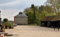
 Church End Farm, Rickling - geograph.org.uk - 3637828.jpg 640 × 480; 120 KB
-
 Cottage in Rickling Green Road - geograph.org.uk - 4627610.jpg 4,000 × 3,000; 3.95 MB
-

-
 Crossing the M11 Near Newport - geograph.org.uk - 2984143.jpg 2,560 × 1,920; 999 KB
-
 Dovecote, Church End Farm (geograph 6624149).jpg 1,024 × 635; 192 KB
-
 Duck house at Rickling Hall - geograph.org.uk - 3626170.jpg 640 × 480; 115 KB
-
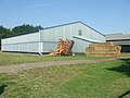
 Farm building, Rickling - geograph.org.uk - 3637860.jpg 640 × 480; 118 KB
-

-
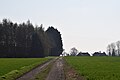
 Farm track leading to Hanginghill wood - geograph.org.uk - 3637821.jpg 640 × 480; 120 KB
-
 Farmtrack - geograph.org.uk - 5236516.jpg 1,024 × 768; 262 KB
-
 Farmtrack And Footpath - geograph.org.uk - 5236530.jpg 1,024 × 768; 263 KB
-
 Field alongside the B1383 - geograph.org.uk - 4627667.jpg 4,000 × 3,000; 4.02 MB
-
 Flyover on M11 - geograph.org.uk - 5584230.jpg 1,024 × 576; 102 KB
-
 Footpath - geograph.org.uk - 5236563.jpg 766 × 1,024; 247 KB
-
 Footpath And Field Edge - geograph.org.uk - 5236567.jpg 1,024 × 768; 365 KB
-
 Footpath And Postbox - geograph.org.uk - 5236508.jpg 1,024 × 768; 325 KB
-
 Footpath from Coney Acre Wood - geograph.org.uk - 3637815.jpg 640 × 480; 122 KB
-
 Footpath Junction - geograph.org.uk - 5236590.jpg 1,024 × 768; 373 KB
-
 Hedgerow across a field - geograph.org.uk - 4738297.jpg 640 × 480; 100 KB
-
 Isolated house near Rickling - geograph.org.uk - 3494241.jpg 4,320 × 3,240; 2.84 MB
-

-
 Junction of minor roads near Rickling - geograph.org.uk - 3494228.jpg 4,320 × 3,240; 2.87 MB
-
 Junction with Rickling Road - geograph.org.uk - 4063459.jpg 3,696 × 2,448; 4.2 MB
-
 Lane by Church End Farm, Rickling - geograph.org.uk - 6052910.jpg 1,024 × 768; 381 KB
-
 Lay-by south of Quendon - geograph.org.uk - 6052816.jpg 1,024 × 768; 455 KB
-
 Longcroft Spring - geograph.org.uk - 3759086.jpg 640 × 430; 48 KB
-
 Looking along the M11 - geograph.org.uk - 4627690.jpg 4,000 × 3,000; 4.24 MB
-
 M11 - B1383 bridge - geograph.org.uk - 2640591.jpg 640 × 428; 97 KB
-
 M11 near Widdington - geograph.org.uk - 3455236.jpg 1,608 × 985; 948 KB
-
 M11, B1383 overbridge - geograph.org.uk - 3323022.jpg 640 × 430; 54 KB
-
 M11, southbound - geograph.org.uk - 3765588.jpg 640 × 430; 54 KB
-
 Moat Farm - geograph.org.uk - 3644196.jpg 640 × 480; 117 KB
-
 National Grid power line 4YL - geograph.org.uk - 3885228.jpg 640 × 480; 121 KB
-
 Old Parish Hall, Rickling Green - geograph.org.uk - 3637800.jpg 640 × 480; 119 KB
-
 Ordnance Survey Cut Mark - geograph.org.uk - 4710641.jpg 4,000 × 3,000; 4.38 MB
-
 Ordnance Survey Flush Bracket S8670 - geograph.org.uk - 4710643.jpg 4,000 × 3,000; 4.26 MB
-
 Pond Lay Plantation - geograph.org.uk - 4738311.jpg 640 × 480; 95 KB
-
 Public footpath through Rickling churchyard - geograph.org.uk - 6104070.jpg 1,600 × 1,067; 699 KB
-
 Pylons and Broom Wood - geograph.org.uk - 3626261.jpg 640 × 480; 116 KB
-

-
 Rickling Green - geograph.org.uk - 2984122.jpg 2,560 × 1,920; 1.13 MB
-
 Rickling Green - geograph.org.uk - 4627585.jpg 4,000 × 3,000; 4.11 MB
-
 Rickling Green from the air - geograph.org.uk - 3844639.jpg 640 × 480; 121 KB
-
 Rickling Green from the Cricketers PH - geograph.org.uk - 3626287.jpg 640 × 480; 116 KB
-
 Rickling Green Road, Rickling Green - geograph.org.uk - 6052845.jpg 1,024 × 768; 268 KB
-

-
 Rickling Road - geograph.org.uk - 265896.jpg 640 × 480; 72 KB
-
 Road towards Wicken Bonhunt - geograph.org.uk - 6052953.jpg 1,024 × 768; 364 KB
-
 Southview (geograph 6624125).jpg 1,024 × 684; 256 KB
-
 St.Simon And St.Jude Quendon - geograph.org.uk - 5236501.jpg 774 × 1,024; 159 KB
-
 Stack 'em high - geograph.org.uk - 5947986.jpg 1,200 × 900; 265 KB
-
 Thatched cottage in Rickling Green Road - geograph.org.uk - 4627613.jpg 4,000 × 3,000; 3.83 MB
-
 The Cricketers Arms - geograph.org.uk - 5198837.jpg 640 × 480; 79 KB
-
 The Cricketers Arms, Rickling Green - geograph.org.uk - 6052831.jpg 1,024 × 768; 340 KB
-
 The green at Rickling Green - geograph.org.uk - 4627590.jpg 4,000 × 3,000; 4 MB
-
 Track through wheat field near Rickling Green - geograph.org.uk - 4039829.jpg 4,030 × 2,990; 4.73 MB
-
 Tree by Rickling Road - geograph.org.uk - 6053018.jpg 1,024 × 768; 336 KB
-
 Tree, Rickling Church End - geograph.org.uk - 6052916.jpg 768 × 1,024; 326 KB
-
 Wells Cottage - geograph.org.uk - 5947996.jpg 1,200 × 900; 283 KB
-
 Woodnook (geograph 6624132).jpg 1,024 × 659; 244 KB


.jpg)


.jpg)


_Primary_School_-_geograph.org.uk_-_3889649.jpg)


.jpg)


.jpg)